I am off for a few days of hiking. The potential SOTA activations are:
 Summit:        WØC/PR-Ø2Ø (Gray Wolf Mtn. – CO)
 Date:          15 July 2012
 Time: Approx.: 1500 UTC – 16:00 UTC
 Location:      N-Colorado / DN70eo
 Elevation:     4138 m / 13576 ft – 10 Point(s)
 Call Sign:     KØMOS
 Frequencies:   18.1425-ssb +/- QRM
                146.52-fm / 144.200-ssb
weather permitting, I will try Rogers Peak as well.
 Summit:        WØC/PR-Ø25 (Rogers Peak – CO)
 Date:          15 July 2012
 Time: Approx.: 1800 UTC – 19:00 UTC
 Location:      N-Colorado / DN70eo
 Elevation:     4074 m / 13366 ft – 8 Point(s)
 Call Sign:     KØMOS
 Frequencies:   18.1425-ssb +/- QRM
                146.52-fm / 144.200-ssb
Assuming that my muscles/joints and the weather are cooperating, I will make an attempt on Mt. Evans on 7/16:
 Summit:        WØC/FR-ØØ3 (Mt. Evans – CO)
 Date:          16 July 2012
 Time: Approx.: 1500 UTC – 16:00 UTC
 Location:      N-Colorado / DN70eo
 Elevation:     4339 m / 14236 ft – 10 Point(s)
 Call Sign:     KØMOS
 Frequencies:   14.285-ssb / alt. freq.: 14.3425-ssb
                146.52-fm / 144.200-ssb
If I have coverage, you can follow my progress and status via APRS:
QRP (5W) only.
Equip.: FT-817 and vertical Buddipole
Keep your ears/antennas pointed towards Colorado.
Thanks
Matt / KØMOS
!! WARNING !! There are old mountaineers, and
bold mountaineers… there are no old-bold mountaineers.
Hiking and mountain climbing are potentially hazardous activities particularly in Colorado with its extreme elevations. I am not accepting responsibility for any death or injury resulting from activations based on my trip reports. Proper training, experience, and personal capability assessment is required – enjoy!
My First S.O.T.A. Activation by Frank Skinner KØJQZ
Some of the best things are unplanned, or half planned. After a grueling morning planting bushes in the 100 degree heat that we have known in Southern Colorado as the norm I asked the XYL (Lynn, KC0YQF) if she was game to head out to San Isabel National Forest near Buena Visita for an overnighter and a hike up Midland Hill the next day. She was game. We hastily packed, feed the fur kids and headed out.
I had no plan and the only thing for sure is I knew the road to turn off to get to the National Forest. We found a campsite and decided to set up camp before the storm hit.
While relaxing in the camper listening to the rain fall I looked at the topo map and noticed there were two ways to get to the trail head. One was to go up a ways and take another county dirt road and one was to go into town to “Riverside Park” on the Arkansas River and I opted for that. The next morning we woke at 5am, had some coffee, stopped in Buena Vista for breakfast and headed to the park. There were a few cars but not many. We headed out.
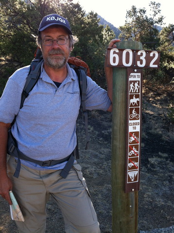
KØJQZ at the Trailhead
Of course I did get lost once and that cost us about 15 to 20 minutes and this was before we got to the Midland Hill Summit Trailhead. After making it to the summit trailhead, we had already hiked about an hour, I realized I may had made a mistake and should of parked at the summit trailhead and forgone the nice but unnecessary visit to Buena Vista’s Riverside Park. No matter we where on our way up to the summit.
Onward we marched. I was sick for a few years so while this is no big feat it has taken me a long time to be able to send code again, walk, run and of course climb up to a summit. We tried Mt Herman a few months ago and I was not really up to the task but walking 3 miles everyday at lunch has really helped me prepare for this.
We saw two people on bicycles on the lower trail but not a sole on the upper trail to the summit.
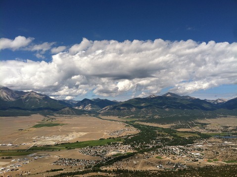
The view from the Summit
Upon arrival at the summit it was time to setup the buddistick vertical and start some QSOs. It is rather funny to think that at 9,500 feet that the little KX1 and Buddistick is a much better station than my K3 (QRP Version) and my vertical at 6,000 feet. A couple of CQs and nothing…. I decided to check to see if I could self -spot and I was able to do a shameless spot and the QSOs started rolling in.
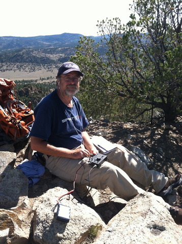
KØJQZ working the pileup
I was only able to operate for a little less than 20 minutes and made only 8 QSOs. I was pretty disappointed but the clouds were moving in and I knew it would take us an hour to get to county road 304 and at least another 30 minutes to make it back to the truck. We made it with about 15 minutes to spare before the sky opened up. Of course we celebrate rain lately and enjoyed the cool down. I apologize for those that waited for me but I had to bug out. One thing I did not want to do is to get stuck on the summit with the ham gear.
I have a few lessons learned. I took too much stuff and while I like the buddistick I just hate carring coax. I built Stu’s tuner and will fashion something else for next time. I took two rigs, the ATS4b and the KX1, I just wanted to make sure I could operate just in case something happened to one of them. The KX1 has the advantage of the built in tuner but the AS4b is smaller and with Stu’s tuner I may just use it next time. There will be a next time.
So my first activation came to an end. I have been following all the hams in Colorado that do this and have worked a few from home. I am fairly active as a chaser but really never had the appreciation for the activators until I tried it. Lucky for me Lynn came along, as it is nice to chat while on the trail. She is studying for her General and when she passes I promised her a rig to get on HF with (KX3 is a top choice). I am just a cw operator so I will leave the fancy SSB Ops to her.
I want to thank the following operators I was able to chat with for my first SOTA Activation.
W6ZKH
W7CNL
K6ILM
WO6M
NS7P
WA2USA
K7NEW
N4EX
72, Frank K0JQZ
f_skinner at yahoo dot com
Some video impressions:
httpvh://www.youtube.com/watch?v=p0d2MFrfu10
If you would like to leave questions or comments, please do so through Youtube.
!! WARNING !! There are old mountaineers, and
bold mountaineers… there are no old-bold mountaineers.
Hiking and mountain climbing are potentially hazardous activities particularly in Colorado with its extreme elevations. I am not accepting responsibility for any death or injury resulting from activations based on my trip reports. Proper training, experience, and personal capability assessment is required – enjoy!
CO14 has reopened after the Highpark fire is 100% contained. I am trying to access the Cameron Pass area though the Canyon to checkout my favorite play-ground. The time is my best estimate… it’s a long drive and a long hike and who knows what kind of obstacles I will encounter through the Poudre Canyon. The time posted takes a few delays into account… I could be earlier than 18:00 UTC. Make sure to verify the summit reference when you talk to me, I have a few alternatives in case I cannot access Clark Pk.
Summit: WØC/PR-ØØ1 (Clark Peak – CO)
Date: 3 July 2012
Time: Approx.: 1800 UTC – 19:00 UTC
Location: N-Colorado / DN70ao
Elevation: 3940 m / 12927 ft – 8 Point(s)
Call Sign: KØMOS
Frequencies: 14.3425-ssb +/- QRM / alt. freq.: 14.285-ssb
If I have coverage, you can follow my progress via APRS: http://aprs.fi/info/a/K0MOS-7
QRP (5W) only.
Equip.: FT-817 and vertical Buddipole
Keep your ears/antennas pointed towards Colorado.
Thanks
Matt / KØMOS
!! WARNING !! There are old mountaineers, and
bold mountaineers… there are no old-bold mountaineers.
Hiking and mountain climbing are potentially hazardous activities particularly in Colorado with its extreme elevations. I am not accepting responsibility for any death or injury resulting from activations based on my trip reports. Proper training, experience, and personal capability assessment is required – enjoy!
Mount Bierstadt or WØC/FR-Ø15 is one of the easier fourteeners (mountains with peaks above 14,000 ft (4267 m)) in Colorado. It is located near Denver in the Frontrange of the Rocky Mountains. The peak is named after the German/American painter Albert Bierstadt. The easy access from Denver and the close proximity to Mt Evans (another 14er) makes this summit a popular destination all year round. There are several routes to the summit, I have chosen the ‘standard’ route from Guanella Pass over the west slopes.
Mt. Bierstadt – Guanella Pass
Trailhead: 11607 ft/ 2565 m
Summit: 14060 ft / 4285 m
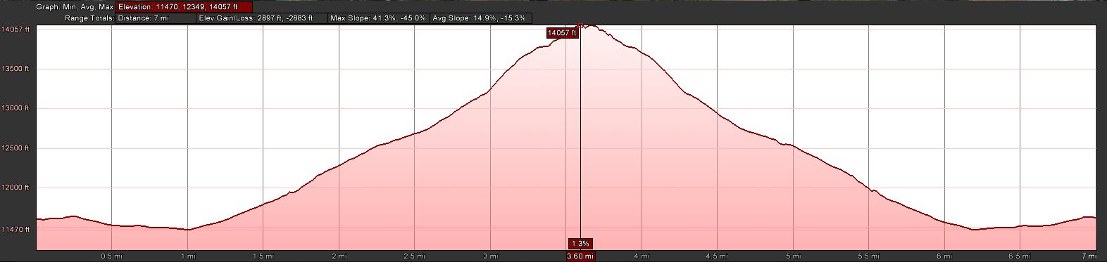
Elev. gain: 2897 ft / 883 m
Roundtrip: 7.0 mi / 11.3 km
How to get there: As mentioned, access to Mt. Bierstadt is rather easy coming from Denver. Take I70 West, exit at the Georgetown. Follow the many signs to Guanella Pass Scenic Byway. Follow the road for ~12 miles all the way to the pass. The road is brand new and two large parking lots (on either side of the road) cannot be missed. The trail starts near the parking area on the east side of the road (first parking lot coming from Goeorgetown), just behind the restrooms.
Red Tape:
Parking lots fill up quickly, specifically on week-ends.
The Ascent:
Mt. Bierstadt – ElevationProfile
The ascent does not present any challenges. The summit is clearly visible from the parking lot and so is the route. The well maintained trail starts rather easy, slightly downhills through the Guanella Pass marsh area with a thick willow growth. To lessen the impact on the trail, you will find wooden bridges leading you towards the base of the mountain. You have to cross a creek and interestingly you will not find a bridge but you have to jump from rock to rock to get to the other side – with quite a few people on the trail, you might have to wait in line until it’s your turn. That’s when I remembered why I am not a big fan of fourteeners… it’s not the elevation, the thin air or the steep slopes – it’s their popularity and the resulting crowds trying to summit. Needless to say that I was never alone during my hike to the summit. I tried to stay equidistantbetween a larger group in front of me and a group of eight college students behind me. You can’t see the other groups as long as you are hiking in the willows, you can however hear them – a problem which was resolved when the trail got steeper about half way up the mountain. After reaching the saddle, most of the elevation gain was behind me and the remaining part to the top consists mostly of boulder hopping.
The Summit:
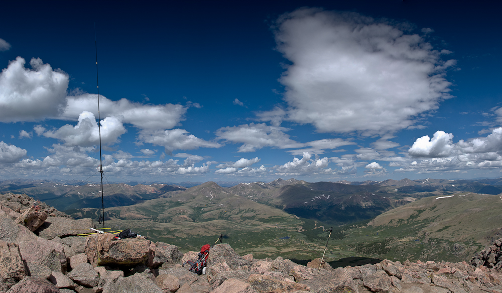
Mt. Bierstadt – The view from the summit
The view from the summit is of course spectacular. Mount Evans (WØC/FR-ØØ3) is just a mile or two to the north-east and can be reached crossing a class 3 ridge (over Sawtooth). Many higher SOTA peaks can be spotted including Torrey Pk. and Gray Pk. (both 14ers) to the west. The summit never had less than probably 25-30 people during the time I was up there. Finding an appropriate location to setup my HF antenna with all the guy lines and counterpoise was important to me… with all the people mulling around, there was a danger that somebody trips and takes down the antenna (or worse).
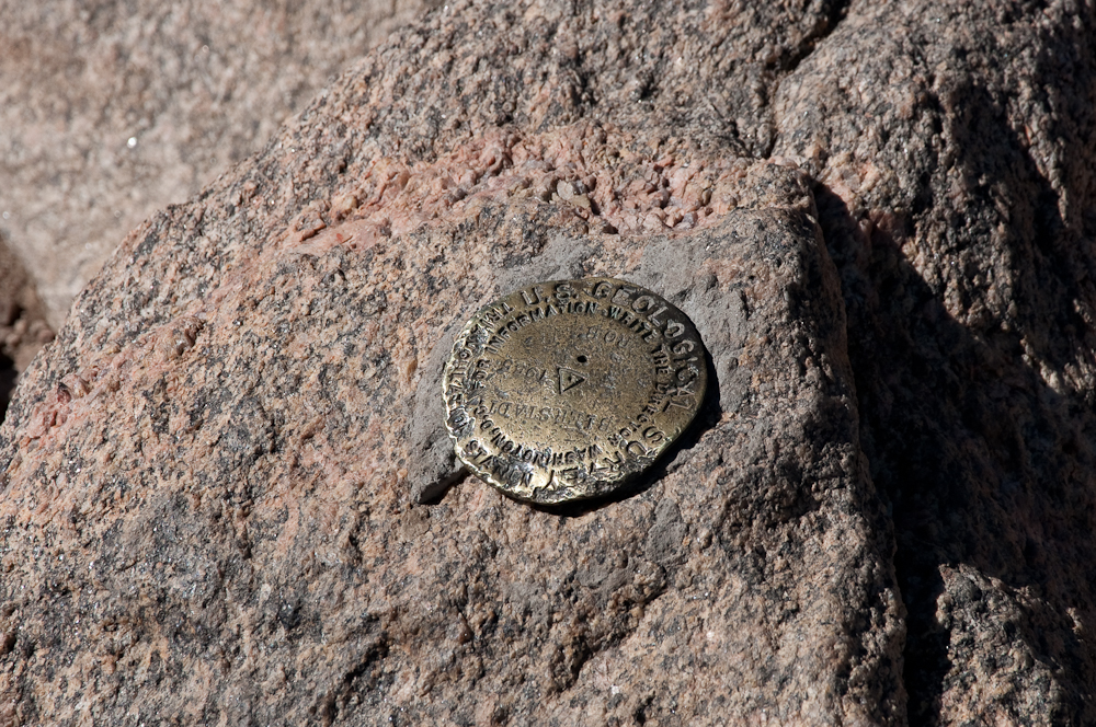
Mt. Bierstadt – The Summit
I set up my 2m tape measure Yagi and pointed it towards the west, hoping to catch Bob/KIØG near Glenwood Springs on the HT. Bob did not answer my call, but Tom/K7HRO picked-up my signal in Cheyenne (WY). Since there were no more takers on 2m, I put down the Yagi (still pointed towards the west) and started to setup my vertical Buddipole. Tuned for 20m, I made contact with the usual suspects, Elliott/K6ILM leading the way. There were also some new (to me) stations who were chasing before I picked up KIØG on the HT. The signal wasn’t great and I started to jump from boulder to boulder, waving my Yagi towards the west in the hope to pick-up a better signal. My behavior attracted the attention of my fellow hikers on the summit who started to wonder whether I had lost my mind, waving a magic wand and speaking in code. Nevertheless, Bob and I had a successful QSO on 2m and I spend the next few minutes answering questions about amateur radio and SOTA.
Keeping an eye on the clouds and weather in general, I re-tuned the BP for 17m… realizing that I would have to leave soon. One of the clouds looked kind of black, but not quite threatening (yet). Made only one contact on 17m withing 10 minutes and decided to call it quits and get off the summit due to the increasingly dark cloud hanging over us. Some newly arrived hikers assured me that they are not worried at all about the clouds – but I was. Within a few minutes I was on my way.
The Descent:
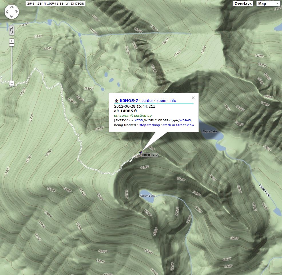
Mt. Bierstadt – APRS
About 300 ft below the summit I saw the first lightning strike towards the west, followed by loud and rolling thunder echoing back from the mountains. Dense rain and hail showers developed quickly and I spent the remaining descent in heavy hail and rain showers. I put on my gaiters and rain jacket before the first wave of hail hit – a smart move… the constant hail and rain made the descent a slippery slope – literally. By the time I reached the flatter area down in the willows, it was a swamp with several inches of hail/rain mix to wade through. Thanks to the gaiters, my feet stayed (mostly) dry – however I was dirty all the way up to my knees as if I had been shoveling manure on a pig farm.
I was wondering how the sandals wearing crowds I had met on my way up and on the summit were coping with the icy situation – I am sure it was tough.
Luckily I still had all my winter equipment in my Subaru Outback. The car was covered in ~2 inches of heavy/wet hail. I literally had to dig out the car – in June.
Some video impressions: httpvh://www.youtube.com/watch?v=opAyuMhfffA
If you would like to leave questions or comments, please do so through Youtube.
!! WARNING !! There are old mountaineers, and
bold mountaineers… there are no old-bold mountaineers.
Hiking and mountain climbing are potentially hazardous activities particularly in Colorado with its extreme elevations. I am not accepting responsibility for any death or injury resulting from activations based on my trip reports. Proper training, experience, and personal capability assessment is required – enjoy!
I am going to try another activation tomorrow. Here the details:
Date: 28 June 2012
Time: Approx.: 16:00 UTC – 17:00 UTC
Name/Reference: Mount Bierstadt / WØC/PR-Ø15
Location: Colorado / DM79dq
Elevation: 4277 m / 14060 ft – 10 Point(s)
Call Sign: KØMOS
Frequencies:
14.3400-ssb +/- QRM
18.1425-ssb +/- QRM
146.52-fm
Some isolated T-Storms in the forecast for the afternoon but I should be off the mountain well before noon.
If I have coverage, you can follow my progress via APRS (K0MOS-7).
QRP (5W) only.
Equip.: FT-817 and vertical Buddipole / VX-8 with tape-measure YAGI (2m)
Thanks
Matt / KØMOS
!! WARNING !! There are old mountaineers, and
bold mountaineers… there are no old-bold mountaineers.
Hiking and mountain climbing are potentially hazardous activities particularly in Colorado with its extreme elevations. I am not accepting responsibility for any death or injury resulting from activations based on my trip reports. Proper training, experience, and personal capability assessment is required – enjoy!
I am going to try another activation. Here the details:
Date: 24 June 2012
Time: Approx.: 18:00 UTC – 19:00 UTC
Name/Reference: Grizzly Peak / WØC/PR-Ø22
Location: Colorado / DM79bp
Elevation: 4084 m / 13399 ft – 8 Point(s)
Call Sign: KØMOS
Frequencies: 18.1425-ssb +/- QRM
. 146.52-fm
If I have coverage, you can follow my progress via APRS.
QRP (5W) only.
Equip.: FT-817 and vertical Buddipole
There are isolated Thunderstorms in the forecats, I might have to cancel.
Keep your ears/antennas pointed towards Colorado.
Thanks
Matt / KØMOS
!! WARNING !! There are old mountaineers, and
bold mountaineers… there are no old-bold mountaineers.
Hiking and mountain climbing are potentially hazardous activities particularly in Colorado with its extreme elevations. I am not accepting responsibility for any death or injury resulting from activations based on my trip reports. Proper training, experience, and personal capability assessment is required – enjoy!
I am going to try another activation. Here the details:
Date: 22 June 2012
Time: Approx.: 20:00 UTC – 21:00 UTC
Name/Reference: Mount Sniktau / WØC/PR-Ø31 Location: Colorado / DM79bq
Elevation: 4026 m / 13209 ft – 8 Point(s)
Call Sign: KØMOS
Frequencies: 14.3425-ssb +/- QRM / alt. freq.: 14.285-ssb
. 146.52-fm
If I have coverage, you can follow my progress via APRS.
QRP (5W) only.
Equip.: FT-817 and vertical Buddipole
Keep your ears/antennas pointed towards Colorado.
Thanks
Matt / KØMOS
!! WARNING !! There are old mountaineers, and
bold mountaineers… there are no old-bold mountaineers.
Hiking and mountain climbing are potentially hazardous activities particularly in Colorado with its extreme elevations. I am not accepting responsibility for any death or injury resulting from activations based on my trip reports. Proper training, experience, and personal capability assessment is required – enjoy!
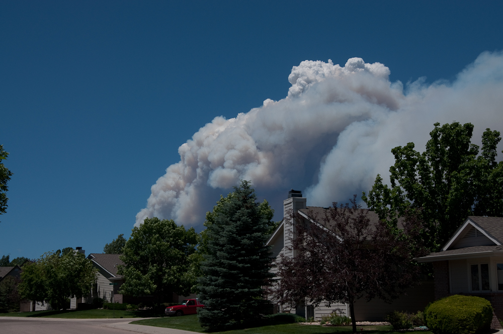
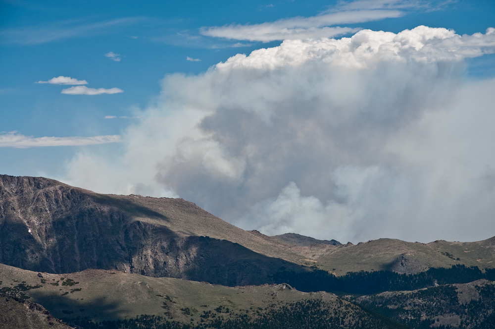
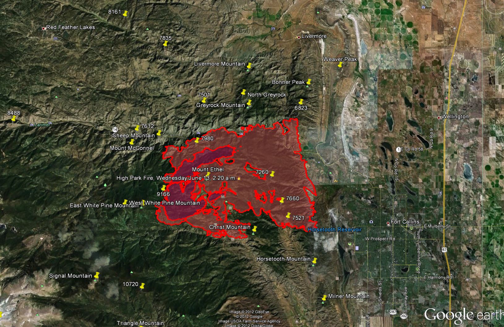
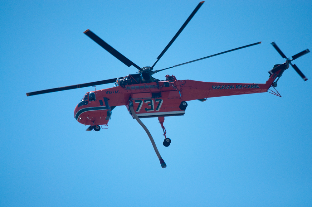
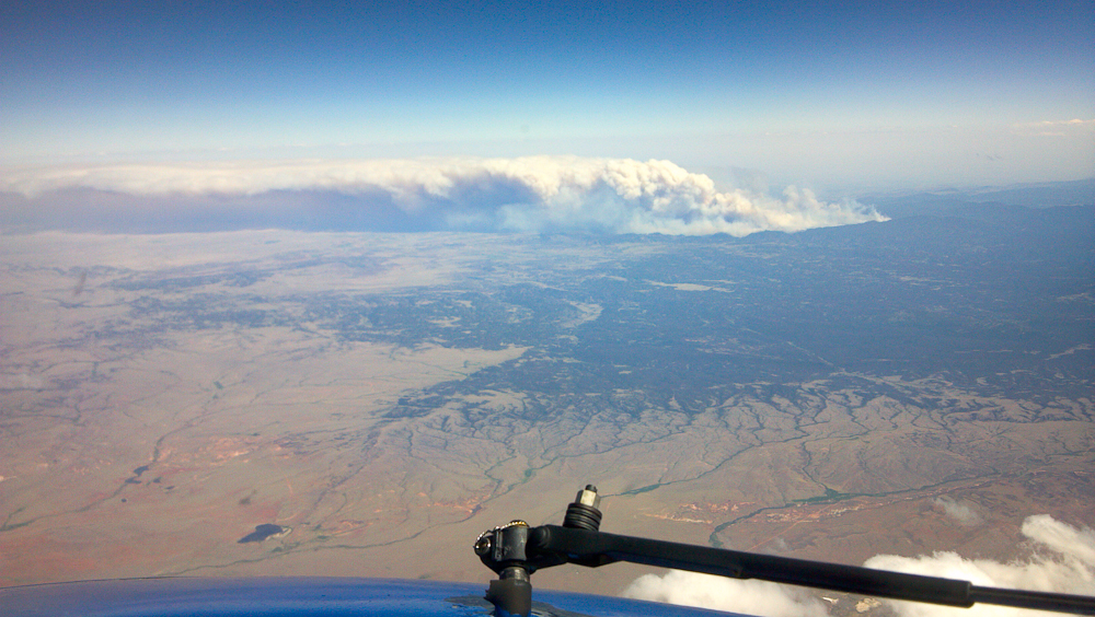
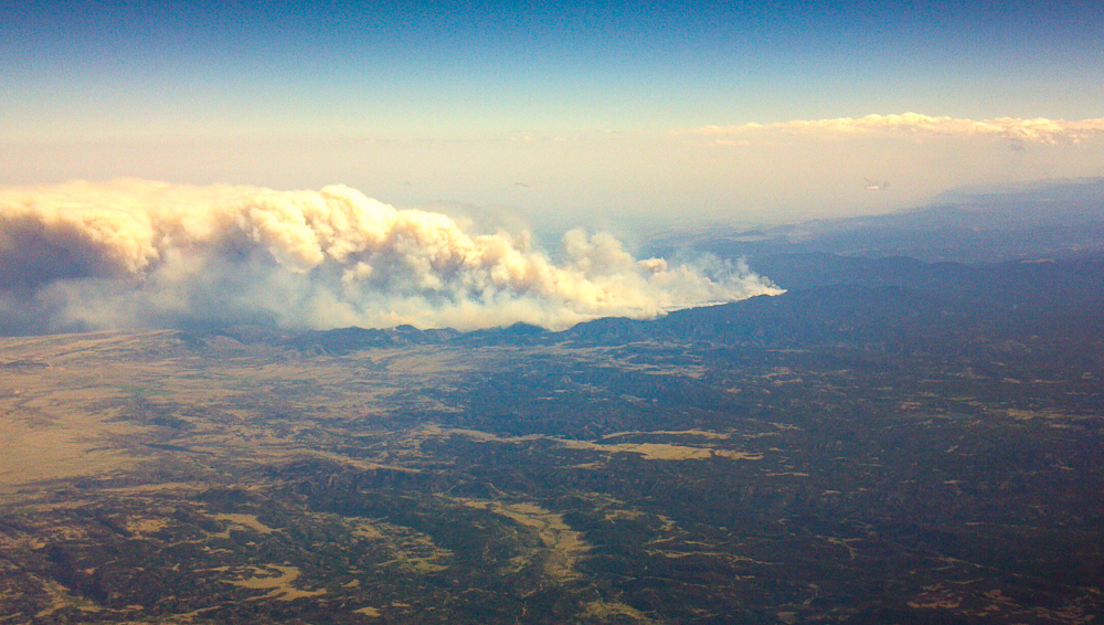
As you might have heard, the wild-fire situation here in the west is pretty bad. We currently have a huge fire going on in northern Colorado which started just about 10 mi from my QTH. So far (day 10) it has consumed an area of more than 58000 acres (~230 square km), destroyed >180 homes and displaced hundreds of people. There is no end in sight and several SOTA peaks are within the burning area or very close by and therefore not accessible due to road closures and smoke. In case you are planning a SOTA activation in N-Colorado, make sure to check the Incident Information System for the latest closures, evacuations and maps. I would suggest to stay away from all summits north-west of Ft. Collins, making US34 (Thompson Canyon) the last easy access into the Rockies.
Highpark Fire as seen from WØC/FR-Ø19 (Sundance Mtn)
I created a map with the latest published data of the fire including the impacted SOTA peaks.
Highpark Fire: impacted SOTA peaksOne of the 17 helicopters tackling the fire
Bottom line, plan your activation around here very carefully.
73, Matt/KØMOS
Update (June 22, 2012):
Just a quick update on the fire in N-Colorado. It now spread to over 68’000 acres (>275 square kilometers), and more SOTA peaks are withing the burn area. Lost structures are now >190 and unfortunately one fatality.
As far as I can tell from the published maps, the following additional SOTA peaks are now consumed by the fire as well.
Kriss/KA1GJU sent me the following pictures of the fire, taken last week from ~36000 ft. Click on the picture to enlarge.
Highpark Fire from above (Photo credit: Kriss/KA1GJU)
Highpark Fire from above (Photo credit: Kriss/KA1GJU)
Stay safe…
Matt/KØMOS
Update (June 27th, 2012):
Larimer County & High Park Incident Command has taken away public access on the NIFC ftp server! I am no longer able to generate GE (Google Earth) maps with the SOTA summits overlays. More SOTA peaks are withing the burn area (WØC/FR-7980) for sure, maybe more). The fire situation is VERY bad and several large and destructive fires are impacting the Frontrange. Here a list with the largest ones.
Highpark fire near Fort Collins (87’284 acres), 257 homes lost so far, hundreds of evacuations. More info: http://co.dtswildfire.com/home/
Flagstaff fire near Boulder (230 acres).
More info: http://www.dailycamera.com/ci_20946242/flagstaff-fire-blaze-now-at-230-acres-but
Waldo Canyon wildfire near Colorado Springs (6200 acres) threatening thousands of homes, 32’000 evacuations so far (Incl. parts of Air Force Academy), structures are lost
More info: http://www.denverpost.com/breakingnews/ci_20949291/colorado-wildfire-waldo-canyon-fire-doubles-size
Woodland Heights Fire in Estes Park (29 acres), 23 homes lost, looks like it’s under control now
More info: http://www.coloradoan.com/article/20120626/NEWS01/120627001/Crews-call-Estes-fire-worstthey-veseen?odyssey=tab|topnews|text|FRONTPAGE
My point? If you are planning to travel to the Colorado Mountains in the next few days/weeks you have a good chance to be impacted by one of the fires. E.g. I25 was closed briefly yesterday, one of the main entrances to RMNP was closed due to the Woodland fire, CO14, CO74e are closed etc. etc. Plan ahead and be flexible. The high temperatures and high winds will stay with us for the next few days – ergo it will most likely become worse.
Matt/KØMOS
!! WARNING !! There are old mountaineers, and
bold mountaineers… there are no old-bold mountaineers.
Hiking and mountain climbing are potentially hazardous activities particularly in Colorado with its extreme elevations. I am not accepting responsibility for any death or injury resulting from activations based on my trip reports. Proper training, experience, and personal capability assessment is required – enjoy!
This week we have another, even bigger wildfire (> 40’000 acres/175 square km so far) just 15 miles from my QTH. Plenty of road-closures (and smoke), cutting me off from lots of SOTA peaks around here. To get some fresh air and to celebrate my one year SOTA anniversary, I will try to get into Rocky Mountain National Park to activate two summits. If it works out, here the details:
Summit: WØC/FR-123 (Trail Ridge – CO)
Date: 13 June 2012
Time: Approx.: 1545 UTC – 16:45UTC
Location: N-Colorado / DN70ck
Elevation: 3758 m / 12329 ft – 6 Point(s)
Call Sign: KØMOS
Frequencies: 14.3425-ssb +/- QRM / alt. freq.: 14.285-ssb
and
Summit: WØC/FR-Ø19 (Sundance Mountain)
Date: 13 June 2012
Time: Approx.: 1730 UTC – 18:30 UTC
Location: N-Colorado / DN70dj
Elevation: 3792 m / 12441 ft – 6 Point(s)
Call Sign: KØMOS
Frequencies: 14.3425-ssb +/- QRM / alt. freq.: 14.285-ssb
18.1400-ssb +/- QRM
If I have coverage, you can follow my progress via APRS.
QRP (5W) only.
Equip.: FT-817 and vertical Buddipole
Keep your ears/antennas pointed towards Colorado.
Thanks
Matt / KØMOS
!! WARNING !! There are old mountaineers, and
bold mountaineers… there are no old-bold mountaineers.
Hiking and mountain climbing are potentially hazardous activities particularly in Colorado with its extreme elevations. I am not accepting responsibility for any death or injury resulting from activations based on my trip reports. Proper training, experience, and personal capability assessment is required – enjoy!
It was a great trip to the La Sal Mountain Range it Utah. Mike/KØYO and I activated four out of the six SOTA peaks. Here a teaser video… full trip report will follow.
httpvh://www.youtube.com/watch?v=mlmn-0oBoVc
!! WARNING !! There are old mountaineers, and
bold mountaineers… there are no old-bold mountaineers.
Hiking and mountain climbing are potentially hazardous activities particularly in Colorado with its extreme elevations. I am not accepting responsibility for any death or injury resulting from activations based on my trip reports. Proper training, experience, and personal capability assessment is required – enjoy!
 !! WARNING !! There are old mountaineers, and
bold mountaineers… there are no old-bold mountaineers.
Hiking and mountain climbing are potentially hazardous activities particularly in Colorado with its extreme elevations. I am not accepting responsibility for any death or injury resulting from activations based on my trip reports. Proper training, experience, and personal capability assessment is required – enjoy!
!! WARNING !! There are old mountaineers, and
bold mountaineers… there are no old-bold mountaineers.
Hiking and mountain climbing are potentially hazardous activities particularly in Colorado with its extreme elevations. I am not accepting responsibility for any death or injury resulting from activations based on my trip reports. Proper training, experience, and personal capability assessment is required – enjoy!