SOTA outings by KØMOS and contributors

Tag: W0/FR-127

  • WØC/FR-127 (Signal Mountain) – 2nd activation

    This was a re-activation for me. If you are looking for all the details on how to get there and other useful info, you can find the original trip-report with the necessary details right here. This post has only a few specifics from today’s activation.
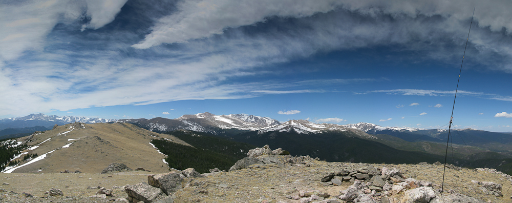
    Signal Mtn. – View from the summit

    From my prior activation in September 2011, I knew that it was going to be a long hike (11.7 mi/18.8 km – 4064 ft / 1239 m) mostly within the tree-zone. The two summits (Signal Mtn and South Signal) are just pushing their ‘heads’ above the treeline providing some amazing views.
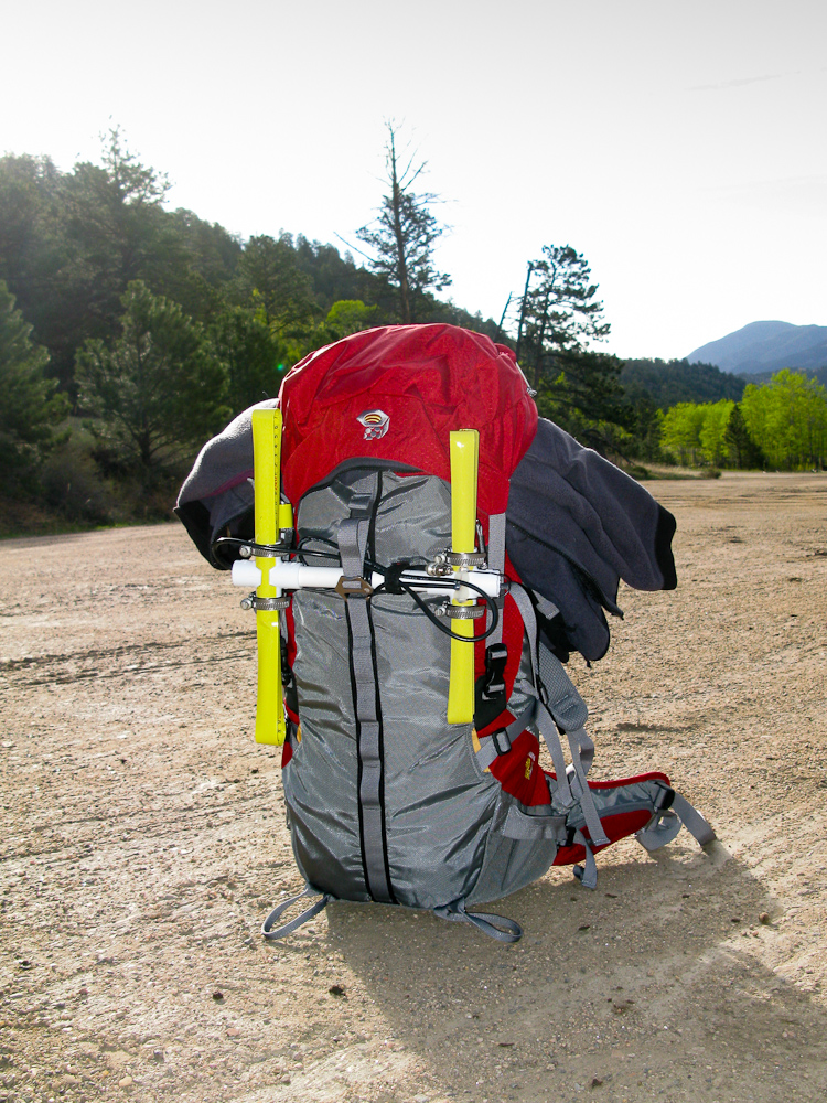
    My backpack with Yagi

    Besides my normal gear, I also carried a ‘tape-measure’ Yagi antenna I wanted to test on the summit. The first two miles of my hike went as expected but the following 2-3 miles through the forest were extremely difficult. A winter-storm must have destroyed large parts of the Bulwark Ridge. Trees were lying around everywhere. And I am not just talking about dead-trees… large and healthy trees were broken apart like tooth-picks, blocking the way to the summit. It was a very time-consuming and exhausting hike, climbing over trees or trying to find a way around it. Often I
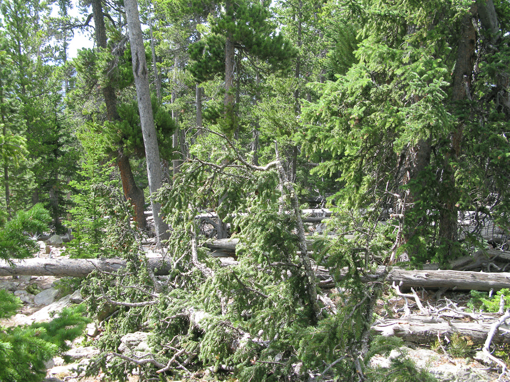
    Devastated Forest

    had a difficult time finding the trail again. Finally, the last 1-2 miles above the tree-line provided more challenges in form of big, soft, and deep snow-fields. Without having any ‘floatation-devices’, I was post-holing through approx. 3-4 ft of snow. Luckily I brought my gators – keeping at least my feet dry. It took me almost 4 hours to reach the summit (compared to 3’10” in September). The view from the summit was worth it though. After setting up my antenna, I  was hiding from the wind behind the small stone-shelter on the top. The wind behaved kind of strangely… completely calm for several minutes, followed by very strong gusts for a couple of minutes and back to complete calmness again. One of the stronger gusts took my antenna down (again), just after switching from 20m to 17m. Unfortunately the stinger of my shock-corded whip got bent during the process . I guess its time to use some of those spare parts. I took it as a sign to leave and packed-up my gear, knowing that it would take me quite a while for the ~6 miles climbing over all the trees again. At least it was downhill this time. I have to admit that I was pretty tired by the time I reached my car.

    Thanks for all the contacts and spots.

    Some video impressions:

    Please post comments or questions through YouTube.


    ATTENTION !! WARNING !! There are old mountaineers, and bold mountaineers… there are no old-bold mountaineers. Hiking and mountain climbing are potentially hazardous activities particularly in Colorado with its extreme elevations. I am not accepting responsibility for any death or injury resulting from activations based on my trip reports. Proper training, experience, and personal capability assessment is required – enjoy!
  • WØC/FR-127 (Signal Mountain) – 11262 ft / 3432 m

    Signal Mountain (WØC/FR-127) can be reached from the Dunraven trailhead from the south, or from Pingree Park Road from the north. If you are lucky enough to have a shuttle driver, it makes a great 11+ mile hike from the north fork of the Big Thompson River all the way to the Poudre River. The peak is located at the north-east end of the Mummy Range  in the Comanche Peak  Wilderness which is part of the Roosevelt National Forest. The summits of Signal Mountain – as well as nearby West Signal – are pushing well above the treeline and thus provide unobstructed 360 degree views. The weather forecast was excellent (it cooled down quite a bit) and I was joined by my best trail-buddy, friend and wife – making this a great anniversary hike.

    Trailhead: 7828 ft / 2386 m
    Summit:   11262 ft / 3432 m
    Elev. gain: 4064 ft / 1239 m
    Roundtrip: 11.7 mi / 18.8 km

    Compare this summit with my other activated summits

    How to get there:
    Take US34 from Loveland towards Estes Park through Big Thompson Canyon. When you pass through Drake, take a right on CR43 along the north-fork (scenic). Take a right on Dunnraven Glade Road (dirt road) which follows the north-east flank of Triangle Mountain. You can’t miss the parking lot since it is the end of the (public) road. A private road continues behind a locked gate all the way to Trails End Ranch.

    Parking/Trailhead

    View Larger Map

    Red Tape:
    Nothing comes to mind – rules of the Roosevelt National Forest apply.

    The Ascent:
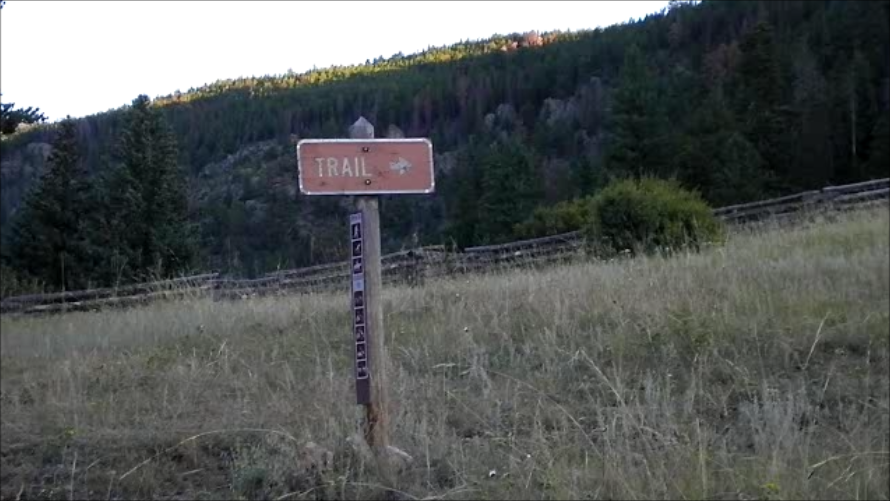
    The official trail-head is about half a mile from the parking lot, following the fairly steep

    Sign to trail-head

    private road after a locked gate towards Trails End Ranch. Shortly before you enter the ranch, the trail-head is clearly marked on your right side with the usual map/posters etc. From here, the trail climbs up the steep hillside to Bulwark Ridge through open terrain. After reaching the ridge, you have some good views to several nearby SOTA peaks such as Triangle Mountain (WØC/FR-Ø82), Crosier Mountain (WØC/FR-Ø57), West Crosier (WØC/FR-Ø64) and even more looking towards Estes Park and the Rocky Mountain National Park (RMNP). Shortly after, the trail intersects with the Indian and Miller Fork trails. Taking the north-west route – following Bulwark Ridge – will lead to Signal Mountain through mostly forested area over a very well established trail. The treeline will be reached after about 3.5 miles, offering great views towards north/north-east.

    Just above the treeline

    The Summit:

    On the summit

    The summit can be reached by crossing over the fragile tundra-like flora from the trail at the highest point before it leads back down on the other side towards Pingree Park. It is a large, barren, rocky and wind-swept summit with a small stone shelter at the very top where the summit-register is ‘hidden’. The summit is large enough for several SOTA teams if necessary… luckily nobody else was encountered during the whole trip. The views are unobstructed and stunning in all directions.

    View from Signal Mtn.
    Did I mention that it was windy?

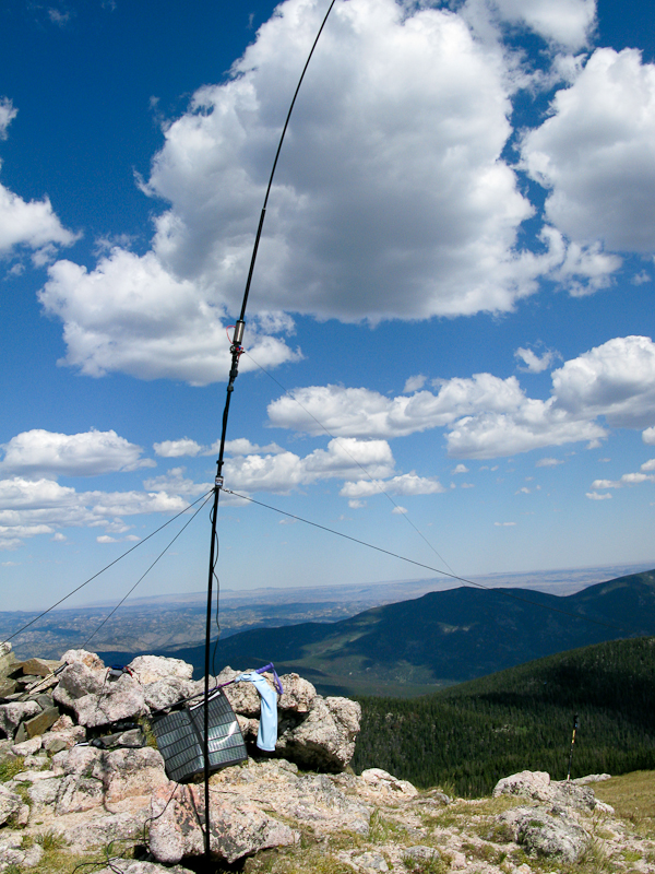
    The weather was just perfect, with a few white and puffy clouds which provided a nice contrast on the blue sky. The setup was easy since space was not an issue and all the rocks lying around helped me with guying the mast in this windy environment . It was my first time with the newly acquired shock-corded mast from Buddipole. I really like the reduced weight of it but it requires a different technique to set it up and to change bands. All the ‘training’ in my backyard helped and I was on the air in no time. It was my first week-end activation and getting QSOs was definitely easier than on all my prior outings, even-though the propagation conditions were not necessarily better than before – at least that is my theory and I am sticking to it.

    The Descent:
    If you arranged for a shuttle in Pingree Park, you might enjoy a different route, but for us it was the same route back to the car.

    Some video impressions:

    If you would like to leave questions or comments, please do so through Youtube.

    I activated this summit again on May 5th, 2012. You can find the trip-report right here:


    ATTENTION !! WARNING !! There are old mountaineers, and bold mountaineers… there are no old-bold mountaineers. Hiking and mountain climbing are potentially hazardous activities particularly in Colorado with its extreme elevations. I am not accepting responsibility for any death or injury resulting from activations based on my trip reports. Proper training, experience, and personal capability assessment is required – enjoy!