SOTA outings by KØMOS and contributors

Tag: W0/FR-088

  • WØC/FR-Ø88 (Mount McConnel) – 2nd activation

    This was a re-activation for me. If you are looking for all the details on how to get there and other useful info, you can find the original trip-report with the necessary details right here. This post has only a few specifics from today’s activation.

    Waking up this morning,  I was not sure whether I saw fog or smoke when I looked out of the window. However, my nose was clear about what was going on – it was definitely smoke… coming from a large wild-fire (Hewlett fire) just a few miles north of here. It has been burning for the last six days and consumed over 7300 acres (~30 square km) in the Poudre Canyon, one of my main access routes to SOTA summits. Checking the Web confirmed that Co14 was closed between Ted’s Place and Rist Canyon due to the fire. I was planning to activate Mount McConnel, an easy hike of ~4,2 mi (6,8 km) and 2110 ft (643 m) ASL, about 10 miles up the Canyon from the fire. The road closure forced me to take an alternate route through Rist Canyon to get to the trail head. The early morning drive along the small and winding road was very enjoyable and I reached the trail-head ahead of schedule. The bridge over the Poudre River to Mountain Park Campground (where the TH ls located) was still closed for the season – so I parked the car on the downhill side of the road on a small gravel strip and started my hike. The temperatures were perfect, low 60s with a light breeze. Wildflowers started to come out everywhere and I quickly found my rhythm heading up the trail.  Hanging out with my own thoughts, I almost stepped on a large male Dusky Grouse who panicked and flapped nervously into the trees. He almost gave me a heart-attack, but I was glad it was just a grouse and nothing more predatory. Shortly after that incident we had another encounter. This time it was a little more civilized and relaxed, at a safe distance. He displayed his square tail but did not allow me to take a good picture – too bad. By the time I reached the summit, it was partly cloudy and with all the particles in the air from the raging fire not too far from here, the views were not as good as I had experienced last time.  I used the top of a tree (growing below the cliff) to attach and tune my antenna for 17m. My first contact was with Kriss/KA1GJU/AM who was en route to San Francisco. He was just about 50 miles east of me at 36’000 ft (~11’000 m) and was kind enough to use his unique position and 400 W radio to drum-up some more contacts – thanks a bunch Kriss. 17m was not very productive so I re-tuned to 20m and worked most of my regular chasers. By the time I could not copy any more chasers, more clouds already moved in and the winds picked-up too. A sign to pack up and head down.

    Thanks for all the contacts and spots.

    Update: Sadly, since then Mount McConnel has now been consumed by the Highpark fire as well. As of yesterday, two more SOTA summits are within the burn area.

    Some video impressions:
    httpvh://www.youtube.com/watch?v=azvG7_AnVAk

    Please post comments or questions through YouTube.


    ATTENTION !! WARNING !! There are old mountaineers, and bold mountaineers… there are no old-bold mountaineers. Hiking and mountain climbing are potentially hazardous activities particularly in Colorado with its extreme elevations. I am not accepting responsibility for any death or injury resulting from activations based on my trip reports. Proper training, experience, and personal capability assessment is required – enjoy!
  • WØC/FR-Ø88 (Mt. McConnel) – 8020 ft / 2444 m

    Mount McConnel (WØC/FR-Ø88), part of the Front Range of the Rocky Mountains, is located about 25 miles (40 km) north-west of Fort Collins, CO. The mountain is within the Roosevelt National Forest in the Cache La Poudre Canyon. The trail up to the summit consists of two overlapping loops.

    1. William Kreutzer Nature Trail and (#936)
    2. Mount McConnel Summit Trail (#992)

    The Summit Trail splits off the Nature Trail at t it’s highest point and loops over the ridge and finally re-joins the Nature Trail making it an easy and enjoyable 4.23 miles (6.8 km) hike.

    Trailhead: 6612 ft / 2015 m
    Summit: 8020 ft / 2444 m
    Elev. gain: 1408 ft / 429 m
    Roundtrip: 4.23 mi / 6.8 km

    Compare this summit with my other activated summits

    How to get there:
    Take US287 N from Fort Collins towards Wyoming. Go west  at Ted’s Place on CO14.

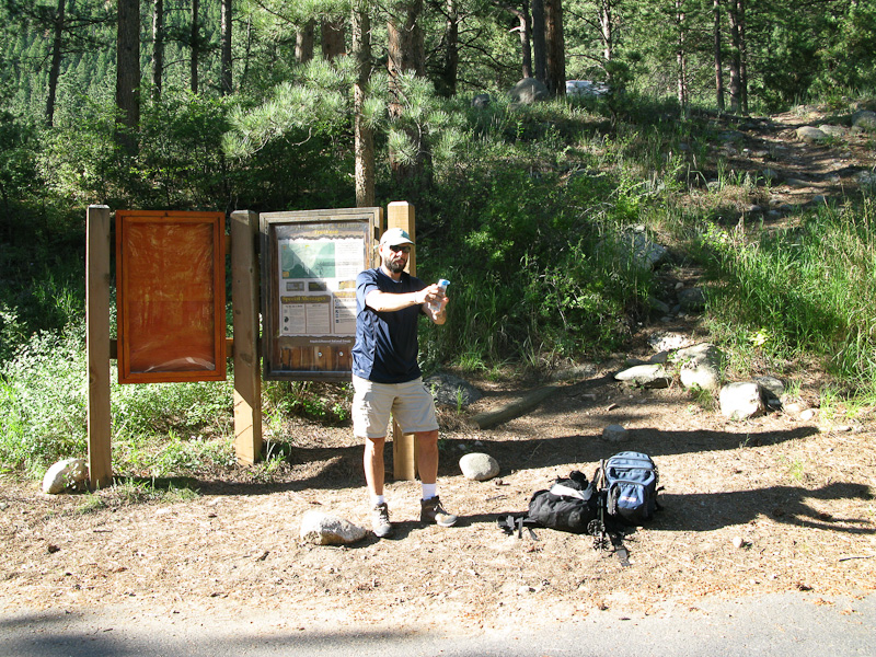
    KØMOS at the trail-head of Mount McConnel

    About 24 miles into the Canyon turn left into the Mountain Park Campground where you will find about five parking spaces. There is an bulletin board right at the parking lot with information, regulations and a map. It seems that the board was relocated at some point in time. The label You Are Here on the map is certainly not were you are. Keep that in mind. You have to go uphills towards the campground where the trail-head is located, despite of what the sign says. Alternative parking can be found just after the bridge alongside the road (facing downhills – on the side of the river).

    Parkinglot/Trailhead

    View Larger Map

    Red Tape:
    The National Forest requires a day use fee of $5.00. Dogs are required to be leashed.


    The Ascent:
    The trail  leaves the Mountain Park Day Use Area at the east end of the campground. I went up Kreutzer Nature Trail (#992). The trail climbs gradually up the south face through Ponderosa pines and Douglas firs. It is a well established trail with several interpretative signs along its way. After about 3/4 of a mile (1.2 km), the Summit Trail splits off and you will get to a quite spectacular overview of Poudre Canyon. Following the trail will bring you very close to some cliffs and several really nice overlooks. Shortly after entering the Cache la Poudre Wilderness (there is a sign), the trail forks again. You have to take the right fork to get to the near summit (approx. 0.2 mi/500m), the left fork continues the Summit Trail (going down to the river again).

    The Summit:
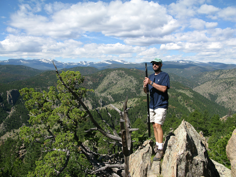
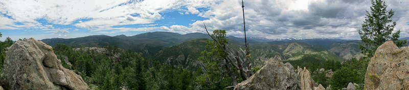
    The trail ends at the base of some large rock outcroppings where you will experience spectacular views into the Mummy Range of the Rocky Mountains.

    View of the Mummy Range from atop Mt. McConnel
    View of the Mummy Range from atop Mt. McConnel


    The available rocks and trees/tree-stumps provided ample and comfortable space for my equipment. Setting it up was a breeze and my signal got out well.

    Setting up the antenna

    After finishing my eighth QSO, I turned off the radio and enjoyed the gorgeous views, the warm sun and the solitude. After an hour or so, another hiker stumbled onto the summit… an RF engineer from Florida who was vacationing in Colorado. After a little chat, he went back down and I packed up my equipment, leaving this place as well.

    The Descent:
    At the fork, I turned south continuing on the Summit Trail which descends back into the Poudre Canyon through very a scenic landscape. The trail is not as well established as on the ascent, but keeping an eye on the stone cairns will help you find the way just fine. The descent is longer, steeper and rockier as well, providing several opportunities for panoramic views over  the Poudre Canyon. It finally joins the Nature Trail again before going down a gulch and emerging east of the bridge leading to the campground.

    Some video impressions:
    httpvh://www.youtube.com/watch?v=XY7SjK-mvrw

    If you would like to leave questions or comments, please do so through Youtube.

    Update: Read the trip report of my second activation of Mt. McConnel


    ATTENTION !! WARNING !! There are old mountaineers, and bold mountaineers… there are no old-bold mountaineers. Hiking and mountain climbing are potentially hazardous activities particularly in Colorado with its extreme elevations. I am not accepting responsibility for any death or injury resulting from activations based on my trip reports. Proper training, experience, and personal capability assessment is required – enjoy!