This was a re-activation for me. If you are looking for all the details on how to get there and other useful info, you can find the original trip-report with the necessary details right here. This post has only a few specifics from today’s activation.
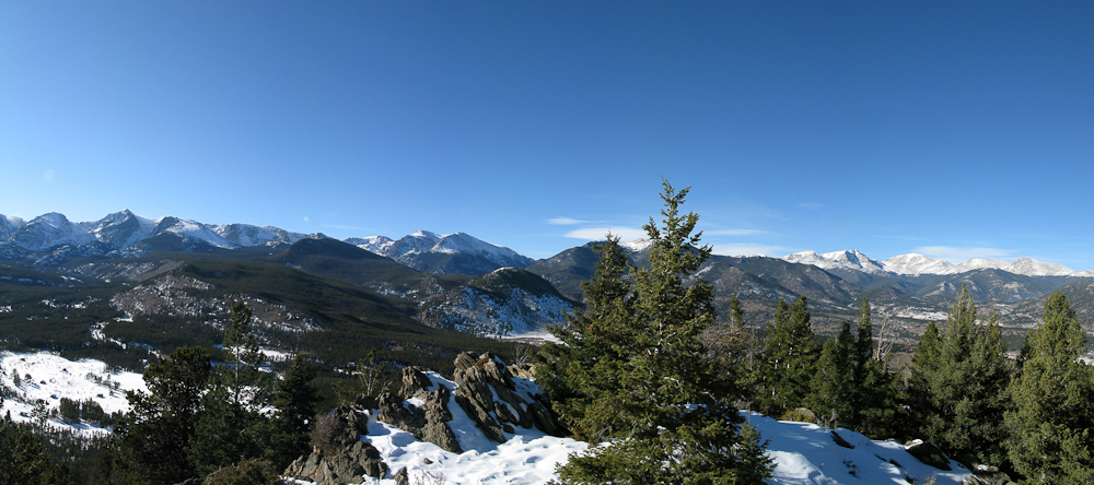
Emerald Mtn. – View from the summit
Today’s activation of Emerald Mtn. was my second summit of the day. Earlier I had activated Eagle Cliff Mtn. (WØC/FR-Ø58 ) on 15 and 20m (see separate trip-report) . Since Emerald Mtn. is just a few miles up the road and the weather was gorgeous, a double activation was an obvious choice. With my earlier acquired information about the trail-head and route, the ascent was a breeze. The south slope was almost snow free and snow-shoes were not required. Without the snow I could even find a small stone cairn on the trail to Glacier Basin campground. The cairn is just before you enter an Aspen grove and after a rock outcropping. That’s where I left the trail and headed towards the summit in an (almost) straight line. Distance and elevation gain is almost identical to Eagle Cliff Mountain, making today’s excursion a 4.5 mi (7.2 km) round-trip with a total of ~2500 ft (750 m) accumulated elevation gain.
Luckily, the S8 noise I experienced last time on this summit was gone – making me believe that it was related to the approaching snow-storm. The winds however were quite strong – even stronger than last time and I had to guy the antenna really well. My extremities started to get cold thanks to the high winds and the fact that I was sitting in the snow – even-though the sun was out. I packed-up my gear and went QRT after I did not get any further responses to my calls. It was indeed a wonderful day in the mountains.
Some video impressions:
httpvh://www.youtube.com/watch?v=pW6KmzYLnOc
If you would like to leave questions or comments, please do so through Youtube.
!! WARNING !! There are old mountaineers, and
bold mountaineers… there are no old-bold mountaineers.
Hiking and mountain climbing are potentially hazardous activities particularly in Colorado with its extreme elevations. I am not accepting responsibility for any death or injury resulting from activations based on my trip reports. Proper training, experience, and personal capability assessment is required – enjoy!
I got up at 6:00 AM this morning, facing a moderate 18 degrees F (approx. -8C) and clear skies outside – just a sliver of the moon and clouds over Longs Peak towards the west. A winter storm warning was issued for later in the day, but I thought I had enough time to activate WØC/FR-Ø58 (Emerald Mountain). The dogs were not too excited to go for a walk in the dark and at these freezing temperatures – but I guess they were relieved that they did not have to join me on the mountain.
The drive up through Thomson Canyon followed the frozen river all the way up to Estes Park. Entering Estes Park through US34 always presents a perfect overview of the surrounding mountains. Even though I was still driving under clear skies, clouds were settling in the mountains in every direction – guess the weather forecast had not lying.
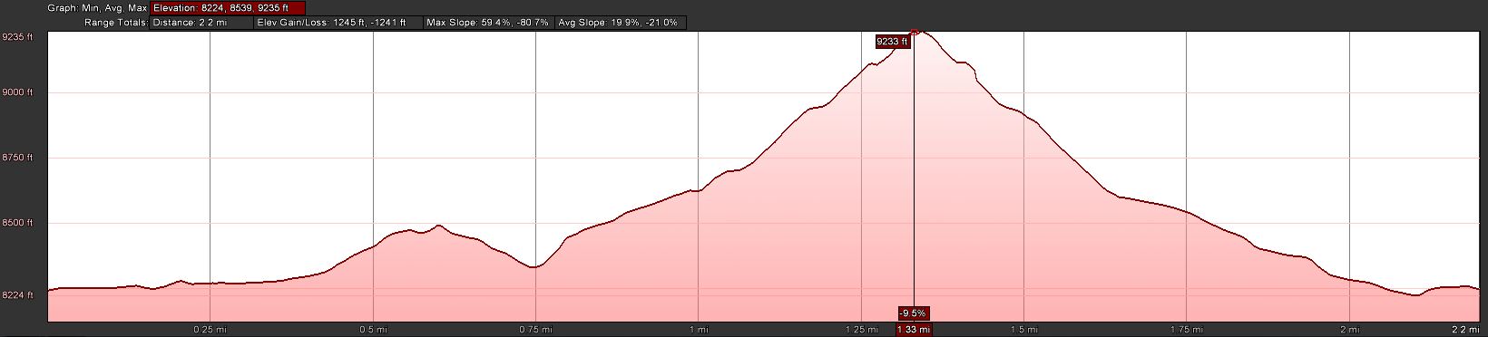
Trailhead: 8244 ft / 2513 m
Summit: 9237 ft / 2810 m
Elev. gain: 1245 ft / 380 m
Roundtrip: 2.2 mi / 3.5 km
How to get there: Take US34 from Loveland towards Estes Park through Big Thompson Canyon. Emerald Mountain is on the south-west side of Estes Park. Stay on US34 towards Rocky Mountain NP. Go left on County Road 66 (or Tunnel Road), following the signs to the YMCA campus. Follow the road all the way to the end. There is a campground at the very end – so is the East Portal of the Big Thompson Project Pipeline. Park your car at the loop of the road (there is room for about 10 cars on a gravel strip at the south side of the loop.
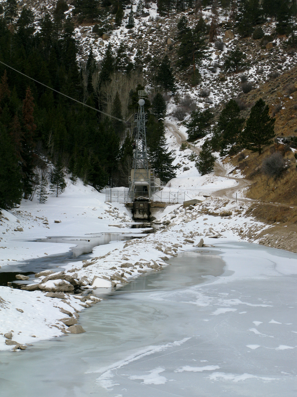
At the East Portal of the Big Thompson Project Pipeline is a small (really small) reservoir – and the surrounding area is Federal property. You are not supposed to park, fish, boat, pee etc. within 100 yards of the dam – Homeland security and such. Emerald Mountain is – at least partially – within the RMNP, ergo it is a fee area and their rules apply (no dogs etc.) I am not sure about RMNP entry fees… since the trail starts outside of the park, I think you are not required to have a NP pass. I have a yearly pass anyway and did not investigate this aspect so far.
The Ascent:
Elevation Profile
I selected the south face of the mountain for my ascent. It can be tackled from almost any side but I was hoping that the south would have less snow compared to the other options. In addition, for part of the way I could use a trail going from the East Portal TH to the Glacier Basin campground in RMNP. I just passed the reservoir of the East Portal when I realized I forgot my camera in the car… so I turned around to get it. That is when I broke my sun-glasses… not that I needed them today but still… #$@%. Walking back to the reservoir, snow flurries started to fall and a stiff wind came up from the west. I continued the road uphills when a Jeep drove towards me, driving downhills but backwards? It was Sam, a RMNP Ranger patrolling ‘his’ park. We talked for almost half an hour. He was very interested in SOTA and I was interested in his insider’s know-how of all the different routes to SOTA summits in the park and around Estes Park. We finally parted ways and I headed uphills in a (almost) straight line, trying to make up for lost time to keep my appointment on the summit. Luckily the south face was almost snow free – even better, the soil was frozen and I made good time. Every now and then, I could even see a faint trail going up the mountain.
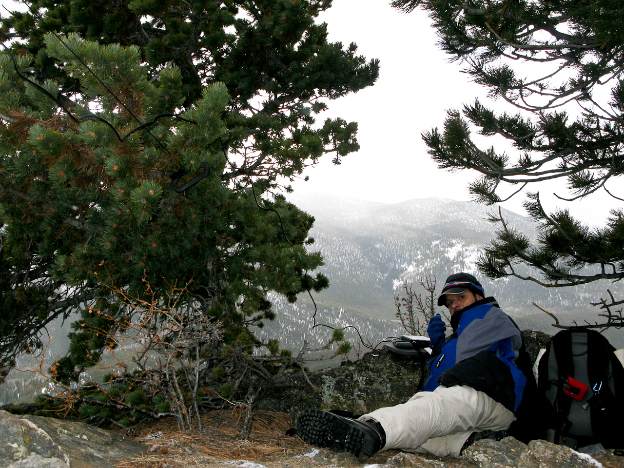
The Summit: The summit is rather small. I pretty much used up most of the space with my antenna guy-lines. It could host two small teams of activators. There are some rocks which can provide shelter from the wind – unfortunately the lee side was filled in with a deep snow drift. I had about six inches of snow on the top with some clear areas under (Christmas) trees – I claimed this spot immediately as my operating position.
Operating position
Setting up the equipment and antenna took a little longer than usual – fiddling with Buddipole coil-taps with cold fingers is not easy. I did not want to drop one into the snow. Turned on the SWR analyzer and…. nothing… lets hope it is just an empty battery. So I had to use the internal meter of the FT-817. Turned on the radio on 20m and I experienced S8 noise throughout the band… I am used to S8-S9 noise at home but on a summit? No clue why… I had activated several summits nearby and never before had an issue on 20. Two adjustments to the counterpoise and I was on the air, calling CQ 20 minutes ahead of plan. The temperature was below freezing and the wind ~15-20 mph (guesstimate). There was a small blue cloud and the sun tried to peak out every now and then but finally gave up, overwhelmed.
Thanks to the high noise level, I could only hear strong stations. After 12 contacts on 20m in 25 minutes I had to wrap it up. My feet and hands started to get uncomfortably cold and I was shivering.
The Descent: Soon after leaving the summit it got warmer. Getting out of the wind and moving my body certainly felt good. I soon found a faint trail and followed it all the way down directly to the car – a route I would recommend to the next activator.
Some video impressions: httpvh://www.youtube.com/watch?v=PcCG2f8j5og
If you would like to leave questions or comments, please do so through Youtube.
I activated this summit again on January 10th, 2012. You can find the trip-report right here.
!! WARNING !! There are old mountaineers, and
bold mountaineers… there are no old-bold mountaineers.
Hiking and mountain climbing are potentially hazardous activities particularly in Colorado with its extreme elevations. I am not accepting responsibility for any death or injury resulting from activations based on my trip reports. Proper training, experience, and personal capability assessment is required – enjoy!
 !! WARNING !! There are old mountaineers, and
bold mountaineers… there are no old-bold mountaineers.
Hiking and mountain climbing are potentially hazardous activities particularly in Colorado with its extreme elevations. I am not accepting responsibility for any death or injury resulting from activations based on my trip reports. Proper training, experience, and personal capability assessment is required – enjoy!
!! WARNING !! There are old mountaineers, and
bold mountaineers… there are no old-bold mountaineers.
Hiking and mountain climbing are potentially hazardous activities particularly in Colorado with its extreme elevations. I am not accepting responsibility for any death or injury resulting from activations based on my trip reports. Proper training, experience, and personal capability assessment is required – enjoy!