SOTA outings by KØMOS and contributors

Tag: vorarlberg

  • OE/VB-287 (Galinakopf) – 2198 m / 7211 ft

    As I am writing this (November, 25th, 2011), I learned with great sadness that OE9GWI is now a silent key. Even-though I never met Gerhard personally, I had the pleasure working him on all my SOTA activations in Austria. He chased and spotted me on every activation – including this one. He was not only active in the the SOTA program but was also a fellow Buddipole user – I am sorry I could not share this trip report with him – I am sure he would have liked a report from a summit in his ‘back-yard’.
     

    The rather nasty weather (for a Coloradoan anyway) gave me two days off from my activations. During these days, I exchanged a few e-mails with a local HAM – OE9HRV, Herbert – who was my first contact on the ‘Pfänder‘ (on my first activation in Austria). He not only knows his ‘Ländle’ but is also a very busy SOTA activator. He advised me on summits, routes and other local considerations and invited me for a joint activation of the ‘Galinakopf‘ for the next day. I accepted of course – no better way to activate a summit than with local knowledge. This summit is rather interesting and is part of the ‘Rätikon range‘ of the Eastern Alps. Since the border between Austria and the Principality of Liechtenstein goes right across the summit, it carries two SOTA designations – one for Austria (OE/VB-287) and one for Leichtenstein (HBØ/LI-ØØ7). According to the rules, you can activate this summit from both sides and claim the points twice. Since Liechtenstein is a rather small country (160 square kilometers or 62 sq mi and a population of about 35’000) it has only a few SOTA summits (11) and finding an SOTA activator in HBØ is therefore a rare opportunity for chasers everywhere. Unfortunately I did not research whether my radio-license is valid in Liechtenstein and therefore chose to activate the summit from the Austrian side only – just to be sure not to violate any rules/laws.

    Trailhead: 5145 ft / 1568 m
    Summit:   7211 ft / 2198 m
    Elev. gain: 3271 ft / 997 m
    Roundtrip: 9.3 mi / 14.9 km

    Compare this summit with my other activated summits

    How to get there:
    Herbert (OE9HRV) provided full service and picked me up at my temporary QTH in Dornbirn. First we headed west into Switzerland and took E43 (N13) south until the exit of Buchs (SG). We continued to Sevelen where we crossed the bridge over the Rhein which brought us into Vaduz (Liechtenstein) and continued towards Malbun via Triesenberg und Steg. We drove in pretty thick fog until we reached Triesenberg at about 3000 ft or 1000 m AMSL. The views above the fog were just breathtaking and Herbert made a short detour to Gaflei to show me around. Just click on the pictures below to get a larger version and a better idea how it looked like.
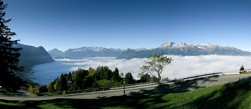
    The view from Gaflei

    There is a skiing area just shortly before arriving in Malbun with the necessary parking lots to accommodate all the cars in winter. That is were we parked the car at 9:30 and walked back down a few hundred yards to to the trail-head.

    Parking/Trailhead

    View Larger Map

    Red Tape:
    Make sure to carry your passport when traveling in this border region. You will slip in and out countries several times a day.

    The Ascent:
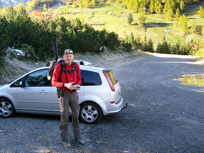
    OE9HRV – Herbert is ready to roll

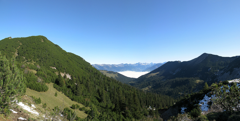
    The first section of the 9.3 mi or 14.9 km hike is quite steep over a well maintained forest road and gets your heart pumping for sure. Very soon we had to stop and take off some layers of clothing in order not to overheat. After ~1.2 miles or about 2 kilometers we reached  a wooden bench where we stopped for a drink of water and to catch our breath. This is where I heard DL9MDI calling me on the local 2m repeater we were monitoring. DL9MDI (Fred) had been helping me out prior to the trip and so far we only communicated via e-mail and SKYPE. It was a nice surprise and we chatted shortly… he wished us good luck and we were back on the trail. The trail gave away some of the elevation gains (~250 ft / 80 m) on our way towards our target. The trail lead into a large valley where we could finally see the summit.
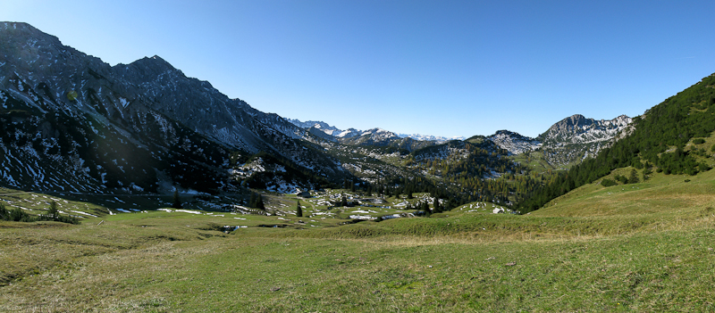
    View into the valley
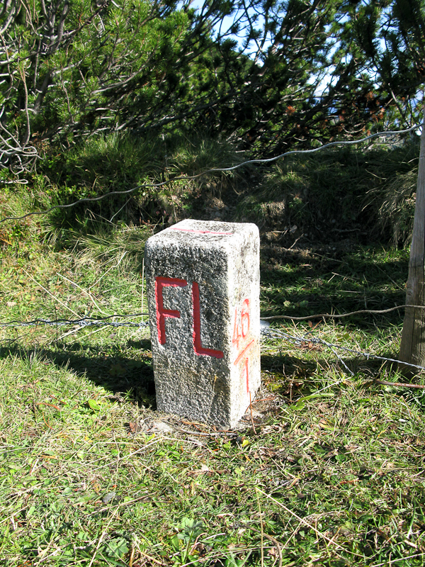
    Grenzstein Austria / Liechtenstein

    We continued the hike parallel to a ridge (connecting the Gamsgrat, Ochsenkopf and Scheienkopf and finally the Galinakopf), which also represents the border of Austria/Liechtenstein, at moderate elevation gain. That changed quite a bit after finally reaching it. We followed the ridge/border to the north, heading directly towards the Galinakopf. The last mile (or 1.6 km) was very steep but offered excellent views to the west and south. The thick fog over the valley reminded me of a calm ocean, something you hardly see here in the Rocky Mountains of Colorado. After reaching the summit, we spent the first few minutes taking pictures and videos, before setting up the equipment.
    View from the ridge

    The Summit:

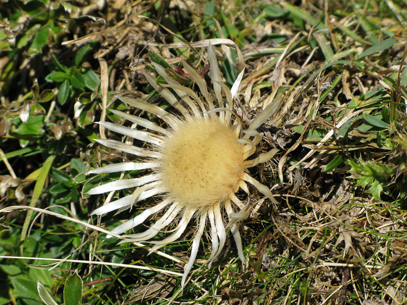
    Silver-thistle along the way

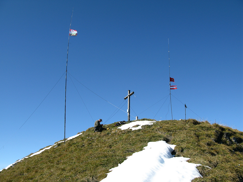
    There is a big wooden cross at the very top with a register. The north side of the mountain is a big, steep and grassy slope – certainly a dangerous avalanche area in winter. The remaining sides are steep cliffs which should give me a nice take-off angle for my vertical Buddipole antenna. Herbert was setting up his double bazooka (for 40m) and J-pol (for 10m) antennas on an insanely tall fiberglass mast. I was setting up my vertical Buddipole close to the abyss.
    Our 'antenna-farm' on the summit

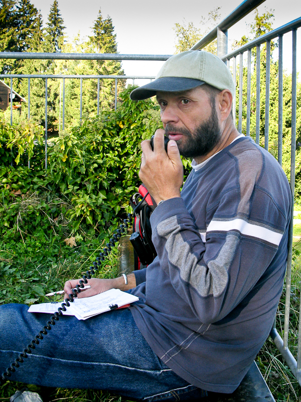
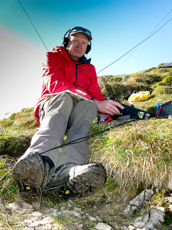
    Within a few minutes, we had our rigs going, Herbert his ICOM 706MK2G on a LIFEPO4 (12 Ah) and I my Yaesu FT-817ND with my foldable solar panel. Within minutes I experienced a pile-up using Herbert’s rig with 100 W on 40m,  something I had never experienced in previous WØ activations. I had my hands full answering the stations – the foreign call-signs did not make it any easier for me. After the first wave was over, I left Hebert take over his own rig and retreated to my 5 W rig.
    OE9HRV is heating up the air-waves

    Normally I operate on 20m but shortly before I left for Europe I talked to Chris (W6HFP) from Buddipole by phone who recommended to try the 10m band. So I tuned the antenna to 28.385 Mhz for the first time ever – not sure what to expect. My second CQ call was answered by VE2JCW – that’s over 6000 km (or close to 4000 miles). I was stunned and excited at the same time since I never expected such distances on just 5W. But it got even better… the next two QSOs were with N4EX and
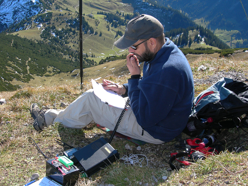
    Working on 40m (Photo by OE9HRV)

    WA2USA (two very active SOTA chasers in the US), both over 7000 km (or ~4500 miles) afar. It does not get better than that. It turned out to be a perfect day in every respect. With the day progressing, the light got better as well and offered lots of opportunities to take pictures of the 360 degrees of unobstructed mountain views with the thick  fog still hanging in the valley well below us – not really a motivator to leave this slice of heaven.

    The Descent:
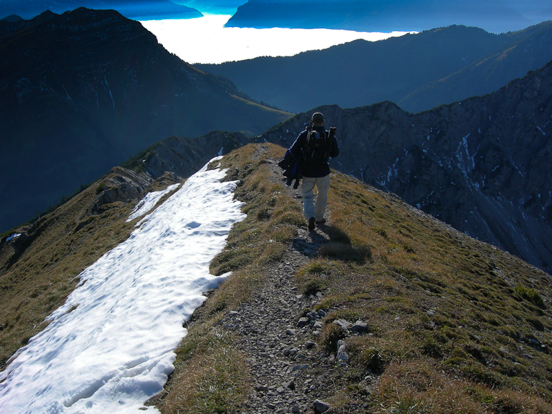
    Heading down (Photo by OE9HRV)

    After spending four hours on the summit, it began to get colder and we still had quite a hike in front of us. At 16:30 we started to pack up our gear and headed down. Not paying attention, we made a unplanned detour on very steep ground just a few meters below the summit. After climbing back up, we started to pay closer attention to the trail and finally made it back to the car after a two hour hike. Herbert dropped me off at my QTH – just in time to have a shower and make my dinner appointment. It was an exceptional day… a great hike and amazing conditions for a SOTA activation – Thanks Herbert!

     Some video impressions:

    httpvh://www.youtube.com/watch?v=BiEe9nKAneM

    If you would like to leave questions or comments, please do so through Youtube.


    ATTENTION !! WARNING !! There are old mountaineers, and bold mountaineers… there are no old-bold mountaineers. Hiking and mountain climbing are potentially hazardous activities particularly in Colorado with its extreme elevations. I am not accepting responsibility for any death or injury resulting from activations based on my trip reports. Proper training, experience, and personal capability assessment is required – enjoy!
  • OE/VB-5Ø4 (Geißkopf) – 1198 m / 3930 ft

    The weather forecast for today was not too good. Therefore I was looking for another SOTA peak nearby. The ‘Geißkopf’,or OE/VB-5Ø4, fit the bill. The ‘Geißkopf’ is part of the ‘Bödele‘, the landmark mountain of Dornbirn, the largest city in the state of Vorarlberg (Austria). There is a great public transportation system which can get you up there. Since SOTA rules demand that I get to the summit human powered (at least the last 150 ft of elvation), I started out well before the ‘Bödele Pass – 3789 ft / 1155 m‘. Even-though there is a bus stop at the pass, that might not result in the required elevation gain from here. Three bus stops (Dornbirn Langwies) before the pass seemed to be a good fit and served as my trail-head. From here it is possible to hike through the woods for the most part and avoid the busy road. Due to the foggy weather, I have only limited pictures/videos.

    Trailhead: 3030 ft / 924 m
    Summit:   3930 ft / 1198 m
    Elev. gain: 1447 ft / 441 m
    Roundtrip: 4.2 mi / 6.7 km

    Compare this summit with my other activated summits

    How to get there:
    As mentioned earlier you have choices, take a car or take public transportation.

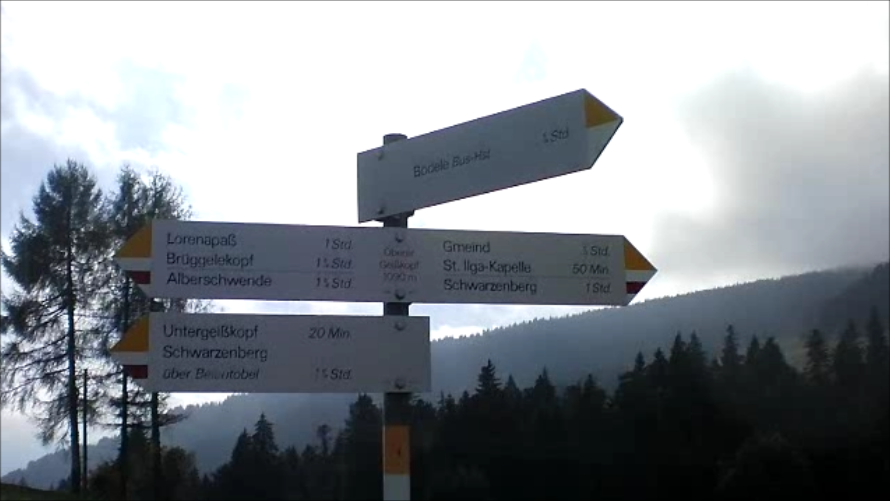
    Just follow the signs

    Take the ‘Bödele-Strasse’ (or L48 ) from Dornbirn or take the Bus line 38 (Dornbirn -Bödele – Schwarzenberg – Bezau) which leaves every 30 minutes, starting at the Dornbirn Railway Station. Park or get out of the Bus at ‘Dornbirn Langwies‘. The trail you are looking for is just a few feet behind the bus-stop – leading south and finally parallels the road.

    Parking/Trailhead

    View Larger Map

    Red Tape:
    This area is a popular local recreation area and finding a parking spot might be difficult, specially on week-ends and/or sunny weather.

    The Ascent:
    There is not a lot to report. It’s a very moderate trail leading directly to the Bödele-Pass (yes, there is a Restaurant). Cross the road to the parking lot. On the north side starts the trail down through a moor and then up through some settlements to the Geißkopf (which you can see from the parking lot). There are no challenges along the way, its a well established trail and there are no doubts when it comes to navigating the area.

    The Summit:
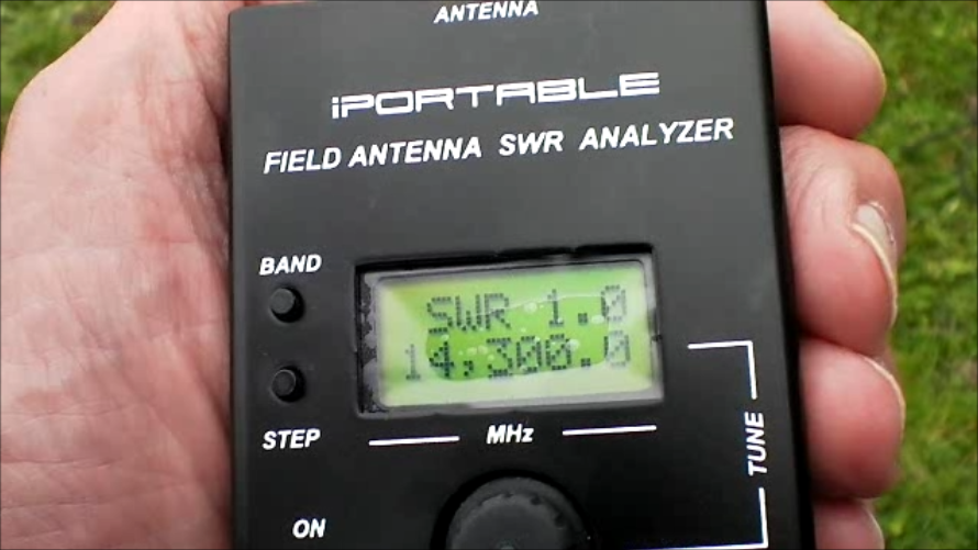
    There is a wooden cross at the highest point (as on most summits in this area) with a wooden bench. Nice for a picnic or to setup your radio. Since the weather was kind of foggy/cloudy (hard to say where the fog stopped and the clouds started) nobody else claimed the summit or the bench. Setting up the antenna for 20 m was easy with the soft, grassy ground (for the pegs) and the available topography. There is enough space for several antennas, in case you are looking for joint activation. Shortly after the antenna was

    Perfect SWR

    up and tuned, the fog rolled in heavily, resulting in chilly temperatures. The scarce sun-rays could not penetrate the fog anymore. My first QSO was DH3RB (Ruediker), a station at the Danish/German border, using a Buddipole configuration as well. Apparently he had seen some of my Youtube videos before and was quite excited to catch me on the air. The remaining QSO’s were with stations in Austria, Greece, England, Bulgaria, Finland and Spain. After 16 QSOs in ~30 minutes, I was happy go pack up my gear due to the chilly temperatures. I am not used to this kind of cold in high humidity.

    The Descent:
    It was a quick descent down the same trail, through the moor and to a nearby parking lot where I had a pick-up shuttle, getting me down to the valley for a nice glass (or two) of ‘Glühwein‘ and cookies.

    Some video impressions:

    httpvh://www.youtube.com/watch?v=2nLgDlCQtbM

    If you would like to leave questions or comments, please do so through Youtube.


    ATTENTION !! WARNING !! There are old mountaineers, and bold mountaineers… there are no old-bold mountaineers. Hiking and mountain climbing are potentially hazardous activities particularly in Colorado with its extreme elevations. I am not accepting responsibility for any death or injury resulting from activations based on my trip reports. Proper training, experience, and personal capability assessment is required – enjoy!
  • OE/VB-512 (Pfänder) – 1064 m / 3491 ft

    I visited Europe for a couple of weeks and took my radio equipment with me to do some SOTA activations. The next few trip-reports summarize my Austrian SOTA activations. BTW, clicking onto a picture included in this trip-report will show you a larger version.

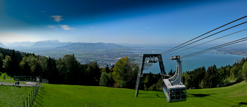
    For my first activation, I was looking for a summit with easy access. I wanted to make sure I have everything with me before heading into the mountains. I found the perfect SOTA summit for my requirements during my time in Austria/Vorarlberg. OE/VB-512 was just a few miles from my temporary QTH and there even is a gondola going from Bregenz (the capital of Vorarlberg) to the very top. Bregenz is delightfully located on the shore of Lake Constance (one of Europes largest lakes) and is probably most famous for it’s summer music festival that features an opera on a open-air /floating stage. Even James Bond could not resist to visit the opera in his quest to rescue the world, in his movie ‘Quantum of Solace‘.

    I decided to take the gondola – which leaves close to the lake shore – and take a short detour downhills in order to satisfy SOTA rules, instead of hiking all the way up.

    Trailhead: 1374 ft / 419 m
    Summit:   3491 ft / 1064 m
    Elev. gain: 2117 ft / 645 m
    Roundtrip: 5.5 mi / 8.9 km

    Compare this summit with my other activated summits

    How to get there:
    Goto the harbour in Bregenz. There is a roundabout with a sign directing you to the base station of the Gondola. If you arrive by train, it’s a short 15 minute walk from the train-station.

    Parking/Trailhead

    View Larger Map

    Red Tape:
    The Pfänder cable car operates daily from 8 AM to 7 PM. It is closed however for an annual audit, so make sure you check their website or call ahead. There is a fee of about € 11.00 for a round-trip. You can check their rates on their website also.

    The Ascent:
    Since I took the easy way up, there is not a lot to report. The ride to the top lasts about six minutes in a large gondola with panoramic views. Make sure to get the to the window (lake facing) quickly to get the best view on your ride up the mountain.

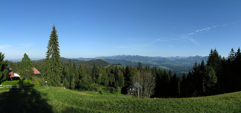
    View from the Summit

    The summit:
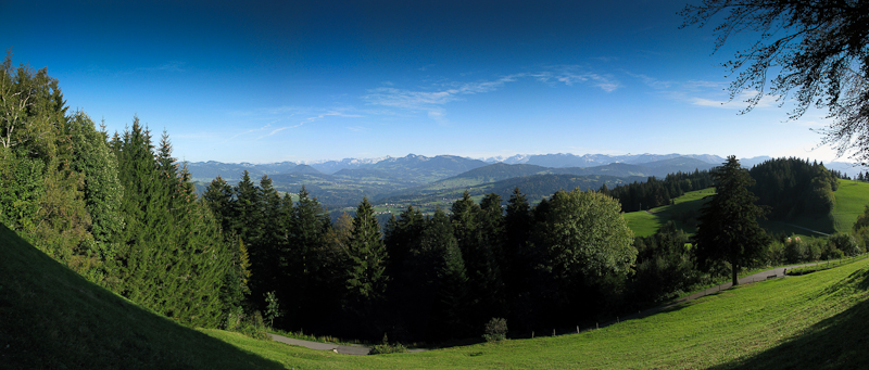
    First of all I had to hike downhills for a while to be in line with SOTA regulations. After coming back up to the gondola station, it is a another few minutes to the very top of the Pfänder. This is not a good location for setting up the radio equipment due to its size and popularity with all the tourists/visitors. It does however provide stunning views across Lake Constance, the Swiss, Austrian, German and Lichtenstein alps (assuming clear weather). Even-though it was a week-day, it was very crowded and I started to miss the solitude of the Rocky Mountains.

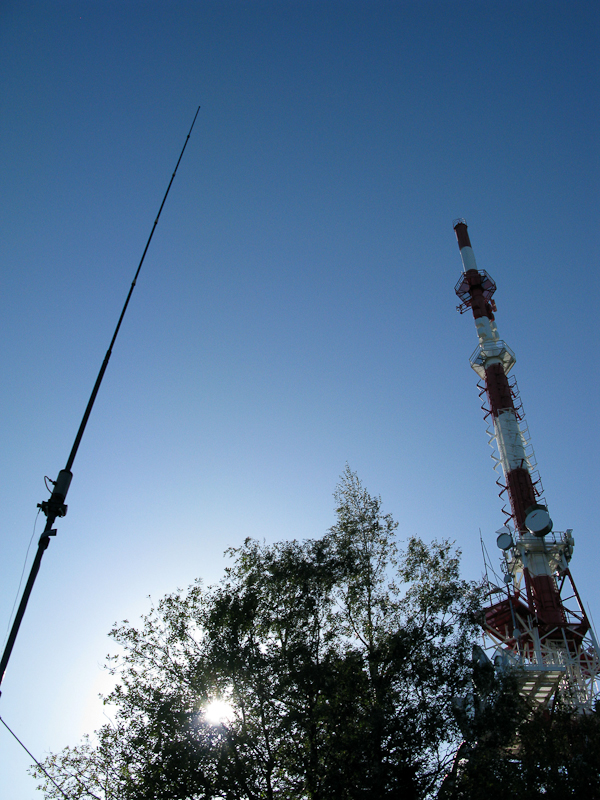
    My Buddipole competing with the Radiotower

    The summit is quite large, providing several restaurants within a few minutes of walking and a huge radio tower!!! I started to setup my equipment about 60 m from the tower and was wondering whether all the RF flying around would even give me a chance to get out. My back-up plan was an activation on 2m and I had my little HT programmed with the Pfänder repeater frequencies to announce my presence. Unfortunately I was not able to open the repeater, which seemed strange to me at such a short distance (I learned later that the repeater was out of order). It took me unusually long  to get the antenna and radio up and ready. For the first time I carried a small antenna analyzer (IP30) with me to get the antenna resonant… but no matter what I tried I could not even get close to an SWR acceptable for transmission – at least that is what the analyzer indicated. I finally ignored the analyzer and hooked up my FT-817, which was quite happy with the antenna. I guess the RF cloud from the radio tower overwhelmed the IP30.

    KØMOS/OE calling CQ on 20m

    My first response to my CQ SOTA on 20m came from OE9HRV (Herbert) and my second contact was OE9GWI (Gerhard), both residents of Bregenz – a whopping 3 miles from my current location. As is turns out, both of them are very active SOTA activators / chasers. Both contacts turned into very reliable chasers during my time in Austria and Herbert was a very knowledgeable source for all SOTA summits ‘im Ländle‘ Vorarlberg. He even invited me to a very memorable activation of the Galinakopf (OE/VB-287) – report/video will follow. The remaining contacts were to Austria (no surprise), England, Greece, Spain and Canada (VE1WT) – 3413 mi / 5493 km on 20m with 5W into my Buddipole – not bad for the first day. I was quite happy with the results and the activation. Since the sun was slowly setting, I was packing up to take more photographs and to catch the last gondola.

    The view to the east
    Another view from the summit

    The Descent:
    The descent in the gondola was certainly a treat – great views across the lake and Bregenz for six minutes :)

    Some video impressions:
    httpvh://www.youtube.com/watch?v=uN4Bl-6NyGw

    If you would like to leave questions or comments, please do so through Youtube.


    ATTENTION !! WARNING !! There are old mountaineers, and bold mountaineers… there are no old-bold mountaineers. Hiking and mountain climbing are potentially hazardous activities particularly in Colorado with its extreme elevations. I am not accepting responsibility for any death or injury resulting from activations based on my trip reports. Proper training, experience, and personal capability assessment is required – enjoy!