SOTA outings by KØMOS and contributors

Tag: Bighorn Mountain

  • WØC/FR-Ø36 (Bighorn Mountain) – 3487 m / 11463 ft – Activation attempt

    Bryan/NØBCB and I attempted to activate Bighorn Mountain for the TTF/SOTA event on Saturday. The summit (3487 M / 11463 ft) is in beautiful Rocky Mountain N.P., the weather forecast was excellent with temperatures in the 70s (~20 C) and the amount of ALERTS posted on SOTAwach promised a very busy activation with tons of S2S possibilities.
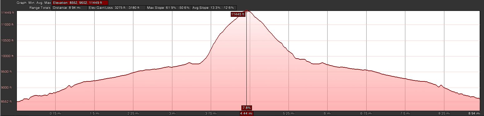
    Bighorn Mtn. - ElevationProfile
    Bighorn Mtn. – ElevationProfile
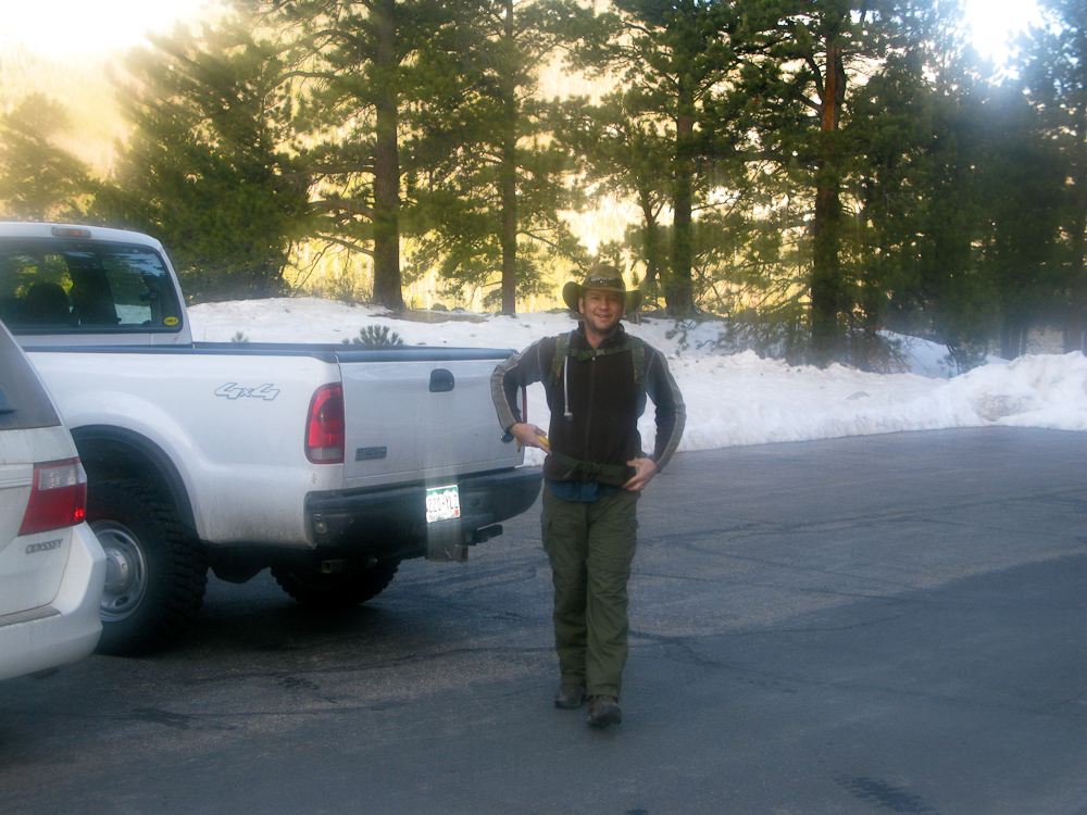
    Bryan/NØBCBat the Trailhead of Bighorn Mtn.
    Bryan/NØBCB at the Trailhead of Bighorn Mtn.

    We started early at the Lawn Lake trail-head to have enough time available on the summit. We headed up at 7:00 AM with temperatures around 30F (~0 C). The snow on the ground was hard and crunchy. The first three miles of the trip climbs rather steadily along the banks of Roaring River on an established trail. Thanks to the fresh snow we received last week, the trail was snow covered and soon became a major obstacle on our way up. Snow-depth was around 2-3+ feet and we had to take turns to break the trail. It got increasingly difficult and we made very little progress, on occasions sinking in all the way to out belly-buttons.

    Bryan/NØBC breaking trail
    Bryan/NØBC breaking trail

    Upon reaching the point where we would have to turn SE, leaving the trail and bushwhack our way up the steep slopes, we assessed our situation and options. So far we had only covered 3 miles in 2.5h and we estimated at least another 2h of ascent in deep snow. That would have put us on the summit at least 2h late of our plans and therefor we opted to head back to the TH, and to setup our radios to at least participate in  the TTF event.

    It took us almost 2.5h to reach the TH and we logged our first QSO around 18:15 (UTC). Band conditions and our location (surrounded by mountains) were less than ideal. All bands we tried (10/15/20/40) were pretty quiet, even Megawatt stations barely copyable.  The only SOTA/TTF station I was able to contact was Jeremy/NH6Z in Oregon and a few stations in Florida.

    Overall a disappointing SOTA/TTF day for us but a nice outing in the RMNP. More snow is in the forecast for tomorrow, looks like the snowshoes have to stick around for a little while longer.

    Since we had no chance to take pictures on the summit, check out last years trip-report with video footage.

    73, Matt/KØMOS


    ATTENTION !! WARNING !! There are old mountaineers, and bold mountaineers… there are no old-bold mountaineers. Hiking and mountain climbing are potentially hazardous activities particularly in Colorado with its extreme elevations. I am not accepting responsibility for any death or injury resulting from activations based on my trip reports. Proper training, experience, and personal capability assessment is required – enjoy!
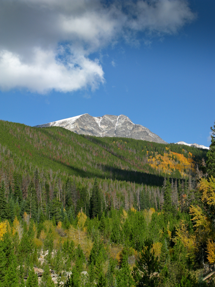
  • WØC/FR-Ø36 (Bighorn Mtn.) – 3487 M / 11463 ft

    It was a ‘last minute’ decision to go on this activation. WØC/FR-Ø36 or Bighorn Mtn.  is located within Rocky Mountain National Park (RMNP), just east of the Mummy Range (Continental Divide). Yesterday we got some snow/rain in the mountains and the road to Mt. Evans is already closed for the season. Trail-ridge road was temporarily closed as well. The weather forecast for today was excellent (at least until later in the afternoon). However, I woke up to thick fog so I could not even see the road, let alone the mountains. The drive up to Estes Park was slow, thanks to the fog and to some heavy trucks in the canyon. I arrived ten minutes later than planned at Lawn Lake trail-head to a beautiful blue sky, bugling elks  and pleasant temperatures.

    Bighorn Mtn. – Trailhead

    Trailhead: 8552 ft/ 2565 m
    Summit:   11463 ft / 3847 m
    Elev. gain: 3280 ft / 1000 m
    Roundtrip: 9.0 mi / 14.5 km

    Compare this summit with my other activated summits

    How to get there:
    Take US34 from Loveland towards Estes Park through Big Thompson Canyon. Enter RMNP through the Fall River Entrance Station and take a right at the Lawn Lake trail-head sign. A rather large parking lot which can be found shortly after.

    Parking/Trailhead

    View Larger Map

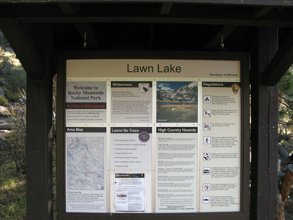
    The trail-head provides toilets and the usual information kiosk.

    Red Tape:
    – RMNP is a federal fee area

    The Ascent:

    bla
    Bighorn Mtn. – ElevationProfile
    Bighorn Mtn – Views from the river banks

    Since there is no established trail to Bighorn Mtn., I consulted Google Earth to find a suitable route. An approach from the west seemed to be a good solution because I could follow the Lawn-Lake Trail for about 3.5 miles before turning east, bushwhacking my way up to the summit. The Lawn-Lake trail follows the Roaring River through a gorgeous forest, mainly pines but with a few Aspens groves which sparkled yellow and golden already. On several occasions along the the river you get an idea of the massive flood that occurred here in 1982, killing several hikers/campers. Huge boulders were swept down-rivers like marbles.  The steep banks of the river also allow some very scenic views of the northern Mummy Range. Shortly after passing the sign to the Cutbank and Golden Banner camp areas, I left the comfortable trail and started the steep and unpleasant bushwhacking part. I tried to aim for the saddle between Bighorn and Tileson. It was very slow going. Thick forest, steep terrain and slippery boulders (thanks to the rain, the lichens on the boulders were very slick) hampered my progress. Every now and then, I could get a glimpse through the trees to the Mummy Range – a spectacular view from the summit seemed very likely.

    The Summit:

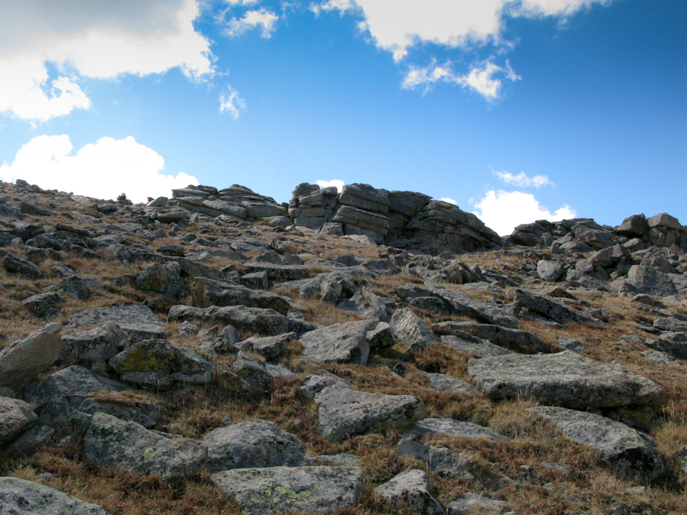
    Bighorn Mtn – The Summit?

    After breaking through the tree-line, I could finally see where I was heading. There were several rock-outcroppings at the top to choose from. The first one I climbed was of course not the summit, but the second one was the highest point and I found a summit book which confirmed that I had indeed reached the top of Bighorn Mtn. The summit is rather large, ideal for multiple activators at the same time. The views are spectacular, one of the best in this area for sure. My initial calls on 2m were unanswered but the HF antenna was up and tuned in no time. Phil/NS7P was the first who answered on 14.343 and thanks to his spot the summit was activated successfully in no time.

    The Descent:
    I tried to find a gentler and easier way down, heading more towards the saddle. The fact that I could actually see where I am going helped quite a bit. The first part was just fine but I ended up in similarly steep terrain, trying to find the Lawn Lake trail. I hit the trail at the same location I had left it, thanks to GPS technology :)

    Some video impressions:
    httpvh://www.youtube.com/watch?v=f4DjZ5q9cj0

    If you would like to leave questions or comments, please do so through Youtube.


    ATTENTION !! WARNING !! There are old mountaineers, and bold mountaineers… there are no old-bold mountaineers. Hiking and mountain climbing are potentially hazardous activities particularly in Colorado with its extreme elevations. I am not accepting responsibility for any death or injury resulting from activations based on my trip reports. Proper training, experience, and personal capability assessment is required – enjoy!