Phase 2 of the US 36 permanent reconstruction is scheduled to begin July 21 as Kirkland Construction transitions into the area to complete the road. Construction is expected to continue into late this fall.
The biggest part of this phase will require a closure of the road between milemarkers 18 and 19, which is near the bottom, close to Lyons. That closure will begin July 29 at 6 a.m. The road will re-open for weekend traffic Aug. 2-3 and then close again for Aug. 4-8. The road will open on Saturday, Aug. 9 at 6 a.m.
If you want to drive up to Estes Park and/or RMNP from the Frontrange, you are better off taking US34 (from the north) or use SH7 from Lyons.
!! WARNING !! There are old mountaineers, and
bold mountaineers… there are no old-bold mountaineers.
Hiking and mountain climbing are potentially hazardous activities particularly in Colorado with its extreme elevations. I am not accepting responsibility for any death or injury resulting from activations based on my trip reports. Proper training, experience, and personal capability assessment is required – enjoy!
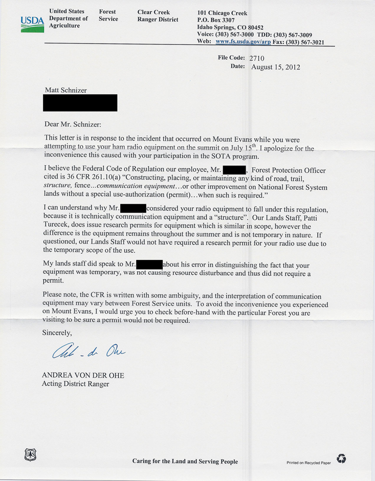
I finally received a letter from the Clark Creek Ranger District regarding my encounter on Mt. Evans (read the first part of the story if you are not familiar with it). It took me almost six weeks and several e-mails to get an official statement from the Ranger District. I guess an underfunded federal agency has more pressing issues to deal with.
The good news is that it was an over-eager FS employee who kicked me off the mountain.
The bad news is that, according to the letter, the Federal Code of Regulation [36 CFR 261.10(a)], which applies to communication equipment, is written with some built-in ambiguity and might be interpreted differently in other Forest Service units.
Official Response
Well, I will deal with another interpretation if and when I run into another issue. The Clear Creek Ranger District interpretation however makes sense to me – chapter closed!
I really appreciate the clarification.
Read the entire letter by clicking on the thumbnail to the right.
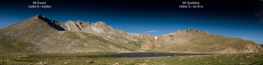
That’s my last post from Mt Evans but there are two more pictures I wanted to share. The first one was shot at the Summit Lake trail-head early in the morning. The trail starts on the right side of the picture, goes up the ridge to Mt. Spalding and over to Mt. Evans.
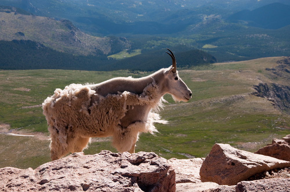
Panorama of the Mt. Evans AreaMountain goat on Mt. Evans
The second picture is from a close encounter of the third kind… well, not quite but is was remarkable. This unflinching mountain goat approached me. The picture is shot with a 52mm lens, not a tele-photo lens. He came up to me at arms lengh… too close for my taste. I normally try to keep a save distance between wild animals and myself, but this guy was not shy at all. Since I had never heard about occurrences of rabies in mountain goats and since I received some goat combat lessons earlier in the year (courtesy of Rooster) on my trip to Mt. Herman, I took the chance to take some real close-up shots instead of retreating.
Comments are open, feel free to add your thoughts.
73, Matt/KØMOS
!! WARNING !! There are old mountaineers, and
bold mountaineers… there are no old-bold mountaineers.
Hiking and mountain climbing are potentially hazardous activities particularly in Colorado with its extreme elevations. I am not accepting responsibility for any death or injury resulting from activations based on my trip reports. Proper training, experience, and personal capability assessment is required – enjoy!
I activated Mt. Evans for Summits on the Air (SOTA) on July 15th. I took the route from Summit Lake to the top early in the morning since thunderstorms were in the forecast for the afternoon. I had the peak to myself for almost half an hour which was unexpected, considering that there is a road all the way to the top. I setup my vertical Buddipole for 20m and started my activation – so far nothing out of the ordinary besides the bad band conditions due to the recent CME.
Mt. Evans – BP on the summit
I was talking to ACØA in Kansas when I spotted a National Forest Ranger running up the path from the parking lot. I could not understand what he was saying since I was
distracted by my ongoing QSO and
the lack of oxygen combined with his running up the mountain made his signal about a 22, with highly distorted audio.
He arrived at the summit breathless and stood next to me, courteous enough to let me finish my QSO (or just to catch his breath?). He then introduced himself and informed me that I have to take down the antenna immediately.
My first thoughts were that the antenna was considered some sort of a safety hazard for other visitors but NO. The reason is, he informed me, that you cannot build a structure on Nation Forest land without a permit. Sounds like a sensible rule to me…. who wants to see cabins etc. erected on public land everywhere. I argued that my antenna can hardly be considered a structure and my short survey among the few visitors on the summit (~10 people) came to the same conclusion – nobody considered my antenna a structure but he insisted. Furthermore he instructed me to drive to the Clear Creek Ranger District HQ in Idaho Springs to get a permit. Needless to say that I was not planning to make a ~60 mile round-trip to get a permit for my activities. I already had enough contacts for my Mt. Evans SOTA activation and the fact that I had planned another activation for later in the day I did not want to waste my time arguing and started to pack up. Luckily I had my tape-measure YAGI with me for my next activation and I was hoping it would pass the NOT BEING A STRUCTURE test by the National Forest (to make sure I did not ask).
I tried to follow up with the person in charge for the Clear Creek Ranger District… she is on vacation. Sure glad I did not drive all the way to Idaho Springs.
GOOGLing, I found Forest Rules You Need to Know, published by the Secretary of Agriculture. On page two, under the chapter OTHER PROHIBITED FACTS it indeed prohibits “Constructing, placing, or maintaining any kind of communication equipment without a special use authorization“. Again, that makes sense to me to avoid that every Tom, Dick and Harry sets up his own repeater on public land… it does however not make sense to me for a temporary, mobile/portable antenna as I was using.
It would certainly put a damper on SOTA activations and the upcoming 14er event. I am almost certain that on Field Day a lot of antennas go up on NF land.
I would be interested in your experience and/or opinion and I am planning to follow up with the Clear Creek Ranger District. Maybe I was just dealing with an overly eager Ranger? Stay tuned…
!! WARNING !! There are old mountaineers, and
bold mountaineers… there are no old-bold mountaineers.
Hiking and mountain climbing are potentially hazardous activities particularly in Colorado with its extreme elevations. I am not accepting responsibility for any death or injury resulting from activations based on my trip reports. Proper training, experience, and personal capability assessment is required – enjoy!
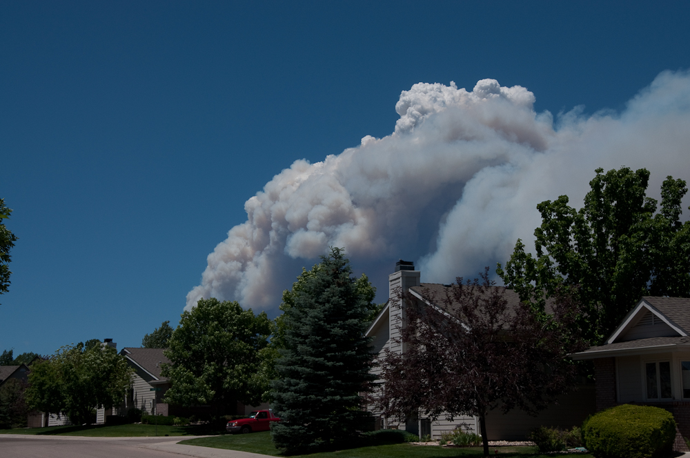
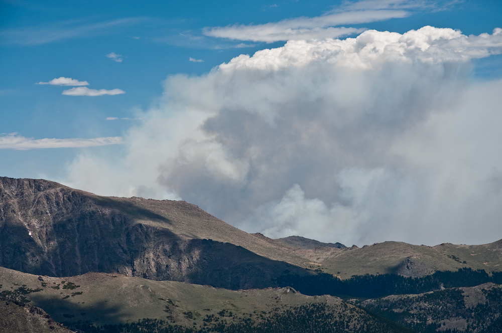
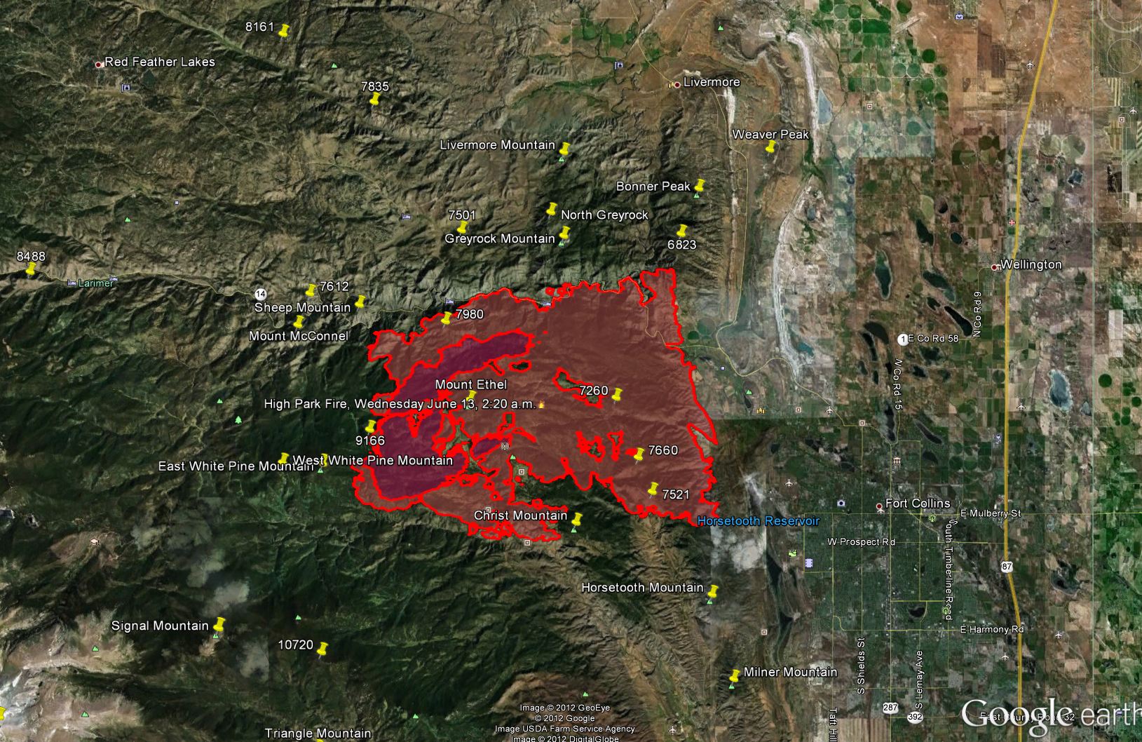
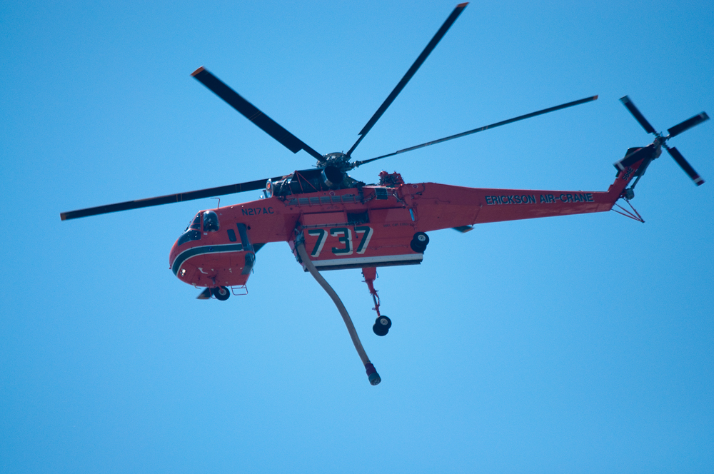
As you might have heard, the wild-fire situation here in the west is pretty bad. We currently have a huge fire going on in northern Colorado which started just about 10 mi from my QTH. So far (day 10) it has consumed an area of more than 58000 acres (~230 square km), destroyed >180 homes and displaced hundreds of people. There is no end in sight and several SOTA peaks are within the burning area or very close by and therefore not accessible due to road closures and smoke. In case you are planning a SOTA activation in N-Colorado, make sure to check the Incident Information System for the latest closures, evacuations and maps. I would suggest to stay away from all summits north-west of Ft. Collins, making US34 (Thompson Canyon) the last easy access into the Rockies.
Highpark Fire as seen from WØC/FR-Ø19 (Sundance Mtn)
I created a map with the latest published data of the fire including the impacted SOTA peaks.
Highpark Fire: impacted SOTA peaksOne of the 17 helicopters tackling the fire
Bottom line, plan your activation around here very carefully.
73, Matt/KØMOS
Update (June 22, 2012):
Just a quick update on the fire in N-Colorado. It now spread to over 68’000 acres (>275 square kilometers), and more SOTA peaks are withing the burn area. Lost structures are now >190 and unfortunately one fatality.
As far as I can tell from the published maps, the following additional SOTA peaks are now consumed by the fire as well.
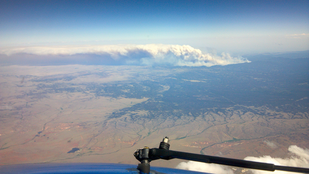
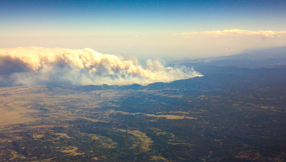
Kriss/KA1GJU sent me the following pictures of the fire, taken last week from ~36000 ft. Click on the picture to enlarge.
Highpark Fire from above (Photo credit: Kriss/KA1GJU)
Highpark Fire from above (Photo credit: Kriss/KA1GJU)
Stay safe…
Matt/KØMOS
Update (June 27th, 2012):
Larimer County & High Park Incident Command has taken away public access on the NIFC ftp server! I am no longer able to generate GE (Google Earth) maps with the SOTA summits overlays. More SOTA peaks are withing the burn area (WØC/FR-7980) for sure, maybe more). The fire situation is VERY bad and several large and destructive fires are impacting the Frontrange. Here a list with the largest ones.
Highpark fire near Fort Collins (87’284 acres), 257 homes lost so far, hundreds of evacuations. More info: http://co.dtswildfire.com/home/
Flagstaff fire near Boulder (230 acres).
More info: http://www.dailycamera.com/ci_20946242/flagstaff-fire-blaze-now-at-230-acres-but
Waldo Canyon wildfire near Colorado Springs (6200 acres) threatening thousands of homes, 32’000 evacuations so far (Incl. parts of Air Force Academy), structures are lost
More info: http://www.denverpost.com/breakingnews/ci_20949291/colorado-wildfire-waldo-canyon-fire-doubles-size
Woodland Heights Fire in Estes Park (29 acres), 23 homes lost, looks like it’s under control now
More info: http://www.coloradoan.com/article/20120626/NEWS01/120627001/Crews-call-Estes-fire-worstthey-veseen?odyssey=tab|topnews|text|FRONTPAGE
My point? If you are planning to travel to the Colorado Mountains in the next few days/weeks you have a good chance to be impacted by one of the fires. E.g. I25 was closed briefly yesterday, one of the main entrances to RMNP was closed due to the Woodland fire, CO14, CO74e are closed etc. etc. Plan ahead and be flexible. The high temperatures and high winds will stay with us for the next few days – ergo it will most likely become worse.
Matt/KØMOS
!! WARNING !! There are old mountaineers, and
bold mountaineers… there are no old-bold mountaineers.
Hiking and mountain climbing are potentially hazardous activities particularly in Colorado with its extreme elevations. I am not accepting responsibility for any death or injury resulting from activations based on my trip reports. Proper training, experience, and personal capability assessment is required – enjoy!
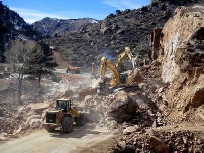 Phase 2 of the US 36 permanent reconstruction is scheduled to begin July 21 as Kirkland Construction transitions into the area to complete the road. Construction is expected to continue into late this fall.
 !! WARNING !! There are old mountaineers, and
bold mountaineers… there are no old-bold mountaineers.
Hiking and mountain climbing are potentially hazardous activities particularly in Colorado with its extreme elevations. I am not accepting responsibility for any death or injury resulting from activations based on my trip reports. Proper training, experience, and personal capability assessment is required – enjoy!
!! WARNING !! There are old mountaineers, and
bold mountaineers… there are no old-bold mountaineers.
Hiking and mountain climbing are potentially hazardous activities particularly in Colorado with its extreme elevations. I am not accepting responsibility for any death or injury resulting from activations based on my trip reports. Proper training, experience, and personal capability assessment is required – enjoy!