


W0N/PH-005 (Scotts Bluff) – 1417 m / 4649 ft
March 31, 2014
by KØMOS
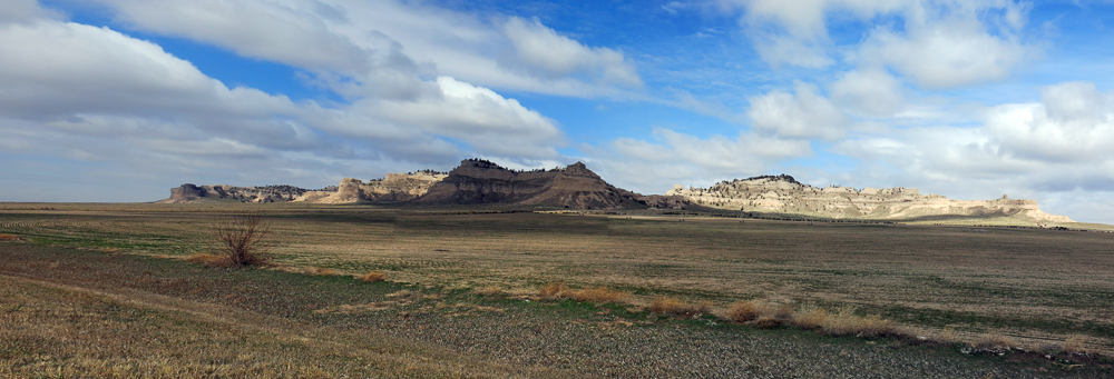
A high wind warning was in effect for northern Colorado for the last day of March and so I decided to head north-east towards the newest SOTA Association in NA: WØN or Nebraska. Scotts Bluff or WØN/PH-005 is the closest and most accessible WØN summit for me and had not yet been activated. Weather forecast predicted mostly cloudy skies, high winds and a 40% chance of snow for the area. The summit lies within the Scotts Bluff National Monument and even has an established hiking trail from the visitor center to the top.
Oc course I did not seriously expect to avoid the high winds by traveling north through Wyoming to the plains of Nebraska, but it was as good as any excuse to make the long trip and activate a new summit in a new association. As far as I know, it was the first activation in WØN.
Scotts Bluff National Monument
 Trailhead:  4118 ft / 1255 m
 Summit:     4649 ft / 1417 m
 Elev. gain:  531 ft /  162 m
 Roundtrip:  3.2  mi / 5.2 km
Compare this summit with my other activated summits
How to get there:
From my QTH (Fort Collins) I took I25 north towards Cheyenne, WY. I took exit 17 onto US-85 N/Canam Hwy/Torrington Rd. Make sure you have enough fuel in your tank. It’s going to be lonely a lonely trip with only sparse signs of civilization.
After 46 miles, turn right onto WY-151 E which becomes NE-88 E after about 10 miles. After another 20 miles, turn left onto NE-71 N/State Hwy 88. After another 11 miles, follow the signs towards Scotts Bluff National Monument.
There is a visitor center with a parking lot on the north side of the road.
There is hardly any traffic on these roads. I passed the time by trying to avoid as many tumbleweeds as I could. With the high winds, it seemed that I was constantly under attack. Tumbleweeds of all sizes rolling over the hills in troves, jumping over fences and crossing the roads with no respect for oncoming traffic. I had to stop twice and pick the under-carriage clean from the remnants of all the collisions.
Red Tape:
There is a $ 5.00 entry fee/car which is valid for seven days. Bikers/Hikers get away with a$ 3.00 fee.
Make sure to check their opening hours, they change depending on the season.
The Ascent:
The trail to the summit starts right behind the visitor center (NE corner). I began my journey with cloudy skies, high winds and a temperature of 29 degrees Fahrenheit (~ -2C)
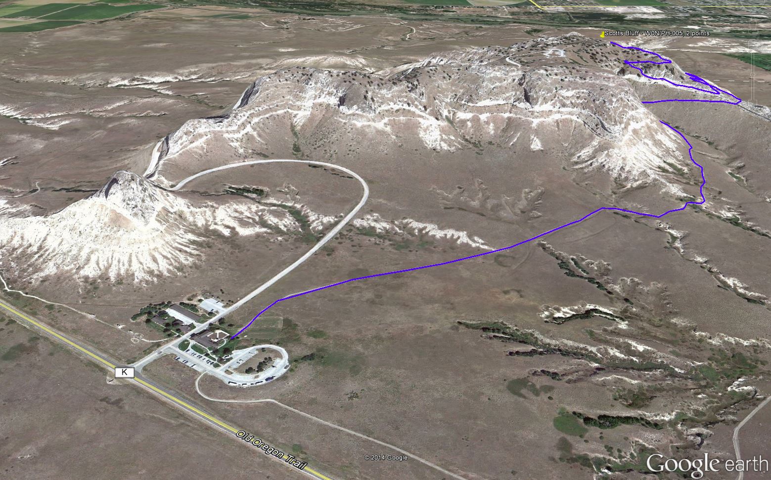
The trail to the summit – Overview
There are no challenges on this hike. Heck, it’s paved all the way to the top :) – you can’t go wrong. The path heads towards NE and hardly gains any elevation for the first 0.6 miles before it eventually heads up a ridge on the east side. With the cold and windy conditions it took me 35 minutes to cover the 1.6 miles to the top, but at least I stayed warm. You end up (almost) at the highest point of the plateau.
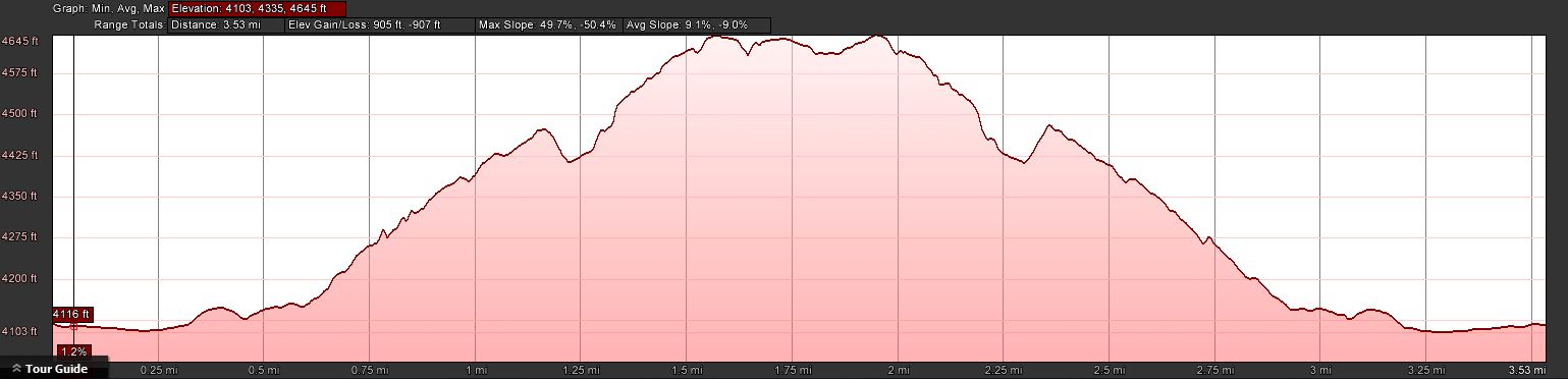
Elevation Profile
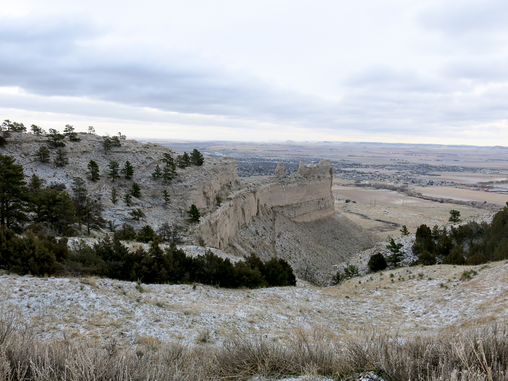
An interesting and rather unusual aspect of the hike is that you get a good view of more than 500 feet (> 150 m) of continuous geologic strata that spans about 11 Mio years into the past. Scotts Bluff is a remnant of an ancient high plain, several hundred feet above than the current plains. It was formed by erosion, well after the continent interior and after the uplifting of the Rocky Mountains.
The Summit:
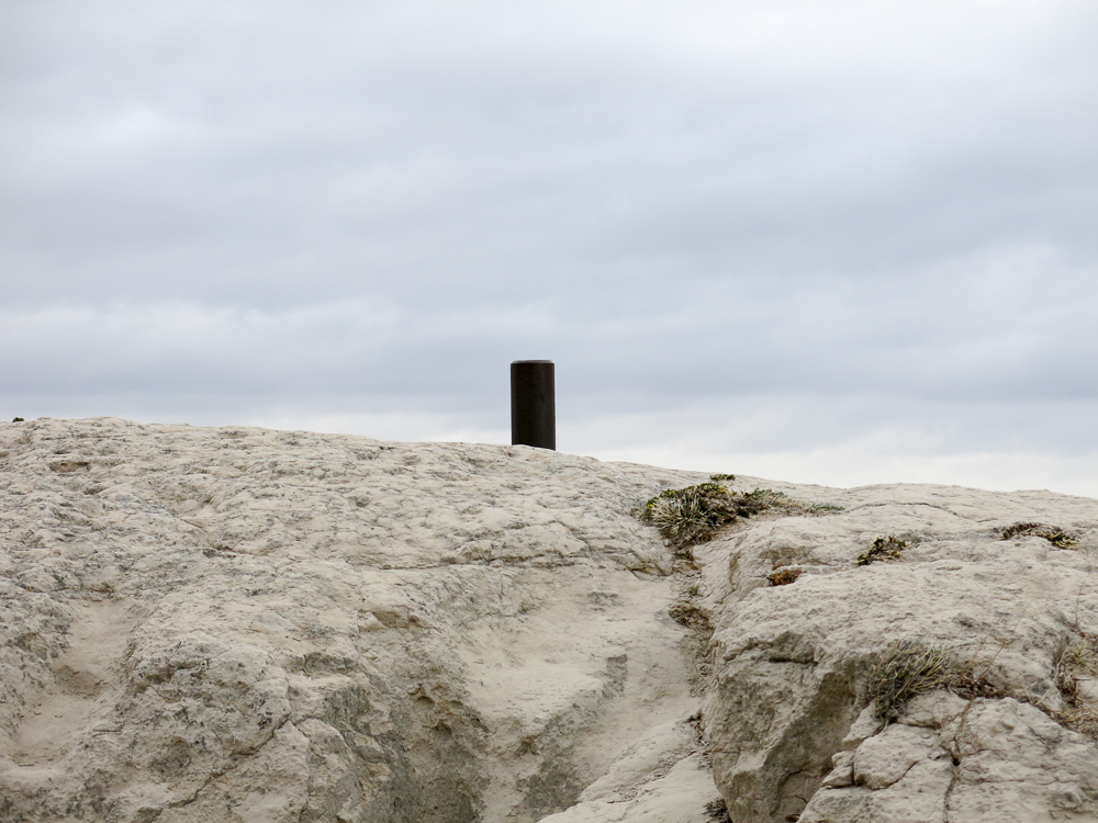
Highest Point
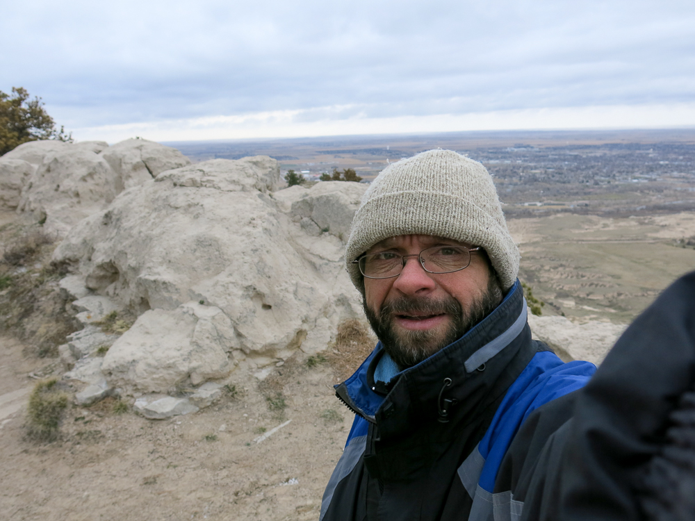
The winds were howling – around 40 mph (~65 km/h). Sand was in the air due to the geological properties of the mountain (sandstone). It took me no time to find the highest point on the rather large plateau but I moved on quickly to find shelter and to erect my fishing pole holding a linked EFHW antenna. I tried a few different locations before I found a large rock to hunker down behind at the right distance to a tree for my antenna.
It was immediately clear that I would not last very long on this summit under these conditions. The windchill, hovering around 10 degrees F (~ -12C) made the activation unpleasant. The mini sand storm did not help either and I was seriously afraid that the fishing-pole would not survive the gusts (up to 69 mph [111 km/h]).
How do I know all these numbers, you might ask? I went to the visitor center to warm up and to learn about the history of the place before hitting the road again. The ranger on duty had access to two weather stations and since I was the only visitor, she had tons of time at her hands to go through the data with me. Highest gust was at 10:07 (local time), just when the first chasers got into my log.
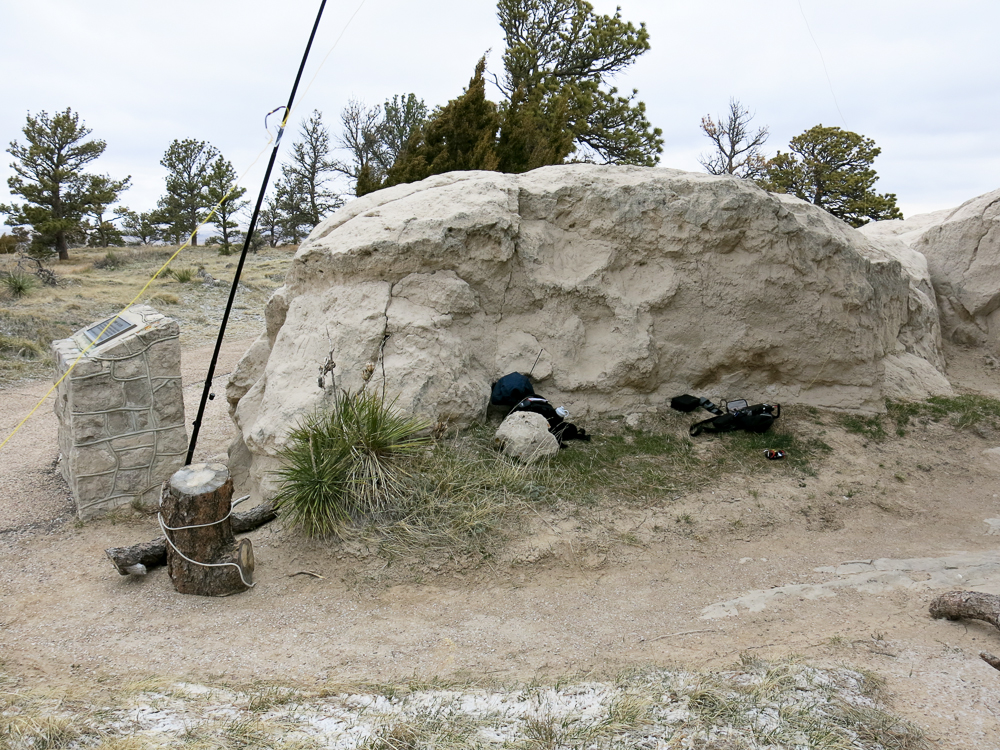
Shack on a summit
The upper portion of the 20m band was packed but my QSOs with an ongoing NET attracted a few SOTA chasers. Moving away from the frequency in order not to hijack the NET left me high and dry… nobody followed me to the new frequency and no spot either. I left the summit shortly after my last QSO with icy fingers and sand everywhere… and I mean everywhere. Just seven QSOs in the log but happy that it worked out after all and happy that my pole and antenna survived the beating.
The Descent:
Just follow the paved path, all the way to the parking lot.
A few more photos:
-
- View from the summit
-
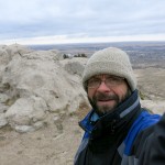
- Selfie on the summit
-
-
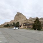
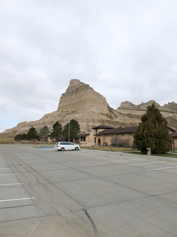
My car @ the visitor center
Eagle Rock in the background
Final Remarks:
Don’t miss the exhibitions in the visitor center incl. the movie (on request). It gives you a nice overview of the significance of the place (Oregon Trail) and of course the fauna, flora and geology.
There is also a road to the top if you decide against hiking. During the high season, there is a bus service which allows you to hike up and take the bus down to visitor center.
Until next time….
73, Matt/KØMOS
Feel free to leave comments and/or questions below.
![]() !! WARNING !! There are old mountaineers, and
bold mountaineers... there are no old-bold mountaineers.
Hiking and mountain climbing are potentially hazardous activities particularly in Colorado with its extreme elevations. I am not accepting responsibility for any death or injury resulting from activations based on my trip reports. Proper training, experience, and personal capability assessment is required - enjoy!
!! WARNING !! There are old mountaineers, and
bold mountaineers... there are no old-bold mountaineers.
Hiking and mountain climbing are potentially hazardous activities particularly in Colorado with its extreme elevations. I am not accepting responsibility for any death or injury resulting from activations based on my trip reports. Proper training, experience, and personal capability assessment is required - enjoy!
Congratulations on first Nebraska activation! I hope to get out there this year, but it’s quite a hike from here. It’s even a six hour drive from my home town of Crete… Frandy N1FJ (usually activating as NE1SJ) I did do the first activations from Michigan, I believe. Loved those easy summits!
Thanks for your comment. Did not know Michigan has summits ;)
73, Matt/KØMOS
Hi Matt, thanks a good read matched with great pictures.
73
Andrew, VK1NAM
Hi Andrew, thanks for your comment. I am always keeping an eye on your blog. Hope be back to VK for some more SOTA activations.
73 and sure hope for an S2S with you in the near future.
Matt/K0MOS