


W0C/FR-072 (Mt. Olympus) 2679 M / 8808 ft
May 3rd, 2014
by KØMOS
Mount Olympus stands tall right between Big Thompson Canyon (US34) and Little Thompson Canyon (US36) on the east side of Estes Park (CO). It’s a stunning mountain even though it’s elevation is not even 9000 ft (~2800 m) – and therefore only a two pointer in the WØC association.
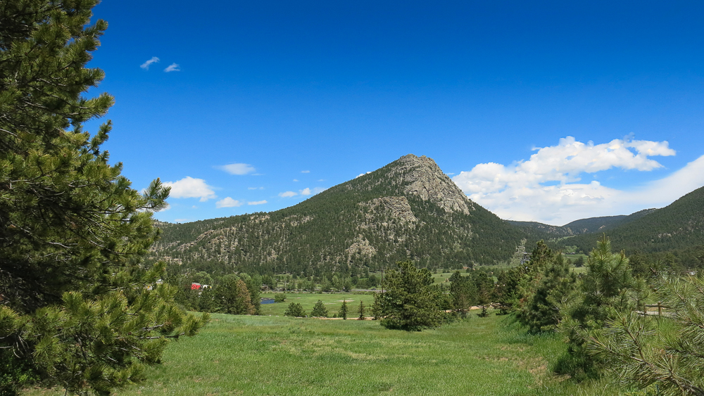
Mt. Olympus – 2679 m / 8808 ft
I have driven by this mountain numerous times in the past but since it is all bushwhacking to the top and only rewards two SOTA points it had lingered on my ‘to-do’ list… for way too long in turns out. The hike is prettier than expected and the summit provides some unusual views towards the continental divide and Rocky Mountain National Park. Definitely recommended – if you have the necessary route finding skills.
The approach from the south (US36) is difficult since this side belongs to the Crocker Ranch and is therefore private property. So is the actual summit (according to the USGS map) but it is possible to get into the activation zone on NF land from the north. There are no signs, barbed wire fences or any other indication that the summit is on private property. It seems that the owner does not mind hikers reaching the very top.
 Trailhead:  7351 ft / 2241 m
 Summit:     8808 ft / 2679 m
 Elev. gain: 1575 ft /  480 m
 Roundtrip:  2.1  mi /  3.4 km
Compare this summit with my other activated summits
How to get there:
Drive east from Estes Park towards Loveland on US34. After passing Lake Estes, the road goes into the Canyon. There is a little gravel pullout on your right with a NF sign, indicating that you are entering Roosevelt National Forest. That’s your best bet to leave your car.
Parking/Trailhead
Red Tape:
Keep in mind that the summit is on private property, but as mentioned above, there is no indication that the owner has any issue with you climbing to the top.
The Ascent:
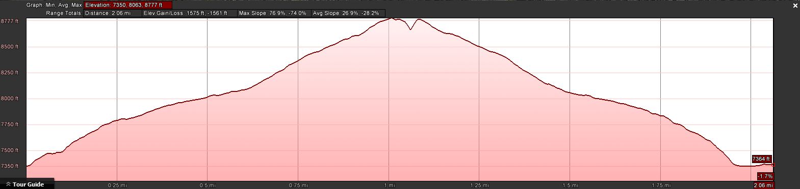
The elevation profile
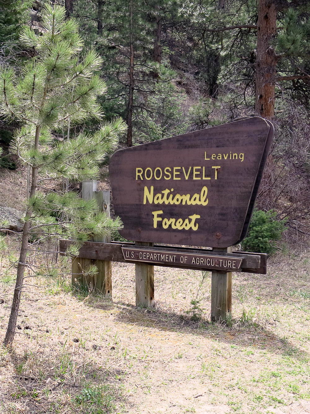
Park at the sign
I climbed up the steep slope just behind the sign, keeping my route to the NE (downriver). I traversed numerous rock outcroppings and stayed way left of the steep couloir. Eventually the terrain became less steep and the forest opened up a bit. Plenty of rock outcroppings everywhere, giving you a chance to climb up and take a peek towards the Continental Divide. I ignored the stone cairns here and there since they they did not indicate a clear path and just followed my gut and navigational instincts.
About half way up the terrain flattens out even further, making for a nice hike through the woods. The cairns became more numerous and they seemed to lead into the right direction. I started to follow them, a wise decision since the slope became steeper and the underbrush more dense. Following the cairns led me comfortably through some really thick stuff right to the summit.
The Summit:
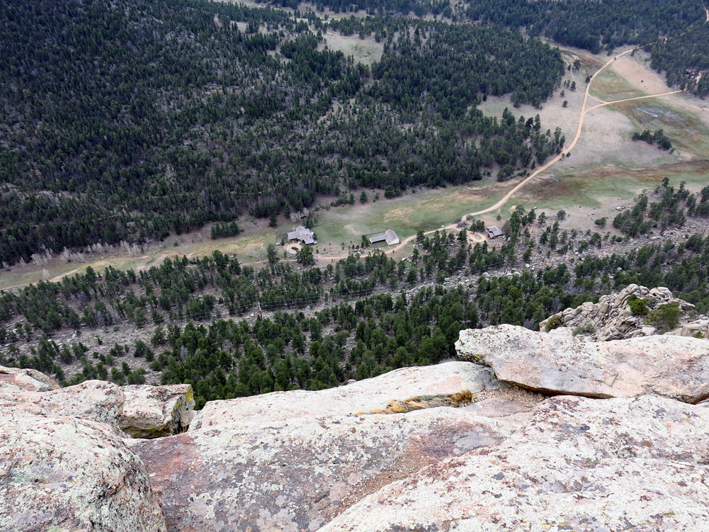
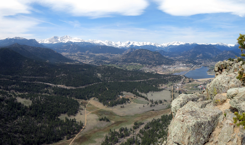
The Crocker Ranch below
If you look at the profile of the summit it looks as if somebody took a knife and cut off a piece at the highest point. The south face is very steep and more inclined towards rock-climbing. It allows some great views toward Estes Park, Rocky Mountain N.P and the Continental Divide as well as to the Crocker Ranch just below the rocky face.
The summit is rocky, quite small with a few ‘trees’ to tie your mast to, and a steep drop-off to the south. I was carrying a 16ft fishing pole with a linked EFHW which I wedged between the rocks at the highest point – perfect. With hardly any wind and mostly sunny skies the activation was very pleasant. The rocks even provided some nice options to sit on.
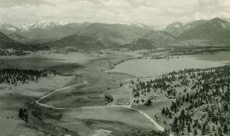
I found two historical photos taken from about the same spot. Take a closer look at the three pictures below… interesting to see the huge changes over time:
-
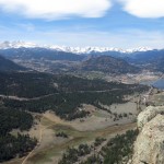
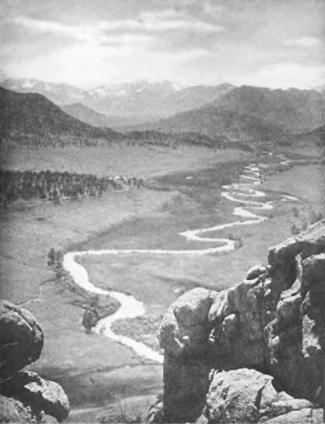
- Photo taken 2014
-
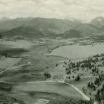
- Photo taken ~1940 // Courtesy of the OldEstes Collection – Dave and Carol Tanton
-
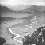
- Photo taken ~1900 by Enos Mills
The Descent:
I followed the cairns on my way down. At some stage I missed some of them and just followed the general direction to the TH. I missed the car by ~50ft.
Some video impressions:
[weaver_youtube http://youtu.be/M8BhegARSmU id=M8BhegARSmU sd=0 percent=100 ratio=0.5625 center=1 rel=0 https=0 privacy=0]If you would like to leave questions or comments, please do so through Youtube.
![]() !! WARNING !! There are old mountaineers, and
bold mountaineers... there are no old-bold mountaineers.
Hiking and mountain climbing are potentially hazardous activities particularly in Colorado with its extreme elevations. I am not accepting responsibility for any death or injury resulting from activations based on my trip reports. Proper training, experience, and personal capability assessment is required - enjoy!
!! WARNING !! There are old mountaineers, and
bold mountaineers... there are no old-bold mountaineers.
Hiking and mountain climbing are potentially hazardous activities particularly in Colorado with its extreme elevations. I am not accepting responsibility for any death or injury resulting from activations based on my trip reports. Proper training, experience, and personal capability assessment is required - enjoy!
Nice view. Thanks sharing