


W0C/FR-059 (Little Scraggy Peak) – 2796 M / 9192 FT
Dec 28, 2013
by KX0R
Little Scraggy Peak is located in the Pike National Forest between Buffalo Creek and Deckers. It’s a fun climb with convenient access and great views.
Drive west of Denver on Highway 285, and turn south on Highway 126 at Pine Junction. Drive down through Pine, stay on 126 through Buffalo Creek, and continue south on the good paved road toward Deckers. About 5 miles south of Buffalo Creek, after a long upgrade, there’s a marked overlook on the east side of the road. Continue southwest about a mile, and find the marked Kelsey Campground entrance on the north side of the road – this is the unofficial trailhead. There’s space for a couple of cars to park next to the gate – otherwise park somewhere off the main highway.
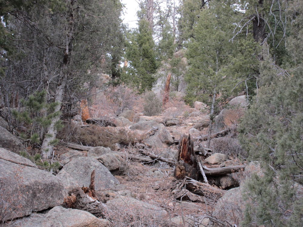
This area gets some light use from rock climbers and others. A small trail heads uphill from the campground entrance and leads toward a prominent climbing rock several hundred feet above. Follow this trail up for a short distance, until the slope increases, and then contour northwest across a sloping meadow; enter the forest where the meadow ends. To avoid private land, stay well north of the fence and signs visible below. Enter a shallow gulch and follow it northwest as it leads up a moderate grade. When in the gulch and nearby slopes, avoid turning right and going up too soon, because there are cliffs and large boulders in the area west of the climbing cliffs above the trailhead. The gulch ends at a saddle at about 8600 feet, east of point 8754. From this saddle climb east up a moderately steep sloping ridge – stay on this ridge and climb gradually up 400 vertical feet to about 9000 feet. This part of the ascent is a standard off-trail hike directly up a slope, with the usual rocks and fallen trees. There are bits of game trail as you go up, and the upper part of the ridge is pleasant. There’s no rock climbing or exposure required for this route.
When you get to the broad ridge-top at about 9000 feet, climb north and find a couple of false summits; head northwest from these points and continue about 1/4 mile to the actual summit. This part of the hike is a pleasant walk through open woods with a few fallen trees and rocks – you can see the main summit rocks to the northwest. The top of Little Scraggy Peak is a granite rock formation with some trees and bushes. Climb up the gullies in the rocks on the southeast side – only a few scrambling moves are required. The actual peak is surprisingly flat. The views are spectacular in all directions, from Pikes Peak to the south, all the way north to Longs Peak. Green Mountain looms up to the west, the huge Hayman burn fills the south view, and Devils Head rises in the east. Long Scraggy Peak and Raleigh Peak stand prominently to the northeast, and Thunder Butte rises in front of Pikes Peak. On top, Little Scraggy Peak doesn’t seem small at almost 9200 feet; it’s actually higher than Long Scraggy Peak. The view is full of SOTA peaks, and this summit is a great place to survey opportunities for many other climbs!
The exposed peak is large enough for setting up an activation, if you have a pole. Because there were other visitors on top, I set up in a sunny spot in the rocks a short distance below. There are useful trees and rocks near the summit, so activating this peak should be no problem, unless the weather is extreme. I found a perfect dead tree for my 20-foot Black Widow pole, and I tied off the far end of the EFHW to a big rock; then I hooked up the gear and got on the air. This first activation was about as easy as I could ask for on December 28 – it was about 45 F, there was almost no wind, and the sun was warm. With my ATS-3B at 5W, 33 feet of #24 teflon wire, and my homemade tuner, I logged 36 contacts – including G4OBL – in 35 minutes on 20M CW.
While Little Scraggy sees few visitors, there were 10 of us up there on Dec 28, 2013. A party of 8 climbed up from a trail to the north, and that longer, mostly off-trail route might be worth considering instead of my shorter, steeper off-trail ascent. The climb described here is about 1.6 miles each way, 1200 vertical feet, and can be done in just over an hour in good conditions. There were several inches of snow in the shadowed woods and on parts of the ridge-top when I was there. Since most of my route was on the sunny south side of the mountain, about half of the ascent was on dry ground. In good weather, this can be a nice SOTA climb for the colder months.
Little Scraggy is not an ideal site for a VHF/UHF activation. Because of its remote location west of the Rampart Range among other mountains, VHF and UHF coverage may be limited in several directions; there is a narrow view of the southern Metro area and the Plains. Sites like Devils Head and Genesee Mountain have much better coverage. On the other hand, for an HF activation with lightweight equipment, Little Scraggy is great! The easy access, paved roads, and huge views make up for the off-trail hike.
George Carey Fuller
KX0R
-
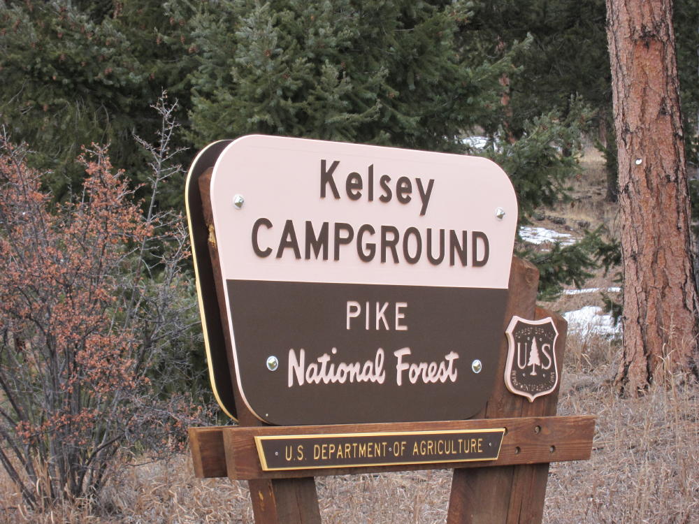
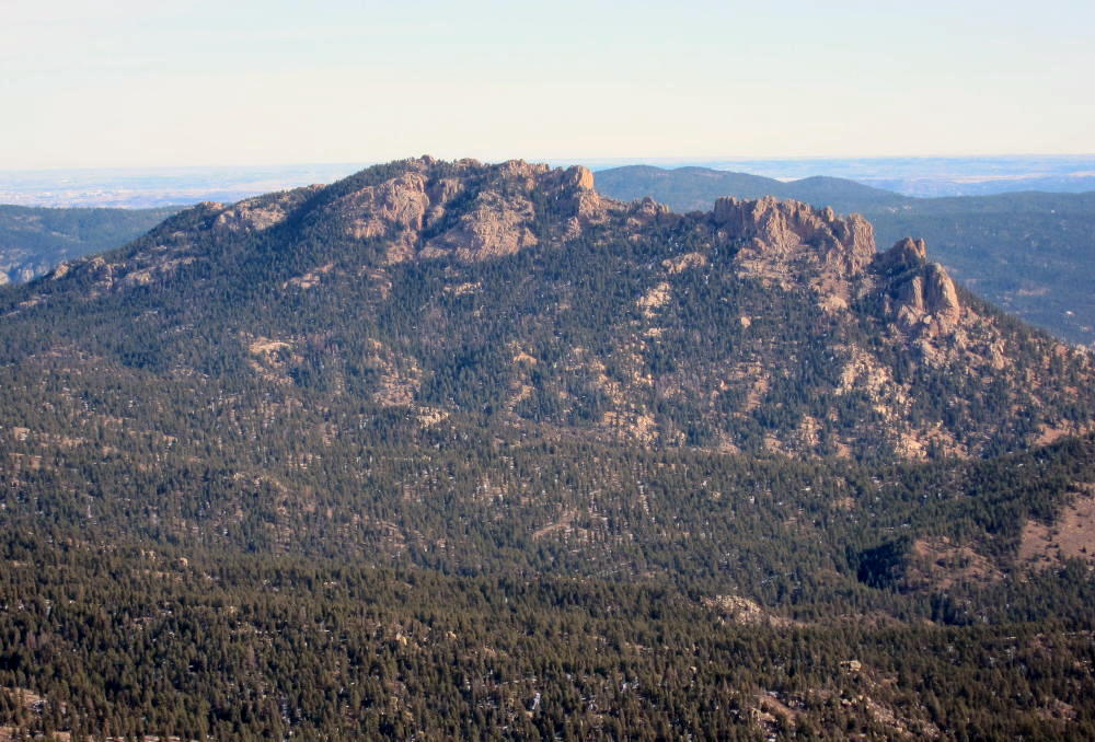
- Sign at Little Scraggy Trailhead
-
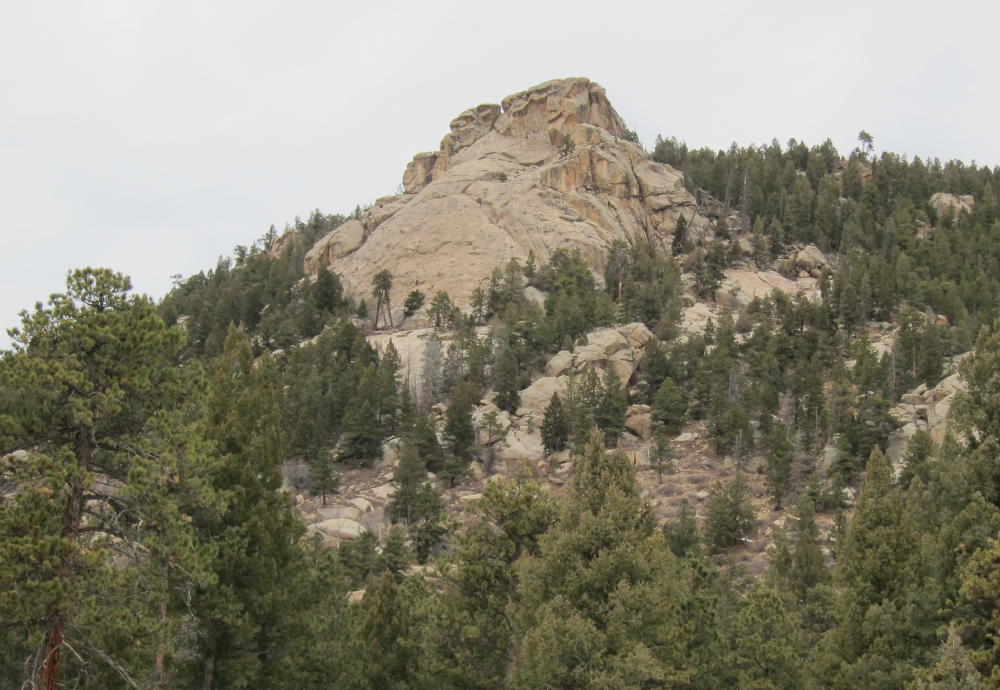
- Climbing Rocks above Trailhead
-
- Route up West Side of Little Scraggy
-
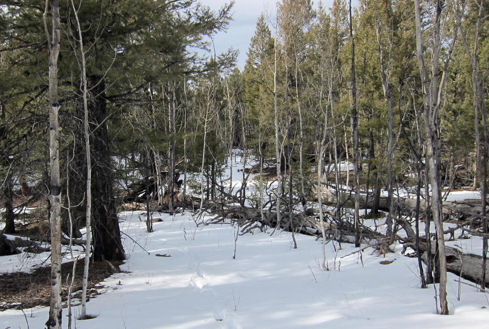
- Route on Little Scraggy near Summit
-
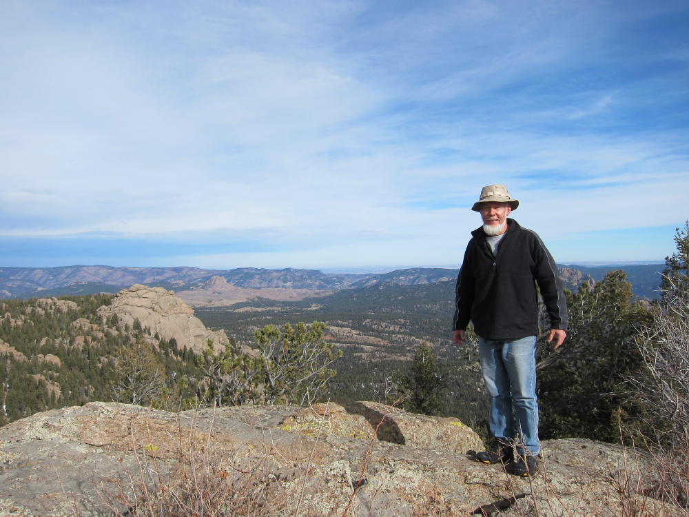
- First Activator KX0R on Little Scraggy Summit
-
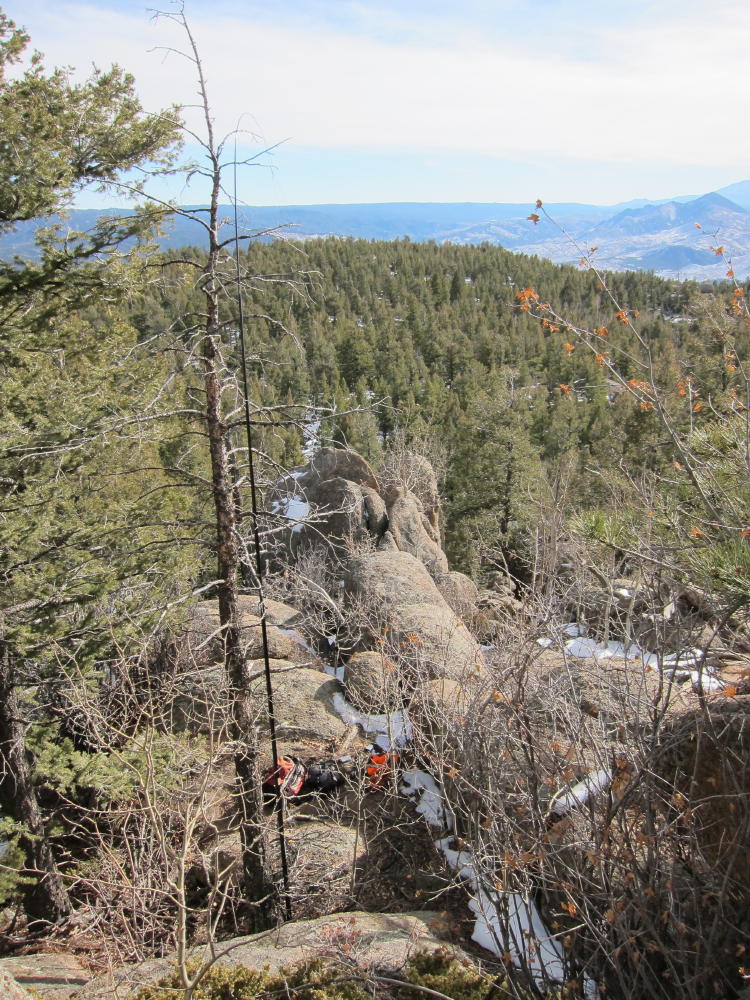
- Antenna and Activation near Summit
-
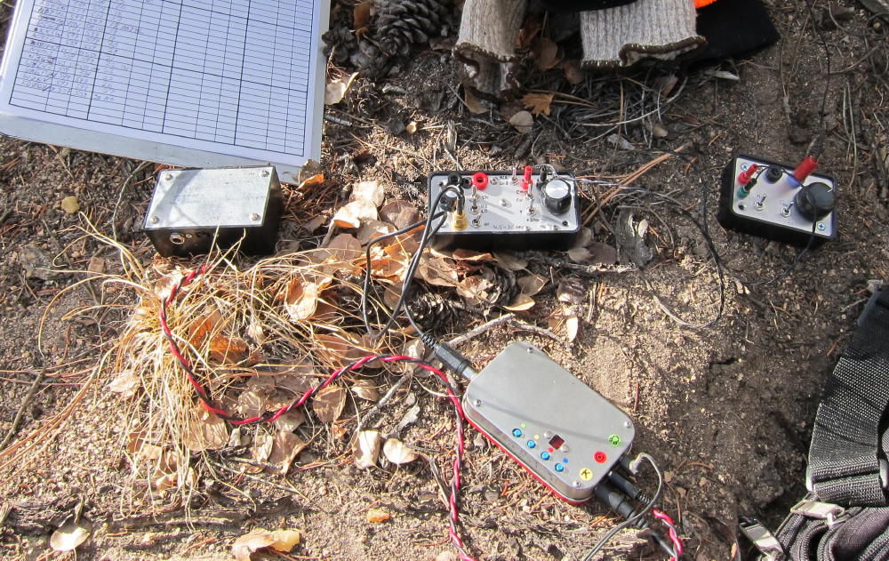
- KX0R Radio Gear on Little Scraggy
-
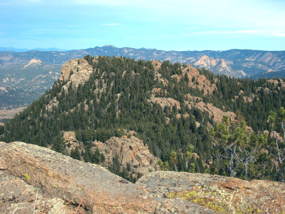
- View of Little Scraggy False Summit to North
-
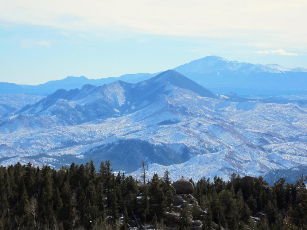
- Pikes Peak and Thunder Butte
-
- Long Scraggy Peak from Little Scraggy Peak
![]() !! WARNING !! There are old mountaineers, and
bold mountaineers... there are no old-bold mountaineers.
Hiking and mountain climbing are potentially hazardous activities particularly in Colorado with its extreme elevations. I am not accepting responsibility for any death or injury resulting from activations based on my trip reports. Proper training, experience, and personal capability assessment is required - enjoy!
!! WARNING !! There are old mountaineers, and
bold mountaineers... there are no old-bold mountaineers.
Hiking and mountain climbing are potentially hazardous activities particularly in Colorado with its extreme elevations. I am not accepting responsibility for any death or injury resulting from activations based on my trip reports. Proper training, experience, and personal capability assessment is required - enjoy!