


W0C/SP-121
Sulphur Mountain
2847 m / 9339 ft
Nov 14, 2015
July 16, 2016 with N0TA
By KX0R
Sulphur Mountain is located in South Park, a few miles north of Spinney Mountain W0C/SP-118.
Key points:
• No trail
• Hike up and along a hogback ridge
• Geology field trip
• Fine HF site
• Good dual activation with Spinney Mountain W0C/SP-118
• ~2.2 miles round-trip
• About 585 vertical feet
-
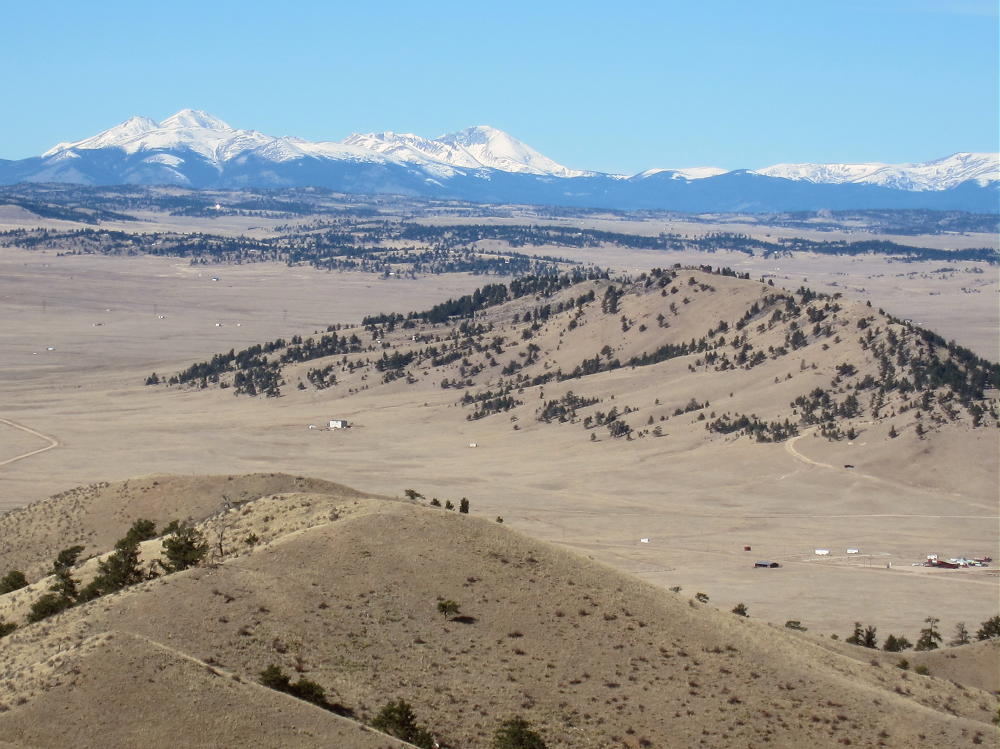
- Sulphur Mountain from Spinney Mountain
Sulphur Mountain is about a mile from the north entrance to Spinney Mountain State Park.
Driving Directions:
• Drive to Highway 24 west of Wilkerson Pass, either via Lake George from the east, or via Hartsell from the west.
• Continue to CR 23 – the turn is about 4.5 miles west of Wilkerson Pass, or about 10.5 miles east of Hartsel
• Drive south on CR 23 for 1.4 miles
• Turn west on CR 418, Mineral Springs Road, and drive 1.4 miles to the mineral springs near the south end of Sulphur Mountain
• Sulphur Mountain is well-named for these springs– they smell of sulphur.
• Park here off the road
-
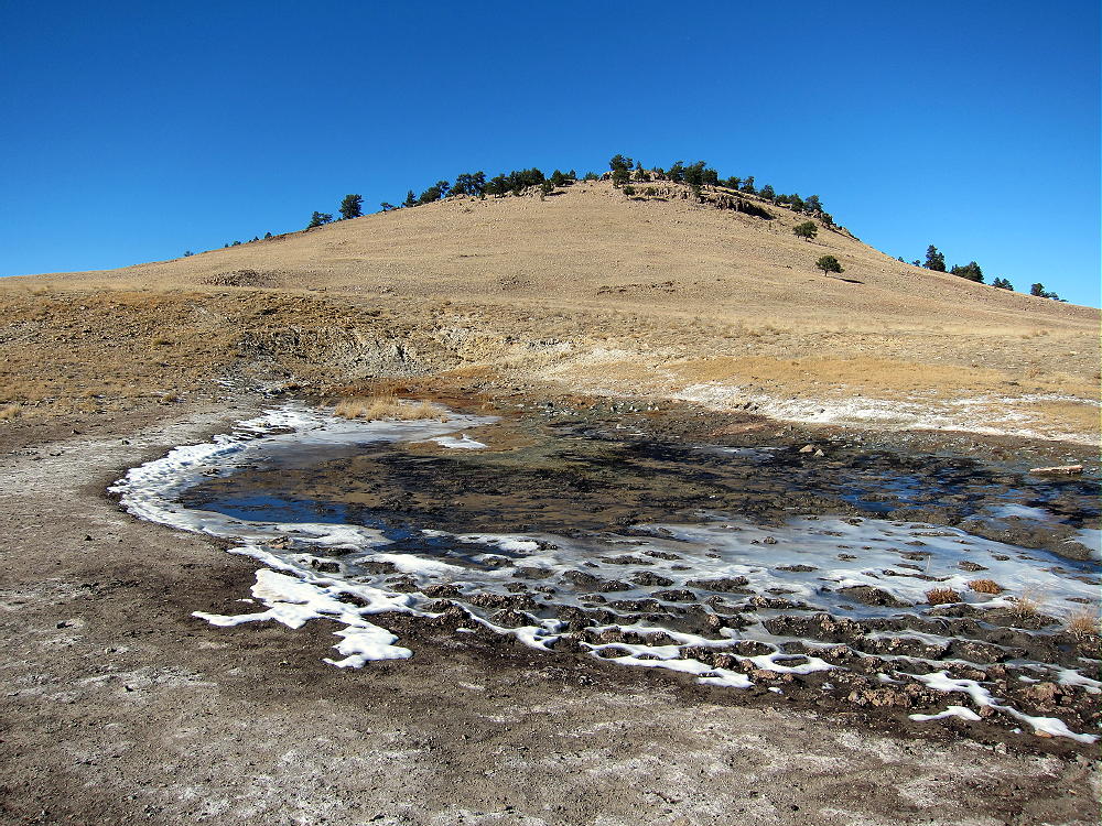
- Sulphur Mountain Mineral Spring
Thanks to Walt, W0CP, for first activating Sulphur Mountain!
Before activating Sulphur, examine the Google satellite image. Most of the land around the 2-mile-long mountain is private, but there’s hiking access at the south end near the springs. The springs area isn’t posted.
The Hike:
• Walk up the draw just west of the springs. This area appears to be an informal shooting area.
-
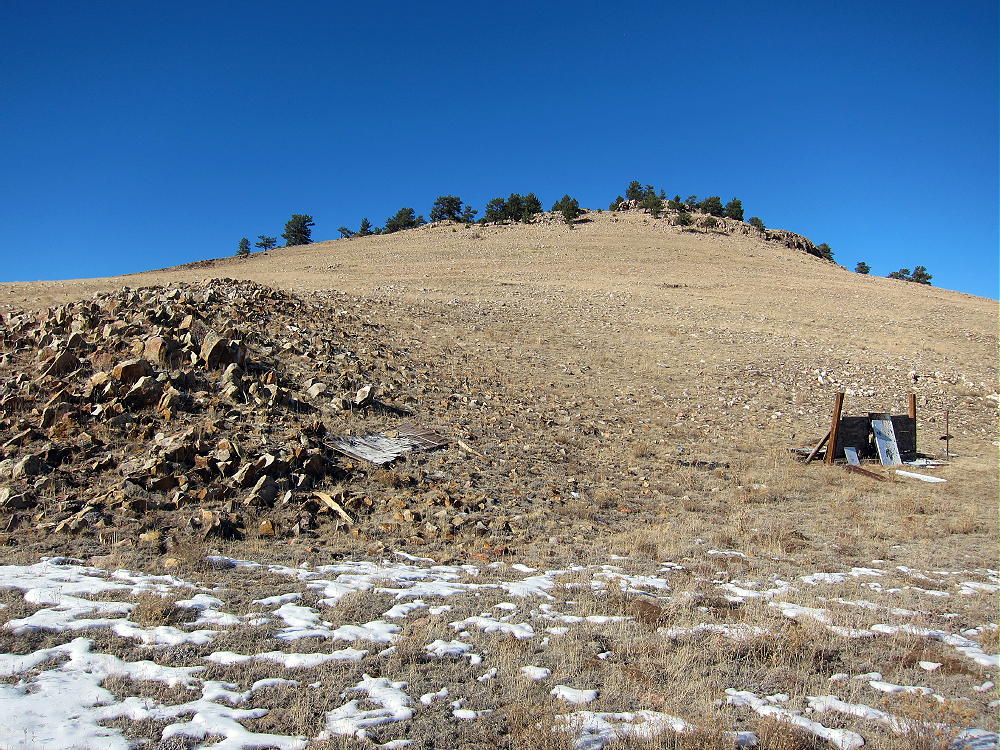
- Sulphur Mountain – Shooting Area, South End
• Head up the open rocky slope toward the right – east side – of the ridge.
• Avoid the private road west of the draw – it doesn’t lead toward the summit.
• Some of the land on the mountain may be private, but it wasn’t posted anywhere along the route when I was there. It appears that the occasional visitor is OK.
Details:
Sulphur Mountain is a hogback ridge running SE-NW. The ridge is on the major Elkhorn Thrust Fault. The summit ridge is partly made of inclined bedded quartzite and other rocks.
-
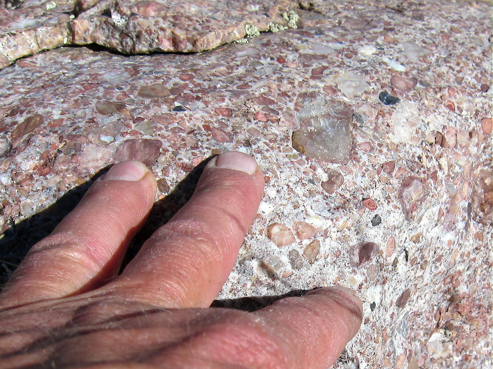
- Sulphur Mountain – Bed of Conglomerate
Follow the ridge along the east side, through sparsely-forested meadows. Game trails make most of the route easy. The ridge-top is rocky, and depending on conditions, it may be easier to hike below and parallel to the ridge, instead of right along the top. The peak is about 0.6 mile from the south end of the ridge, or about a mile from the mineral springs.
-
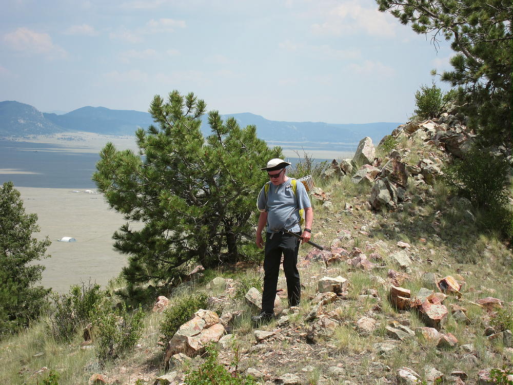
- Sulphur Mountain – N0TA on the Ridgetop
The summit is a bump on the long, prominent ridge; the activation zone is large. It was pleasant when I was there in the fall. The views of South Park and the surrounding mountains are impressive. Even though a few houses stand down below, you can’t see them from the top of the ridge.
-
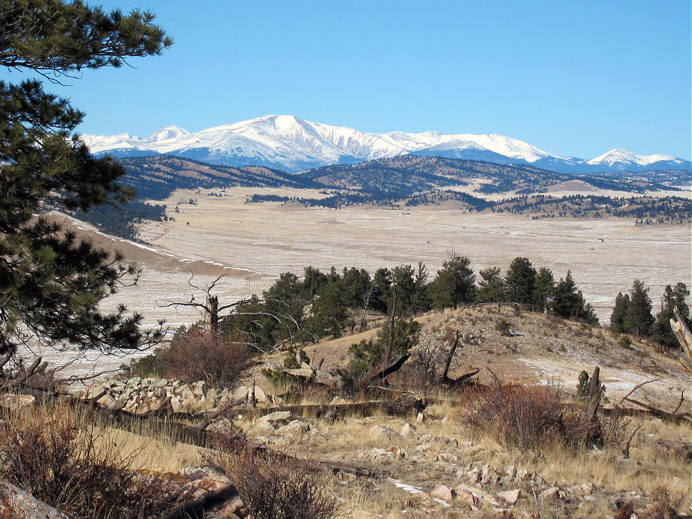
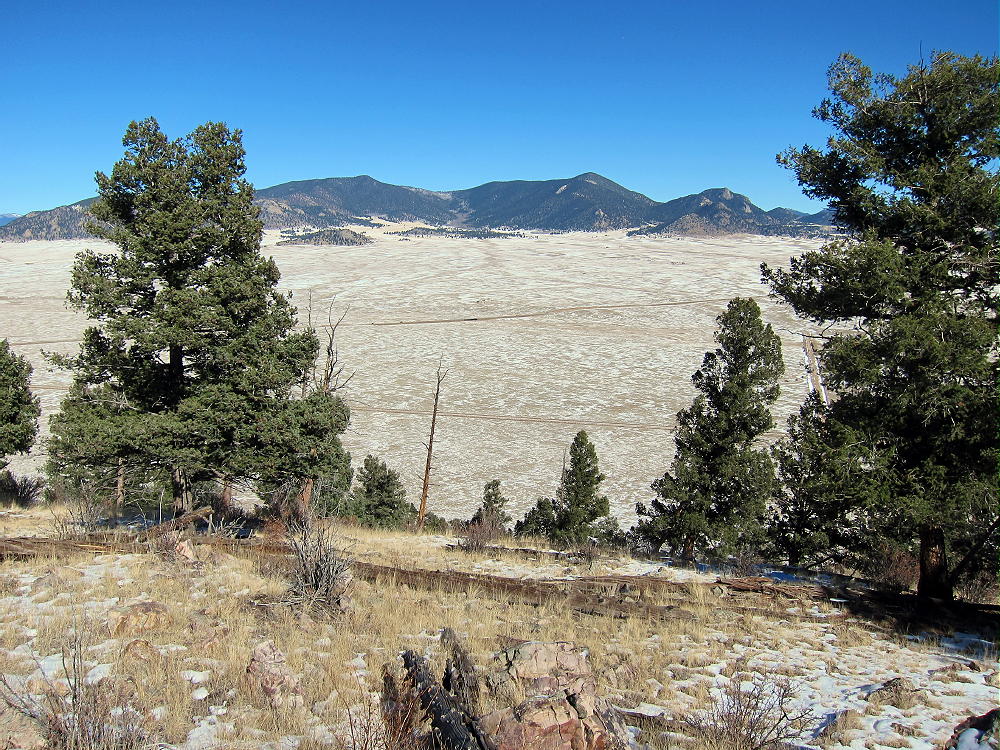
- Sulphur Mountain View North to Mount Silverheels
It’s easy to set up for a SOTA activation anywhere near the rocky peak. The large activation zone has a some trees for supporting an antenna pole. Shelter from wind is provided by the summit ridge. Sulphur Mountain is a good HF site; I heard no man-made RF noise. VHF/UHF coverage is limited mostly to South Park.
-
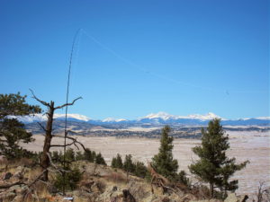
- Sulphur Mountain KX0R Activation – Nov 14, 2015
-
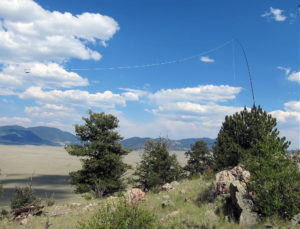
- Sulphur Mountain – KX0R SOTA Activation – July 16, 2016
I had a fine HF activation on Sulphur, with 43 contacts on 10, 14, and 18 MHz CW.
Although I saw no hunters, be careful of hunters in the fall.
It’s possible to combine an activation of Sulphur Mountain with nearby Spinney Mountain W0C/SP-118 a few miles to the south, as well as with other SOTA summits in South Park.
73
George
KX0R
-
- Sulphur Mountain View East to Badger Mountain
![]() !! WARNING !! There are old mountaineers, and
bold mountaineers... there are no old-bold mountaineers.
Hiking and mountain climbing are potentially hazardous activities particularly in Colorado with its extreme elevations. I am not accepting responsibility for any death or injury resulting from activations based on my trip reports. Proper training, experience, and personal capability assessment is required - enjoy!
!! WARNING !! There are old mountaineers, and
bold mountaineers... there are no old-bold mountaineers.
Hiking and mountain climbing are potentially hazardous activities particularly in Colorado with its extreme elevations. I am not accepting responsibility for any death or injury resulting from activations based on my trip reports. Proper training, experience, and personal capability assessment is required - enjoy!