


W0C/SP-091
10462
3189 m / 10462 ft
Nov 14, 2016
By KX0R
Peak 10462 is a fun sub-alpine SOTA peak in the Puma Hills, on the east side of South Park.
• Pike National Forest
• Moderate climb and activation
• Nice scenery
• Fine HF site
• Secret closed road most of the way
• ~ 4.25 miles round-trip
• ~ 1750 vertical feet
-
- 10462 from 10874
Driving access:
• Drive down 285, cross Kenosha Pass, and continue to Jefferson
• Turn south on Highway 77 and drive about 16 miles to Tarryall Reservoir
• Continue south on Highway 77 for 6.8 miles south of the Reservoir
• Turn right, west, on tiny FR 266
• Go SE only about 0.15 mile on this rough 2WD road
• Park near 8800 feet
• Google Maps are incorrect/inadequate for this area
The climb:
• Hike up a marked, closed old road/trail as it climbs along Gooseberry Creek
• Continue southwest about 1.5 miles to the end of the road near 10,000 feet
• Follow game trails up south to a saddle at 10,300 feet, east of 10462
• Hike west up the ridge to the summit
Additional Details:
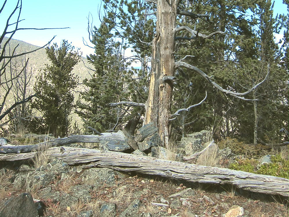
The closed road provides a superb access to this pleasant SOTA peak. It’s “secret”, because it’s not shown on the Pike National Forest map, nor does it have a marked “trailhead”. It has no posted number, and its only marking is that it’s closed to motor vehicles. There’s convenient parking where the closed road forks off FR 266.
-
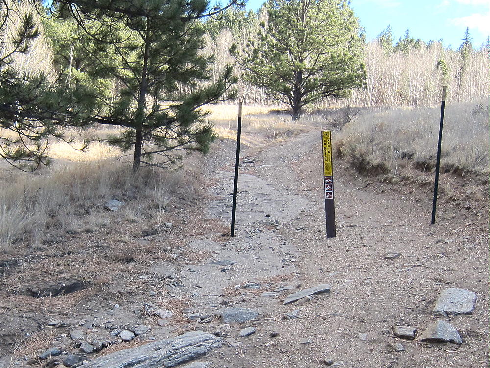
- 10462 – Trailhead of “Secret” Closed Road
The old road climbs steeply and efficiently up the Gooseberry Creek drainage, through conifers and aspen groves, to the end at about 10,000 feet. Most of the road is visible on the Google satellite images at high magnification – that’s how I found it!
-
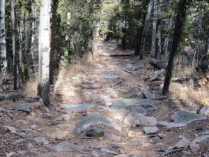
- 10462 – Old Closed Road near Gooseberry Creek
-
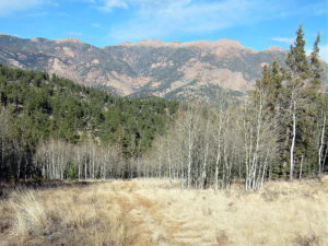
- 10462 – View East from Old Road
The climb from the end of the road to the saddle near the summit is only about ¼ mile. There are some subtle game trails leading up to the saddle between 10462 and its eastern sub-peak. The last 150 vertical feet up to the peak is a short, pleasant hike up the east ridge of 10462.
-
- 10482 Summit Cairn
The pointed summit is small but nice; a few rocks holding a register in a jar mark the peak. The jar contains the signature of famous Colorado Summitpost author Sarah Simon! Here’s her report on UN 10462. She likes 10462 as much as I do.
-
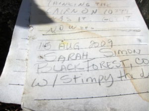
- 10462 – Register Signature of Sarah Simon
A small prospect hole has been dug into the rocks on the northeast corner of the top. The day I was there, it was a windy day, so I set up in a sunny spot southeast of the peak.
-
- 10462 SOTA Activation Antenna
-
- 10462 SOTA Activation Antenna – 2nd Pole
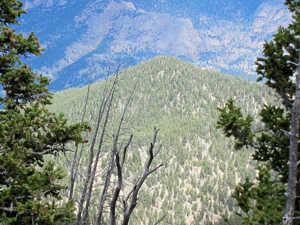
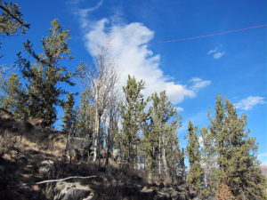
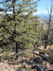
10462 is an almost ideal SOTA peak. It’s prominent in all directions, and no close peaks block HF propagation significantly. Little development is nearby, and the noise level is very low. Views are limited by trees, but the vista east into the Lost Creek Wilderness is impressive.
-
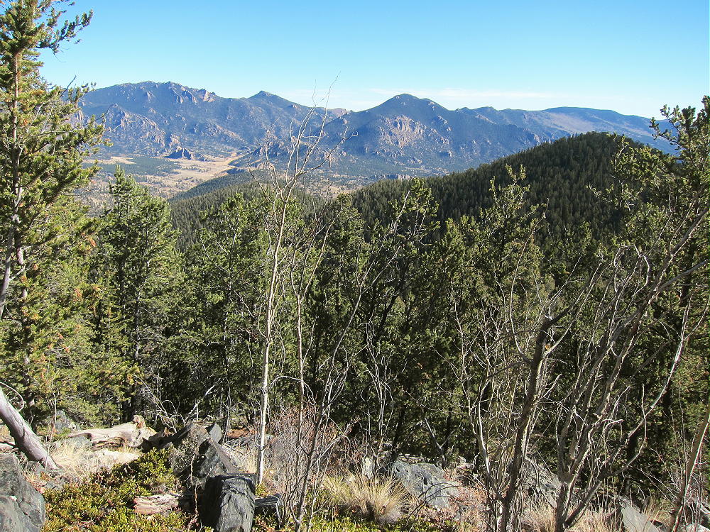
- 10462 – Lost Creek Wilderness and Eastern Sub-peak
Pikes Peak stands far to the southeast, to the right of the eastern sub-peak.
-
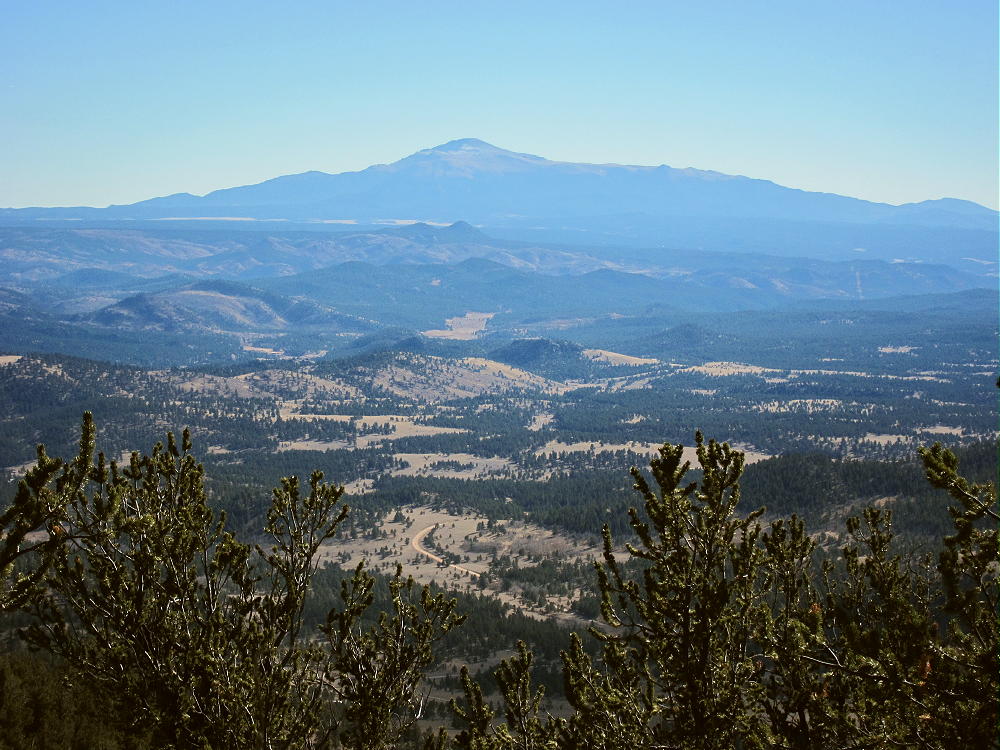
- 10462 – View Southeast to Pikes Peak
It’s possible that 10462 is accessible from Weber Park, south of the peak. Most of that area is private land, and I have no information about access to the National Forest land leading up to 10462 from the south side.
Peak 10462 could easily be combined with another SOTA peak for a dual activation – possibilities include:
W0C/SP-113 Eagle Rock Short, steep, close by
W0C/SP-078 10874 Short, steep, rough road
W0C/SP-072 Badger Mountain Moderate with 4WD
W0C/FR-066 Tappan Mountain Easy, quick
W0C/FR-038 South Tarryall Peak Long, hard, close by
etc.
Be aware of possible hunters in the fall – wear bright orange.
Geology Comments:
The summit hill of 10462 has an interesting mix of ancient pre-Cambrain rocks.
On the south side, massive orange granite forms large rounded boulders in a continuous exposure.
-
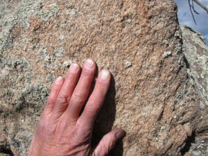
- 10462 – Massive Granite near Summit
-
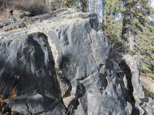
- 10462 – Massive Dark Gneiss near Summit
On the north side, dark gray gneiss shows an equally massive and continuous exposure right along-side the granite.
-
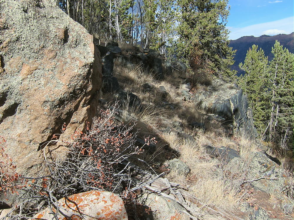
- 10462 – Granite and Gneiss Contact along Route up the Summit
The route to the top from the saddle runs right up along the contact between the two strikingly different rocks; it’s hard to miss this conjunction of these two very different ancient rock types.
73
George
KX0R
![]() !! WARNING !! There are old mountaineers, and
bold mountaineers... there are no old-bold mountaineers.
Hiking and mountain climbing are potentially hazardous activities particularly in Colorado with its extreme elevations. I am not accepting responsibility for any death or injury resulting from activations based on my trip reports. Proper training, experience, and personal capability assessment is required - enjoy!
!! WARNING !! There are old mountaineers, and
bold mountaineers... there are no old-bold mountaineers.
Hiking and mountain climbing are potentially hazardous activities particularly in Colorado with its extreme elevations. I am not accepting responsibility for any death or injury resulting from activations based on my trip reports. Proper training, experience, and personal capability assessment is required - enjoy!