


W0C/SP-049
South Twin Cone Peak
3761 m / 12340 ft
First Activation
Aug 19, 2015
By KX0R
South Twin Cone Peak is a prominent alpine summit in the Lost Creek Wilderness, about 4 miles east of Kenosha Pass.
Key points:
• Pleasant alpine peak
• Seldom climbed
• No trail to the top
• Navigation and route-finding required
• Access via dirt road from Kenosha Pass
• Road requires moderately high clearance vehicle
• Accessible in summer and fall
• Fine HF site
• ~11.4 miles round-trip to the summit via my route
• ~ 2000 feet total vertical gain
• With a 4WD high-clearance vehicle, the hiking distance can be reduced
-
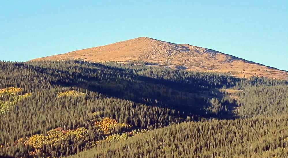
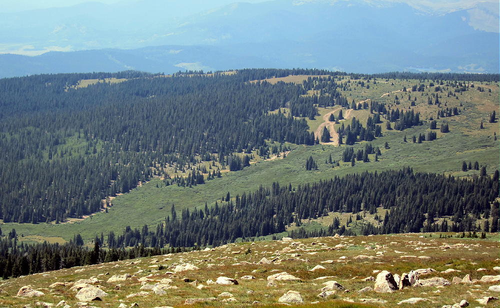
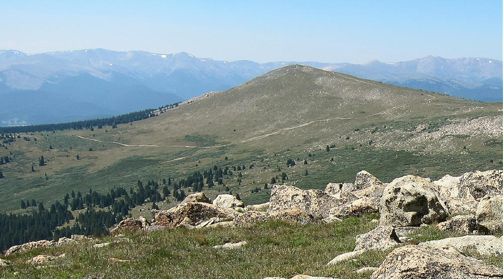
- South Twin Cone from South Park
Driving Directions:
First drive to Kenosha Pass via Highway 285. Turn east onto Forest Road 126 at the Pass. FR 126 begins as an easy 2WD dirt road.
-
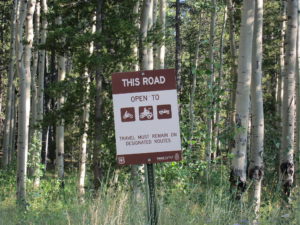
- South Twin Cone – FR-126 Sign
-
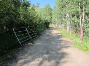
- South Twin Cone – FR-126 Gate
-
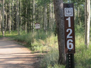
- South Twin Cone – FR-126 Signs
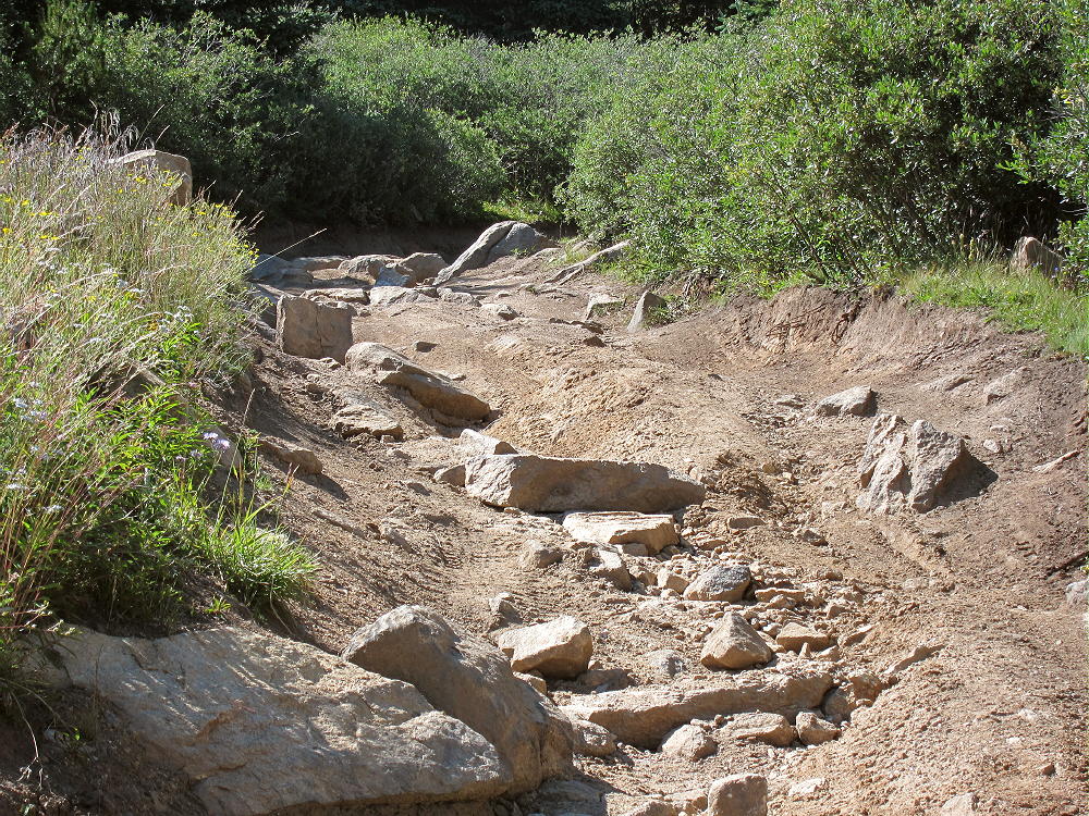
Follow the road into the Kenosha Creek drainage and continue upstream. The road crosses a ford in the creek – this is a big pile of rocks. Only cars with adequate clearance – at least 5 inches – can drive over these rocks without possible damage. Some of the land in the valley along the road is private, but it’s OK to pass through to the National Forest.
About three miles from Highway 285, at 10,400 feet, FR 126 leaves the creek and heads up a series of steep switchbacks. The road quickly gets steeper and rockier. Depending on your vehicle, you might be wise to park near the first switchback, before the road gets more serious – I did this. There are more large rocks as the road ascends, but a careful driver should be able to drive a high-clearance vehicle higher than I did, even without 4WD.
Either drive or hike up the switchbacks as the road climbs the southwest side of North Twin Cone Peak. Continue along the rocky 4WD road toward North Twin Cone. There are several nice campsites along this road.
After climbing above 11,300 feet, the road descends east about 200 vertical feet for about 2/3 mile into the upper Kenosha Creek drainage, south of North Twin Cone and west of South Twin Cone.
From the obvious turn-around and parking spot, FR-126 ascends a long, steep, rocky 4WD hill.
-
- South Twin Cone Route via 4WD FR-126
Only experienced drivers with very-high-clearance vehicles should attempt to drive up the rough trail toward North Twin Cone Peak. It’s more practical to park and hike up!
-
- South Twin Cone Route, Road FR-126 Near 11,200 Feet
Hiking Directions:
To reach South Twin Cone, leave the jeep trail south of North Twin Cone at about 11,800 feet, and hike east across the tundra. There’s no marked route, but there are hints of a path. Heading east too soon leads into a big willow swamp.
-
- South Twin Cone Peak Across the Willows – DO NOT Cross here!
It’s not necessary to climb all the way east, up to the ridge between North and South Twin Cones. The upper part of the willows area is sparse, and animal paths lead through the thickets. The best route to South Twin Cone may depend on the season and conditions.
-
- South Twin Cone Peak above Willows – Cross Through Here or Higher Up
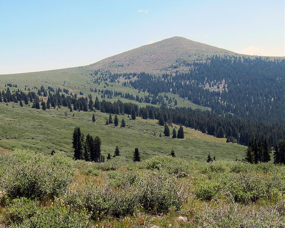
It might be possible to short-cut east from the jeep road at 11,200 feet and climb up the forested southwest ridge of South Twin Cone, but I don’t know if this is a practical route. I chose to hike via the North Twin Cone road, because it’s mostly easy and open all the way.
-
- South Twin Cone Hike, View of Route Near North Twin Cone
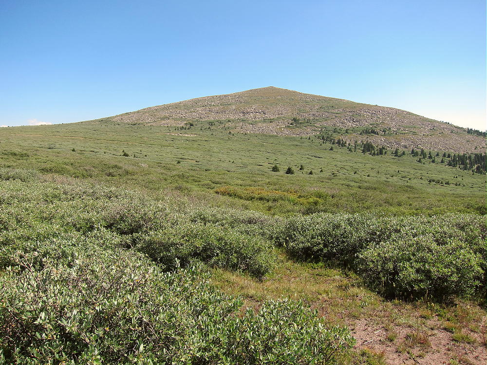
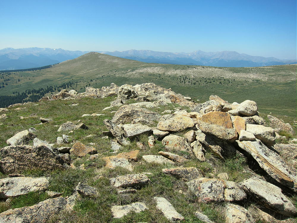
Above about 11,600 feet the area is mostly alpine meadows filled with rocks and wildflowers. The upper part of South Twin Cone is an easy climb over tundra and large rocks. The large, rounded summit slopes gently to the east – the activation zone is spacious. Some shelter from wind is provided by large rocks and the summit itself. The views are spectacular. Alpine terrain extends southeast for miles into the wilderness.
-
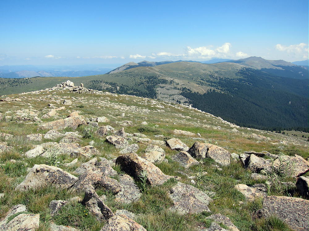
- South Twin Cone and View Southeast into Lost Creek Wilderness
Details:
South Twin Cone is a fine HF radio site. There’s little blockage of HF signals in any direction, and the ground slopes down at a nice angle. The HF noise level is very low – there’s almost no development for miles. This high site probably is not a very good VHF/UHF site; but it may have limited coverage of the Front Range foothills, parts of the eastern Plains, some of the Denver Metro area, and areas to the southeast. Coverage of South Park is likely good.
-
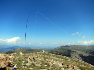
- South Twin Cone SOTA Activation
-
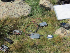
- South Twin Cone SOTA Radio Gear
There’s a small solar-powered radio facility on North Twin Cone. I experienced no HF noise from this site.
I made 23 HF contacts on four bands during my SOTA activation of South Twin Cone. It was fun to operate from this wonderful high spot on a sunny, dry day. I saw no one after I left my car. It’s surprising how many nice, accessible mountains are seldom visited!
-
- South Twin Cone Summit, View Toward North Twin Cone
In bad weather, South Twin Cone may experience lightning storms, high winds, hail, and snow; this mountain is best climbed in dry, stable weather. The descent route is high and exposed to the weather for a long distance.
I started the hike at 10:22 AM from where I parked on the road at 10,400 feet, and I reached the summit at 12:58 PM. On a day with storms this would have been way too late for a SOTA activation! Because of the drive and the length of the hike, South Twin Cone may require a very early start if storms are likely. It will be a long day.
While there are other SOTA peaks in the area of South Twin Cone, it would be difficult to do a dual activation with another summit. Possibilities include:
W0C/SP-070 11356 6 miles NW, off Hall Valley Road
W0C/FR-062 Mount Bailey 10 miles east, off 285 near Bailey
Camping nearby might make it practical to activate multiple summits in the area. Numerous forest campgrounds and campsites are within a few miles of Kenosha Pass.
South Twin Cone is a fine SOTA peak with reasonable access. The low-noise alpine summit and wildflower-meadows are really nice! The only reason it’s not quite a “SOTA Classic” is that the long hike runs for miles along a jeep road. I’m planning to come back!
73
George Carey Fuller
KX0R
-
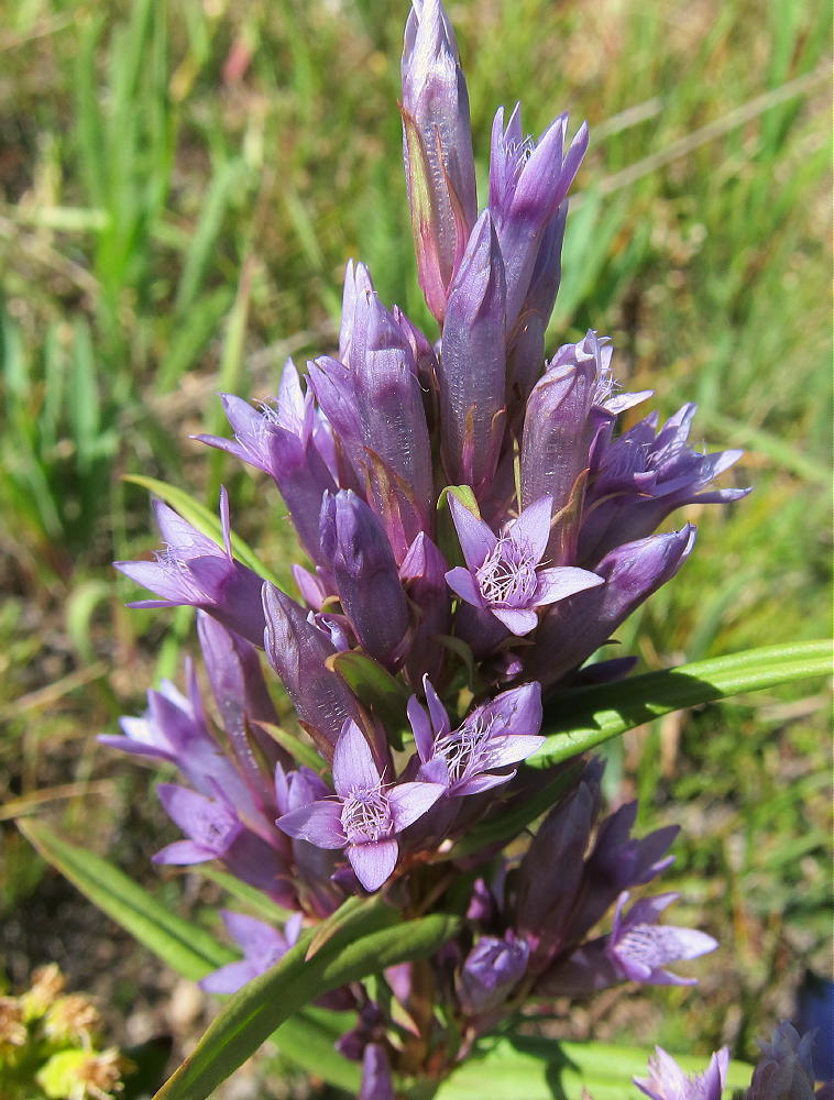
- South Twin Cone Alpine Flowers
![]() !! WARNING !! There are old mountaineers, and
bold mountaineers... there are no old-bold mountaineers.
Hiking and mountain climbing are potentially hazardous activities particularly in Colorado with its extreme elevations. I am not accepting responsibility for any death or injury resulting from activations based on my trip reports. Proper training, experience, and personal capability assessment is required - enjoy!
!! WARNING !! There are old mountaineers, and
bold mountaineers... there are no old-bold mountaineers.
Hiking and mountain climbing are potentially hazardous activities particularly in Colorado with its extreme elevations. I am not accepting responsibility for any death or injury resulting from activations based on my trip reports. Proper training, experience, and personal capability assessment is required - enjoy!