


W0C/PR-072
North Diamond Peak
3613 m / 11852 ft
July 29, 2016
By KX0R
North Diamond Peak is a prominent summit in the Medicine Bow Range near Cameron Pass.
Key Points:
• Colorado State Forest
• Roosevelt National Forest
• Long scenic drive up Poudre Canyon
• Access via a steep, efficient trail
• No marked trail up the ridge
• Route finding required
• Nice alpine summit
• Spectacular views
• Superb HF radio site
• ~ 2.5 miles round-trip
• ~ 1550 vertical feet
• SOTA Classic!
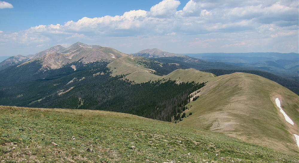
-
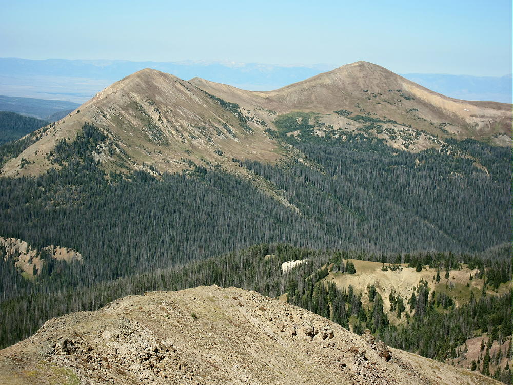
- Diamond Peaks from Table Iron
Driving Directions:
• Drive to Fort Collins, Colorado.
• Drive north on Highway 287 almost 10 miles to Ted’s Place.
• Turn west on Highway 14.
• Drive Highway 14 for about 60 miles, all the way up the Poudre Canyon, to Cameron Pass at 10,276 feet.
• Turn north into the Cameron Pass Rest Area – this is the trailhead.
• This trailhead may be very busy on summer weekends.
The Hike:
• Google Maps show few of the hiking trails or trailheads in this area.
• The trail leading up toward the Diamond Peaks isn’t an official trail.
• From the north end of the parking area, walk west a short distance and look for the trail to Diamond Peaks – there’s no sign.
• Don’t follow the larger, marked “Cameron Connection” trail.
• Follow the trail WSW up the steep hill, just south of a small creek.
• The trail ascends rapidly through the woods to a lush meadow near the creek. This is a good place to see columbines and other wildflowers in mid-summer.
-
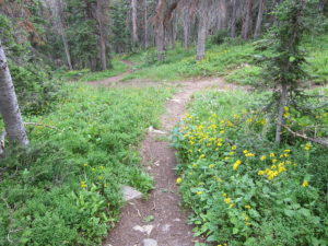
- North Diamond Peak Trail
-
- North Diamond Peak – Bench near Treeline
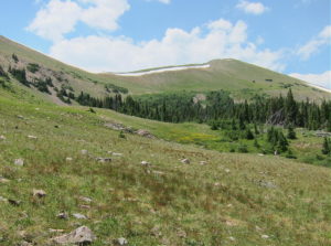
• Follow the path to a bench just above 11,000 feet.
• Small social trails lead west up the steep slope to the long ridge between North and South Diamond Peaks.
-
- North Diamond Peak – Trail to Saddle
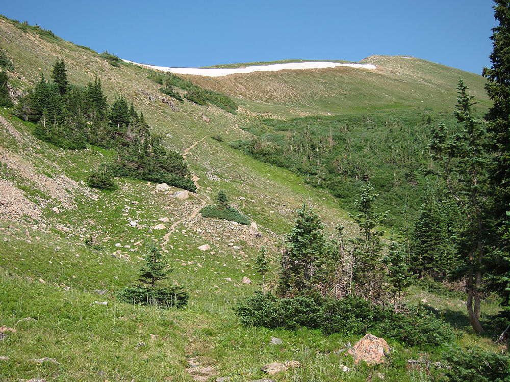
• Pick your route based on the amount of snow remaining along the ridge.
• If there’s a lot of snow, or early in the season, there may be too much snow to climb up safely without proper equipment.
-
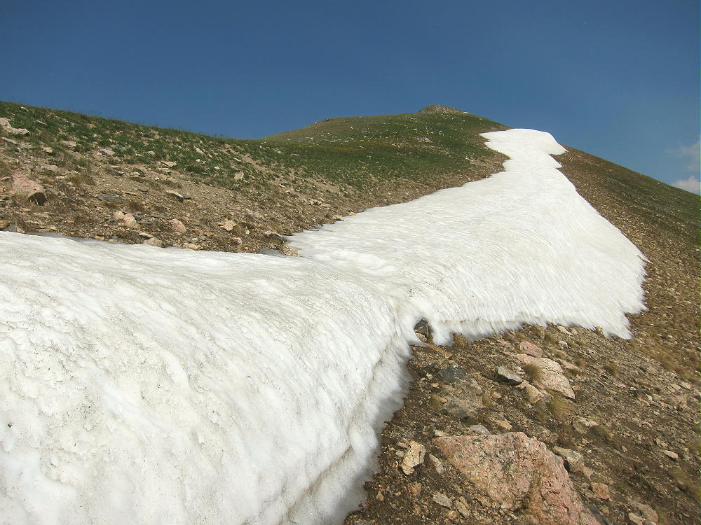
- North Diamond Peak – Snow Bank
• An alternate route may be required, or you may choose not to ascend the peak.
• On July 29, 2016, I was able to step up through the melting snow cornice at one spot in the middle; alternate routes were visible, but they would have required more effort.
• Once above the snow, the route’s an easy stroll north along the top of the ridge to the open, grassy summit of North Diamond Peak.
-
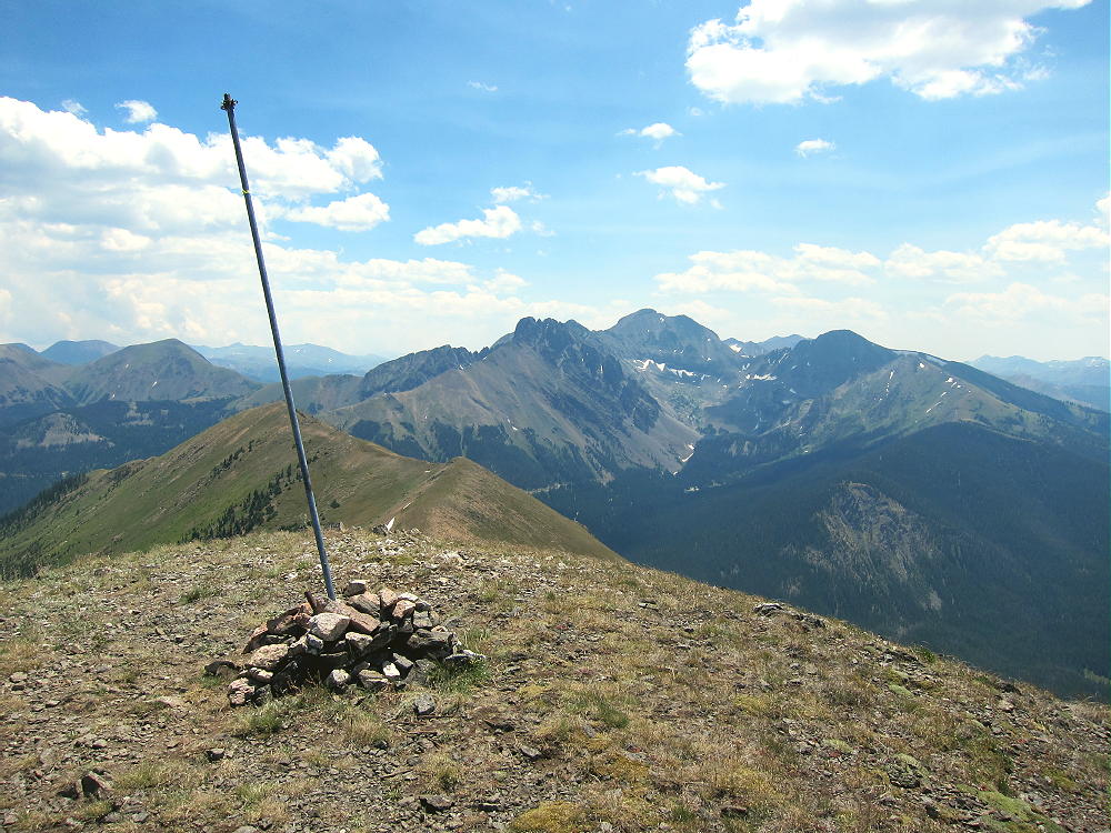
- North Diamond Peak Summit
• South Diamond Peak stands about 0.6 mile southeast along the lovely ridge.
-
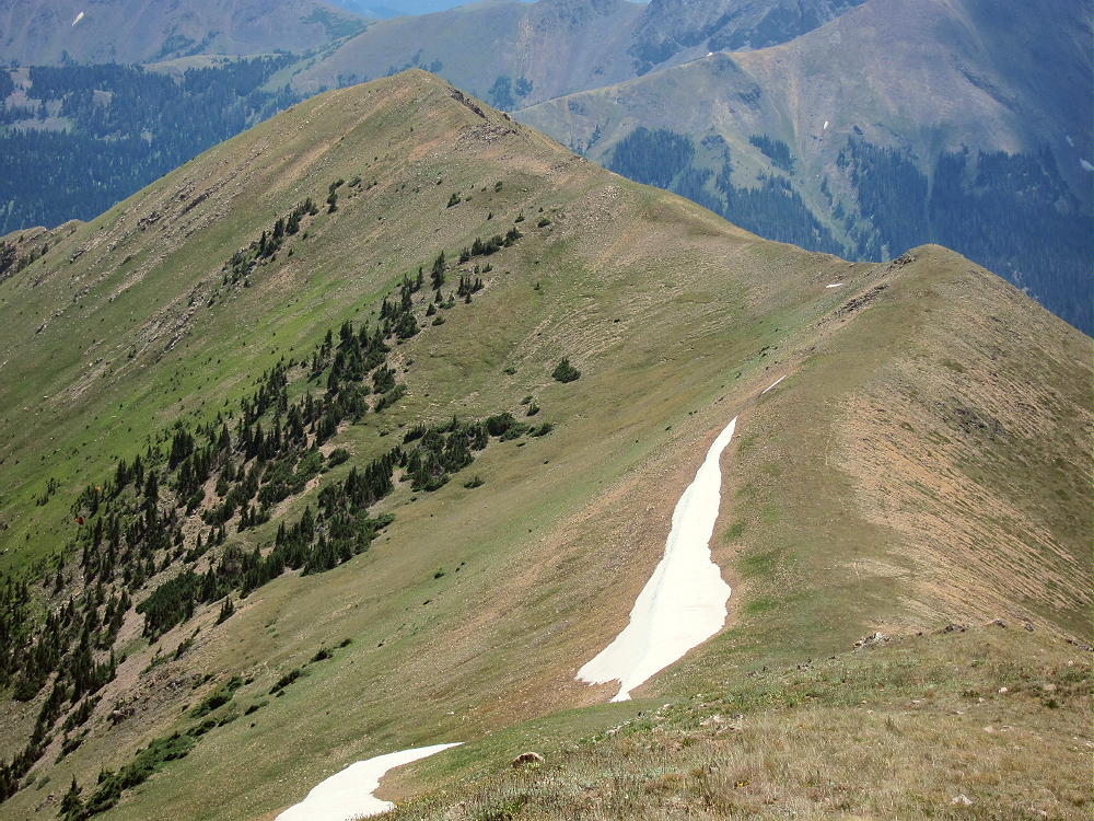
- North Diamond – View of East Diamond Peak
Additional Details:
This peak is probably best saved for some time between mid-July and November, unless you have the equipment and skills required to climb steep snow. This area gets heavy snowfall, and there may be avalanche danger on this route in winter. Snow-slide paths are easy to see on the satellite images!
Plenty of good spots are available for setting up SOTA radio gear along the summit ridge near the peak. The activation zone isn’t large, but there’s plenty of room to set up a pole and a decent wire antenna. A large metal pipe stands in the summit cairn, and this could be used to support a pole or a wire.
Because of wind on top, I set up slightly below the south side of the summit and enjoyed a pleasant activation in a calm, sunny spot. I guyed my pole securely, ran the 52-foot wire up to the ridge, and tied the end to some rocks. It was a compromised alpine activation – not like in many SOTA photos, with the activator sitting right on top, by an impressive antenna system – but a simple, effective, multi-band arrangement. I made 32 CW contacts on 3 HF bands.
-
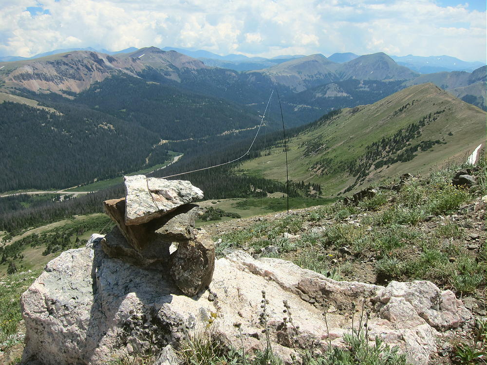
- North Diamond Peak SOTA Antenna
North Diamond Peak is a near-perfect radio summit. It falls away in all directions, and the noise level is very low. There’s almost no development nearby. This peak may be useful for VHF/UHF contacts with parts of southeast Wyoming and northeastern Colorado. It’s blocked for VHF/UHF by many peaks and ranges, but it looks right down into North Park, and it may be able to hit some spots far to the east as well.
The views from the summit are spectacular! The view north along the Medicine Bow Range to Montgomery Pass and Clark Peak is amazing. In the south the rugged Nokhu Crags and Mount Richthofen appear dark and very high. Lulu, Thunder, and Iron Mountains stand along the border of Rocky Mountain National Park, with much higher mountains in the Park behind them. North Park spreads out across a huge area to the northwest. Numerous high SOTA peaks are visible all around!
-
- North Diamond Peak – View North
-
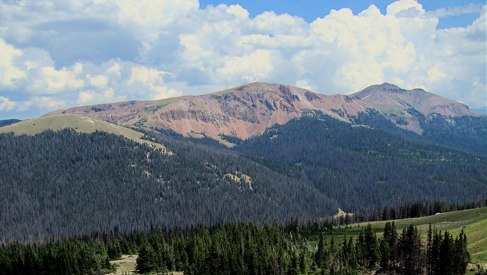
- North Diamond – View of Table Iron and Iron Mountain
North Diamond Peak is a SOTA Classic:
• Spectacular views from the Activation Zone
• Beautiful alpine scenery
• Short, steep, fun hike
• Summit is on top of the Medicine Bow ridge
• Long scenic drive to the trailhead
• Superb HF radio site
-

- North Diamond – Thunder, Lulu, East Diamond, Nokhu, Richthofen, Mahler
North Diamond isn’t for everyone. The hike’s too steep for many activators, especially because of the moderately high altitude. The exposed summit ridge is very dangerous in thunderstorm season, and it’s nothing to mess with in cold weather or high winds. This is no beginner’s SOTA peak.
However, on a nice summer day, North Diamond is truly a jewel! Save it for just the right time…
Nearby SOTA Peaks include:
Iron Mountain W0C/PR-061
Lulu Mountain W0C/PR-006
Mount Richthofen W0C/PR-002
Cameron Peak W0C/FR-027
Clark Peak W0C/PR-001
All of these peaks are challenging!
73
George
KX0R
-

- North Diamond Peak Columbines
![]() !! WARNING !! There are old mountaineers, and
bold mountaineers... there are no old-bold mountaineers.
Hiking and mountain climbing are potentially hazardous activities particularly in Colorado with its extreme elevations. I am not accepting responsibility for any death or injury resulting from activations based on my trip reports. Proper training, experience, and personal capability assessment is required - enjoy!
!! WARNING !! There are old mountaineers, and
bold mountaineers... there are no old-bold mountaineers.
Hiking and mountain climbing are potentially hazardous activities particularly in Colorado with its extreme elevations. I am not accepting responsibility for any death or injury resulting from activations based on my trip reports. Proper training, experience, and personal capability assessment is required - enjoy!