


W0C/FR-123
Trail Ridge
3766 m / 12355 ft
June 20, 2014
By KX0R
Trail Ridge is one of the most accessible alpine summits in Rocky Mountain National Park. Located a short distance above a busy highway, with convenient parking, it offers a spectacular high activation. Having a fun SOTA activation on Trail Ridge depends on good planning and timing.
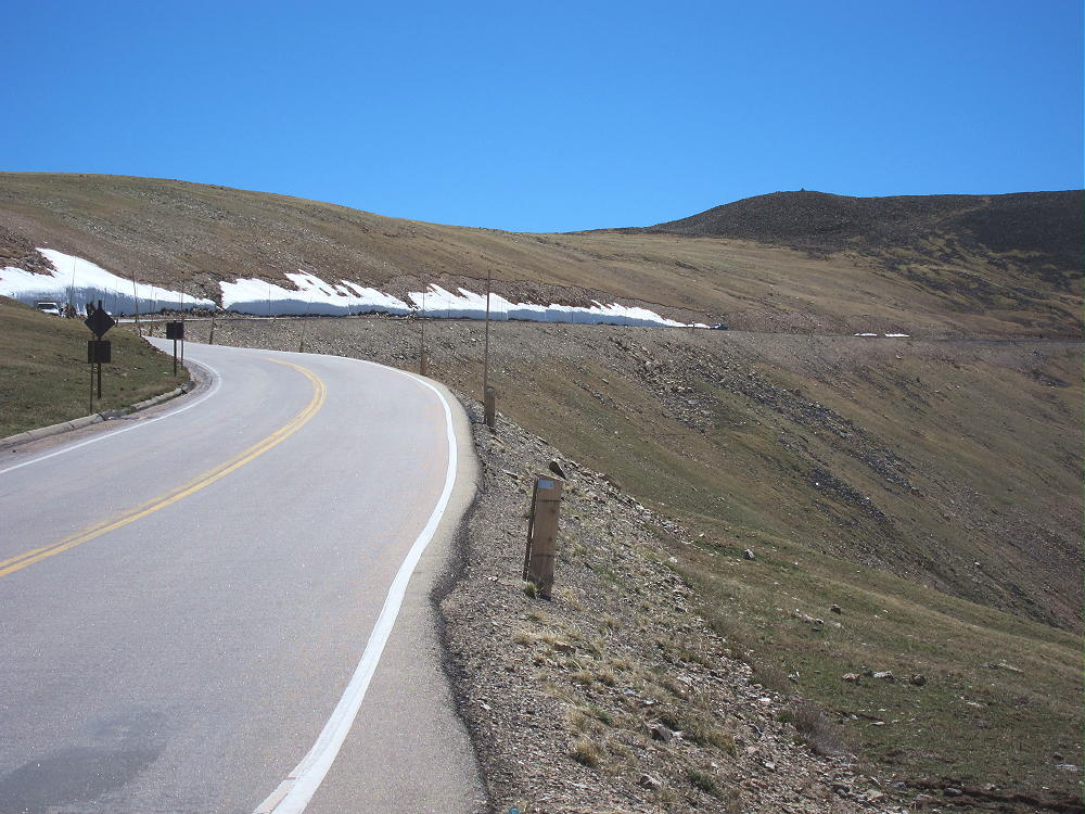
Trail Ridge Summit from Gore Range Overlook on Trail Ridge Road
Drive into Rocky Mountain National Park, pay the fee or show your pass, and continue up Trail Ridge Road; this paved alpine highway is usually open from Memorial Day to early November. This road often has heavy traffic during tourist season, because it provides easy access to alpine terrain with amazing views. Trail Ridge is located near the summit of Trail Ridge Road – this is along the northern part of the Road, before it begins the long descent to the western side of the National Park.
I parked at the Gore Range Overlook, about ½ mile northwest of the summit, on the west side of the road. While it is possible to park closer to the peak, the road is very busy in that section. The hike from the Overlook is about 0.8 miles, with a vertical ascent of only 300 vertical feet. There is no marked trail, and the route is a simple climb over rocky tundra. Try to walk on the rocks to minimize damage to the delicate tundra plants. Even better, do an early activation in June, and walk mostly over the snow.
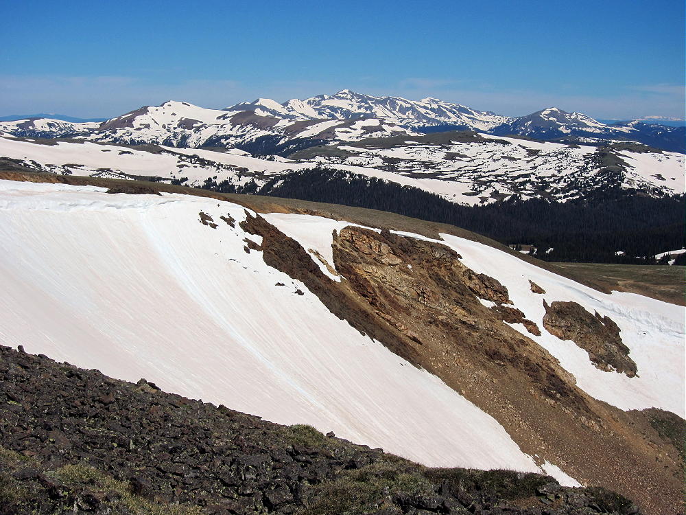
Trail Ridge View North
Trail Ridge is a rocky bump on a long ridge. The Activation Zone is large, but there’s little shelter from wind, other than the ridge itself. On a calm, sunny day in summer, Trail Ridge can be heavenly; but in an hour or two, the weather can turn deadly, with lightning, wind, and cold rain. An early start is wise – both to avoid the crowds of slow-driving tourists, and to beat the storm clouds that often form. A pole is necessary to support a wire antenna.
The peak is a near-perfect radio site, with low noise and a clear view in all directions. The Plains are visible, and UHF/VHF contacts are possible across a huge area. There are marmots living near the summit – these large rodents sometimes intrude into an activation, seeking food – or a piece of string from a guy line.
The day I activated Trail Ridge, I set up just east of the summit to minimize the west wind, and so I couldn’t hear or see the busy road. I set up my Black Widow pole and tied it to a couple of rocks. I ran my 67-foot wire west, into the wind, to stabilize the system.
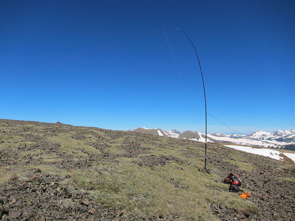
Trail Ridge Activation Antenna
I was in the middle of a busy CW activation, when I realized I was looking at 30 or more elk, 1500 feet down in a meadow in the Fall River Canyon. The view across the valley to 13,514 foot Ypsilon Peak also enhanced the experience. This a really nice place to operate from – if you time it right!
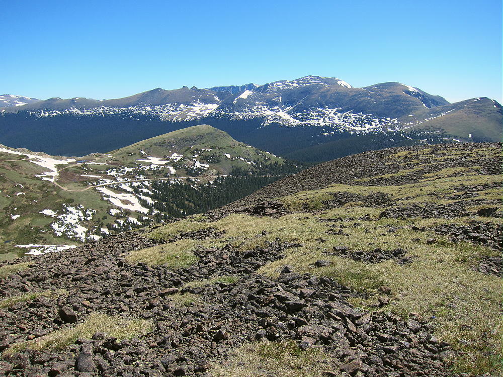
Trail Ridge Summit View to Mummy Range
Be prepared for cold or windy weather on Trail Ridge at any time of year. If you’re not familiar with the area, use the National Weather Service Point Forecast on the online topo map of Trail Ridge to get a reasonably accurate forecast for that part of the National Park.
Trail Ridge can be combined with other nearby summits – including Sundance Mountain and Mount Ida – for a dual activation. I also activated Mount Ida on June 20, 2014, and with the extra-long hike required for Ida, it was an amazing day!
Activating Trail Ridge is a great introduction to alpine SOTA operating!
Good luck and 73,
George Carey Fuller
KX0R
![]() !! WARNING !! There are old mountaineers, and
bold mountaineers... there are no old-bold mountaineers.
Hiking and mountain climbing are potentially hazardous activities particularly in Colorado with its extreme elevations. I am not accepting responsibility for any death or injury resulting from activations based on my trip reports. Proper training, experience, and personal capability assessment is required - enjoy!
!! WARNING !! There are old mountaineers, and
bold mountaineers... there are no old-bold mountaineers.
Hiking and mountain climbing are potentially hazardous activities particularly in Colorado with its extreme elevations. I am not accepting responsibility for any death or injury resulting from activations based on my trip reports. Proper training, experience, and personal capability assessment is required - enjoy!