


W0C/FR-088
Mount McConnel
2445 m / 8020 ft
Oct 9, 2015
Nov 8, 2015 with N0TA
Sep 3, 2016 with N0TA
By KX0R
Mount McConnel is a fine SOTA peak in the Poudre Canyon area.
Key points:
• Maintained trail all the way to the top
• Roosevelt National Forest
• Accessible trailhead
• Easy hike
• Good views and scenery
• Popular in summer
• Large activation zone
• Most of the summit area was burned in 2012
• ~ 4.2 miles round-trip
• ~ 1300 vertical feet
-
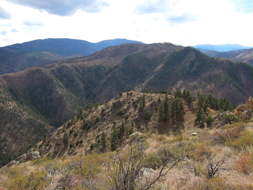
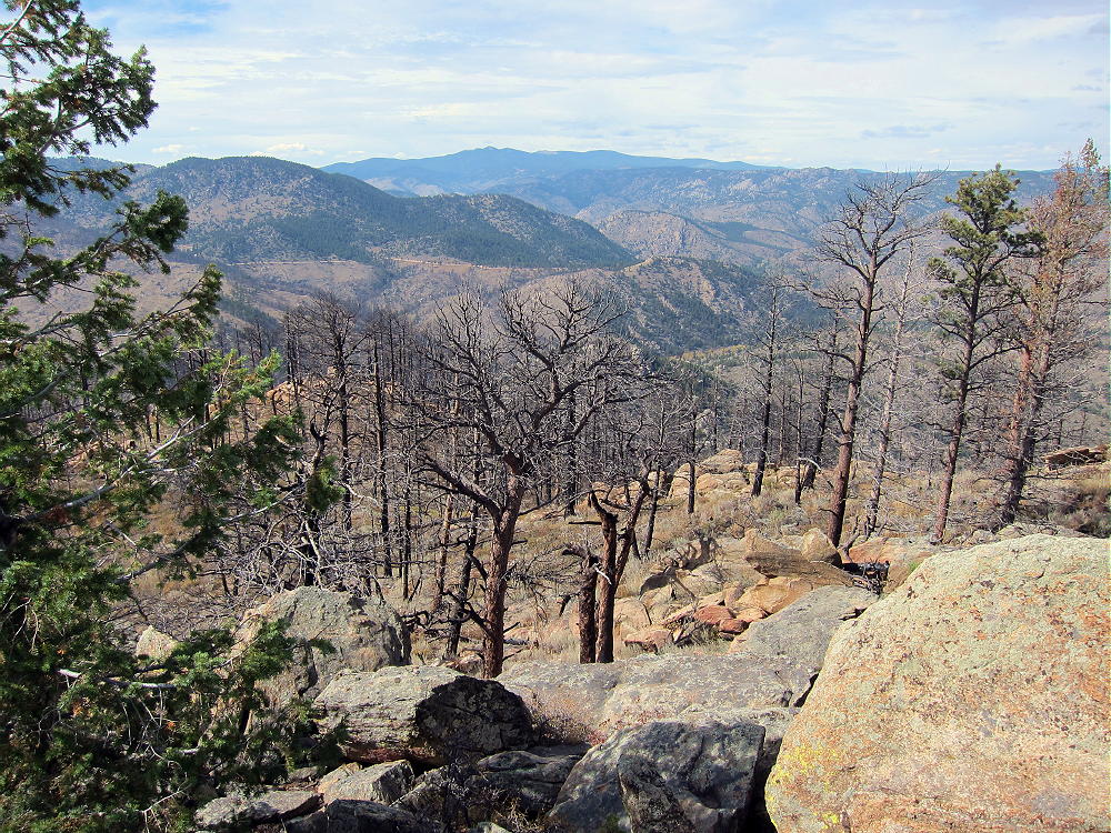
- Mount McConnel from Peak 7612, Oct 20, 2015
Driving Directions:
• Drive to Fort Collins
• Continue northwest from Fort Collins on Highway 287 to Ted’s Place.
• Turn west on Highway 14, and enter the Poudre Canyon after 4 miles.
• Continue up the winding canyon road, past the Narrows, for about 23 miles to Mountain Park Campground
-
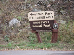
- Mount McConnel – Mountain Park Sign
• This USFS campground is clearly marked.
• Access is via a bridge on the south side of the main highway.
• The trailhead is in the campground area.
• Cross the bridge to find the trailhead.
Across the bridge, a right turn leads to special parking for trail-users; parking is limited, and a fee may be charged. If the campground’s closed, park just east of the bridge along the main highway, and walk across the bridge.
The Hike:
The Mount McConnel Trail # 992 heads up the north side of the mountain from the campground area. After about ½ mile, the path meets the William Kreutzer Nature Trail # 936 – continue up the main trail, which ascends several switchbacks on the north side of the mountain.
-
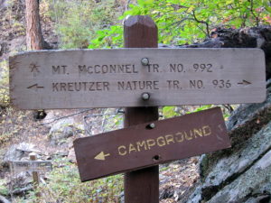
- Mount McConnel – Trail Junction
The route continues up a ridge northwest of the summit – there are good views of the Canyon. The trail passes some interesting metamorphic rock formations with vertical beds.
-
- Mount McConnel – Pre-Cambrian Metamorphic Rock Formations
Part of the summit forest burned in the High Park Fire of 2012.
-
- Mount McConnel – View West through Burned Area
As the trail approaches the mountaintop, an unmarked fork leads west 200 yards to the summit area. The actual peak is the top of a large rock formation. The spacious Activation Zone offers plenty of room to set up, either near the peak, or on other convenient rock formations in the Zone. When the forest burned, the summit area became more open and sunny.
-
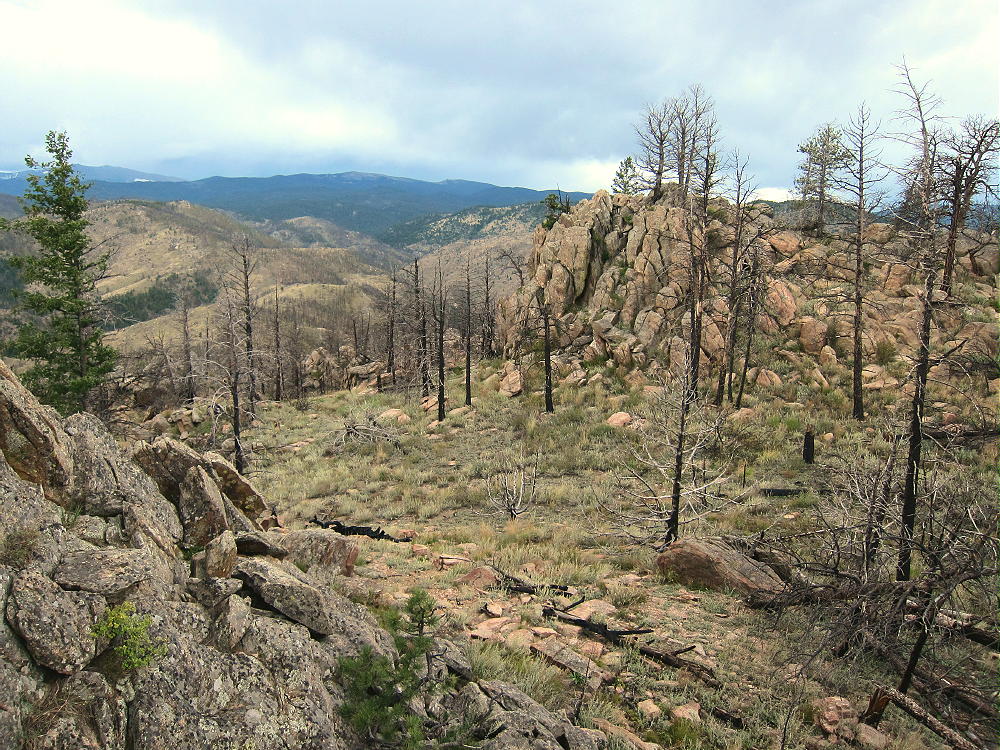
- Mount McConnel – Summit Area
Additional Details:
The main trail continues east from the fork near the summit, traverses several sub-peaks, and leads down the east ridge of the mountain. Then it descends steeply down a “primitive trail” – this is an accurate description. On my first trip up, I ascended via the primitive trail, and it’s steep, with large steps required on some big rocks. It would not be a good route in winter – the main trail is much better. The primitive trail is an alternate, more challenging route with great views down into the Canyon; this path eventually connects with the Kreutzer Nature Trail at a fork. The Nature Trail leads west and connects with the main trail above the Campground. The northern path leads down toward the River and ends by the bridge at the entrance to the Campground.
Trail 992 is a popular trail. In summer an early start is advised, partly to avoid thunder storms, and also because parking is limited. This trail is a National Recreation Trail and was built by the CCC in the 1930’s. R.C. McConnel was an early National Forest ranger in the area.
Mount McConnel is a superb HF radio site. The Activation Zone contains several large rock outcrops upon which you can set up radio gear and operate; there are trees to support a pole, and some shelter from wind is available. An activation “on the rocks” provides additional height for the antenna, enhancing HF propagation.
-
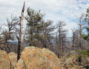
- Mount McConnel – KX0R SOTA Activation on Summit, Oct 9, 2015
-
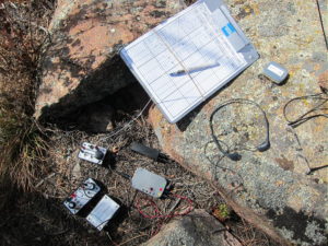
- Mount McConnel – KX0R Radio Gear, Oct 9, 2015
The only development near the mountain is at the campground far below, so the HF noise level is very low.
On Oct 9, 2015, I made 30 contacts on 7, 10, 14, and 18 MHz CW during my 1 hour, 5 minute activation.
On Nov 8, 2015, N0TA and I activated McConnel together. John made 20 contacts on 14 MHz CW, while I made 28 contacts on 7, 10, 18, and 21 Mhz CW nearby.
On Sep 3, 2016, N0TA and I again activated McConnel together. John made 30 contacts on 10 and 14 MHz CW, while I made 27 contacts on 7, 10, and 14 MHz CW.
McConnel is probably a poor VHF/UHF site, due to its location in the Poudre Canyon. The Plains are hidden behind other mountains, and coverage of populated areas is limited.
Several other SOTA peaks are nearby, and a dual activation is possible:
Peak 7612 W0C/FR-205 ~ 1 mile north across the Canyon
Sheep Mountain W0C/FR-097 ~ 2 miles east
7980 W0C/FR-198 ~ 5 miles east
Greyrock Mountain W0C/FR-095 ~ 9.5 miles east
These mountains are all 1-point summits, with rocky tops and challenging hikes. Many excellent higher SOTA peaks are farther west, near Cameron Pass, etc.
Mountain Park Campground offers camping in the warmer months, and there are many other campgrounds in the Poudre Canyon. Numerous opportunities for mountain recreation are available across the area – hiking, fishing, rafting, climbing, backpacking, biking, etc.
73
George
KX0R
-
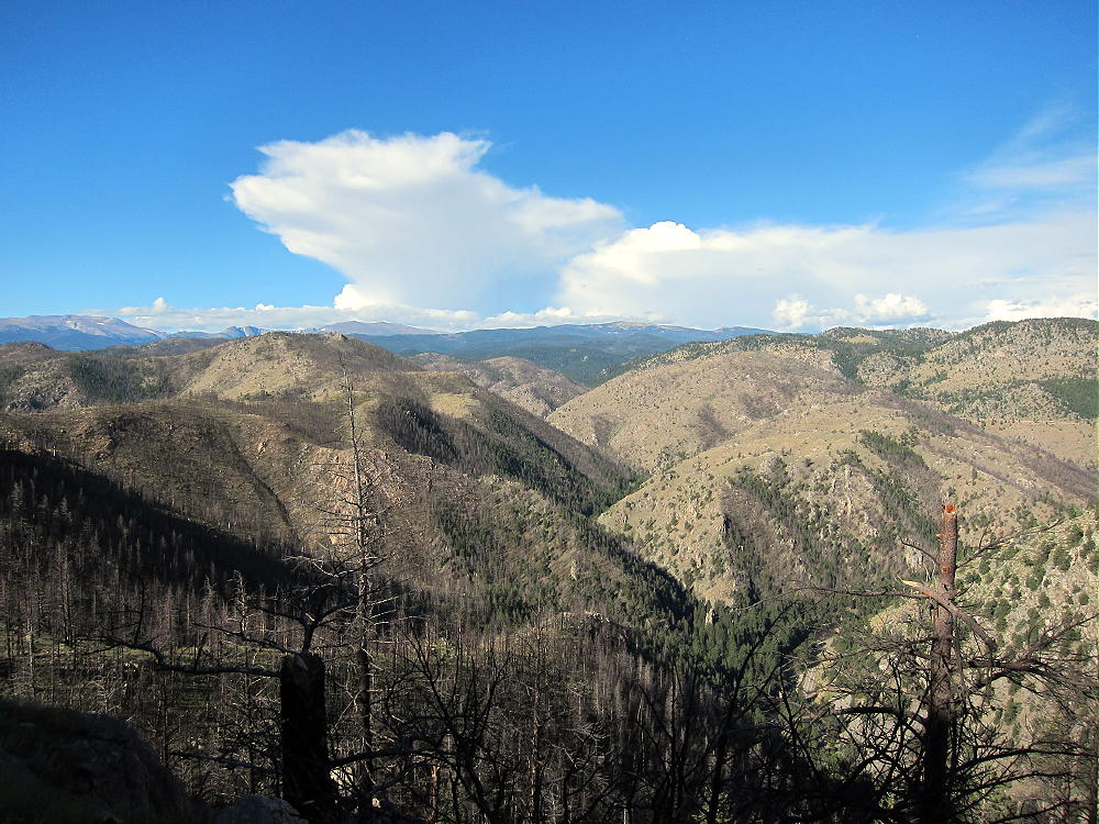
- Mount McConnel – View West, Sep 3, 2016
![]() !! WARNING !! There are old mountaineers, and
bold mountaineers... there are no old-bold mountaineers.
Hiking and mountain climbing are potentially hazardous activities particularly in Colorado with its extreme elevations. I am not accepting responsibility for any death or injury resulting from activations based on my trip reports. Proper training, experience, and personal capability assessment is required - enjoy!
!! WARNING !! There are old mountaineers, and
bold mountaineers... there are no old-bold mountaineers.
Hiking and mountain climbing are potentially hazardous activities particularly in Colorado with its extreme elevations. I am not accepting responsibility for any death or injury resulting from activations based on my trip reports. Proper training, experience, and personal capability assessment is required - enjoy!