


W0C/FR-075
South Boulder Peak
2606 M / 8549 ft
11 July 2013, First Activation
20 April 2014 Second Activation
My First Activation of South Boulder Peak was my second SOTA activation, mostly because the mountain is only a couple of miles from where I live. This prominent summit is close to the Denver-Boulder Metro Area, but it’s not a popular SOTA peak, and it’s somewhat challenging.
South Boulder and nearby Bear Peak are twins, because the sedimentary rocks within these mountains have the same sequence. This is the result of a fault that runs between them – the fault has shifted the rocks so that the sequence of layers repeats. Both mountains have resistant sedimentary summits, with older igneous rock west of each peak. Unfortunately Bear Peak is not a SOTA peak.
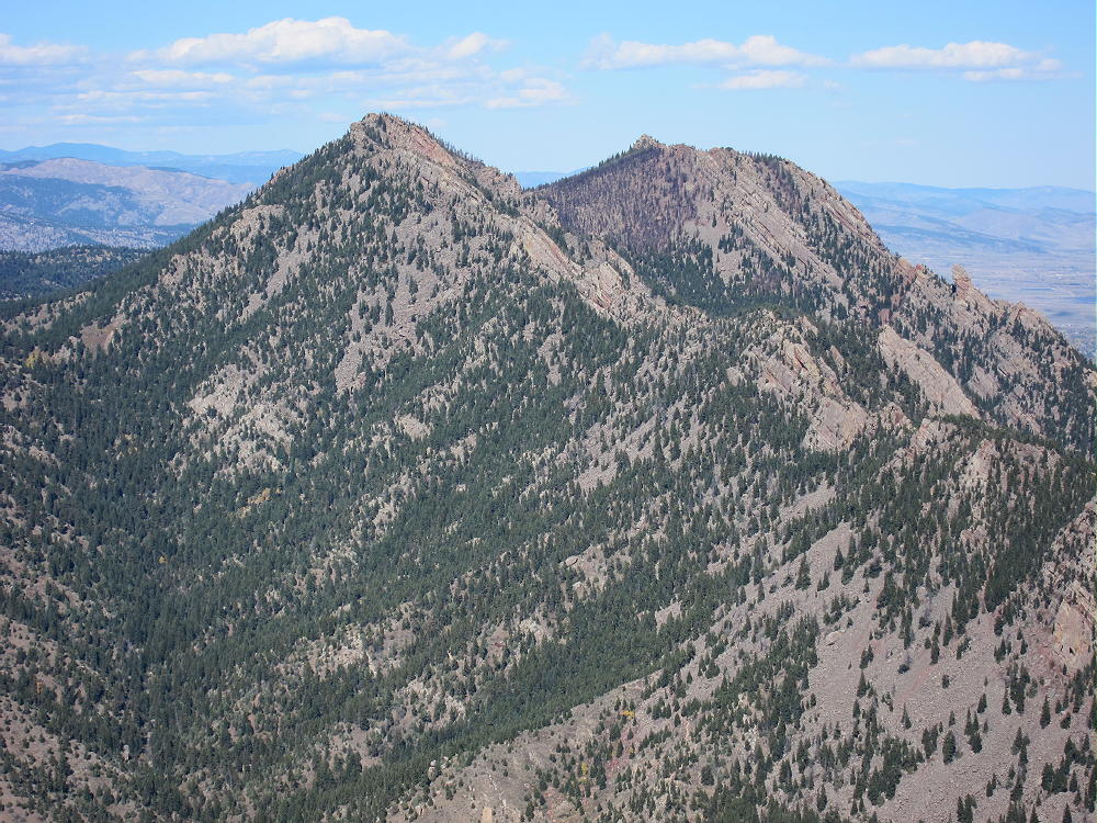
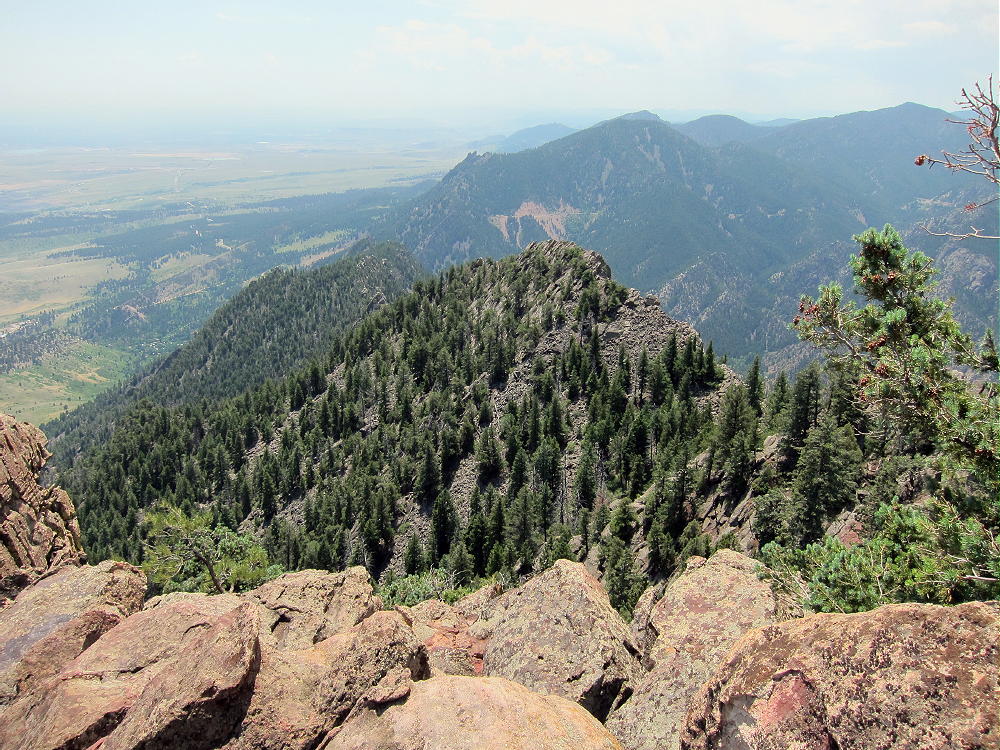
South Boulder and Bear Peaks from Eldorado Mountain
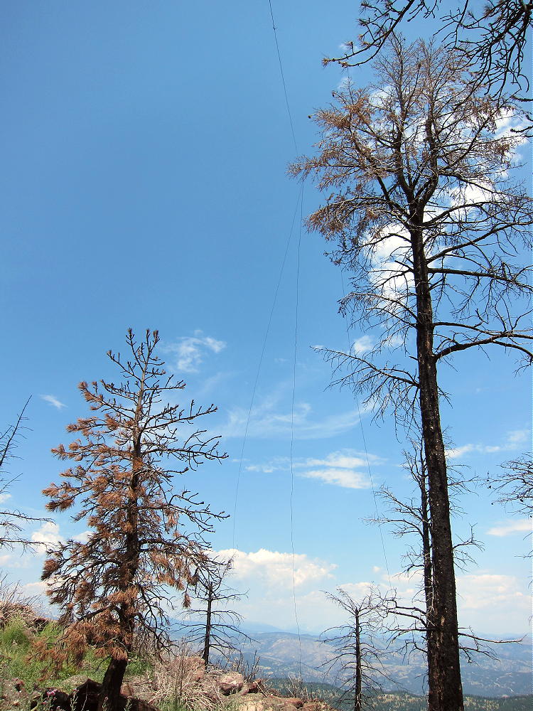
South Boulder and Bear Peaks have been ravaged by two recent natural disasters. In June of 2012 the lightning-caused Flagstaff Fire raced up the west side of the peaks and threatened to come across and ignite the forests of the Boulder Mountain Park. Fire-fighters stopped the fast-moving fire, but most of the trees near the summit of South Boulder Peak were killed in the intense blaze. The dead trees are mostly still standing, and much of the soil was burned as well.
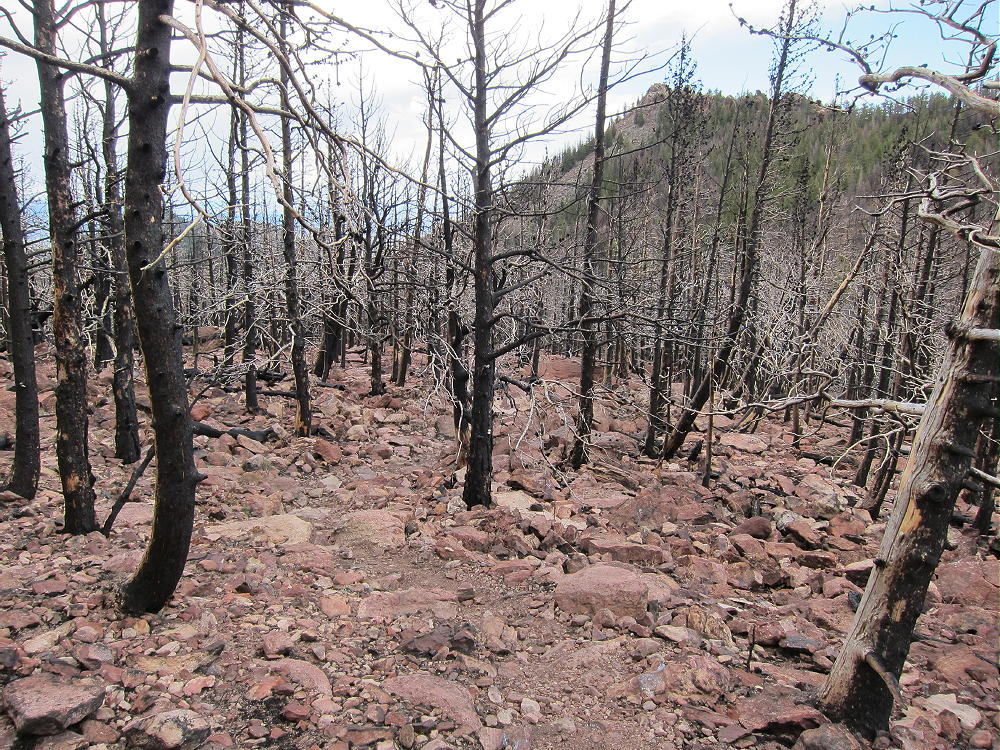
Burned Forest near Bear-South Boulder Saddle
In September of 2013 a period of sustained, heavy rain occurred, and flooding occurred in most of Boulder County. The floods were severe in the mountains and in the nearby canyons. Because of the fire, the slopes of South Boulder Peak were unprotected by vegetation, and the heavy rains caused severe erosion over the entire area. In particular, the trails up Bear and South Boulder Peaks were flooded and badly damaged. These trails have been partly restored.
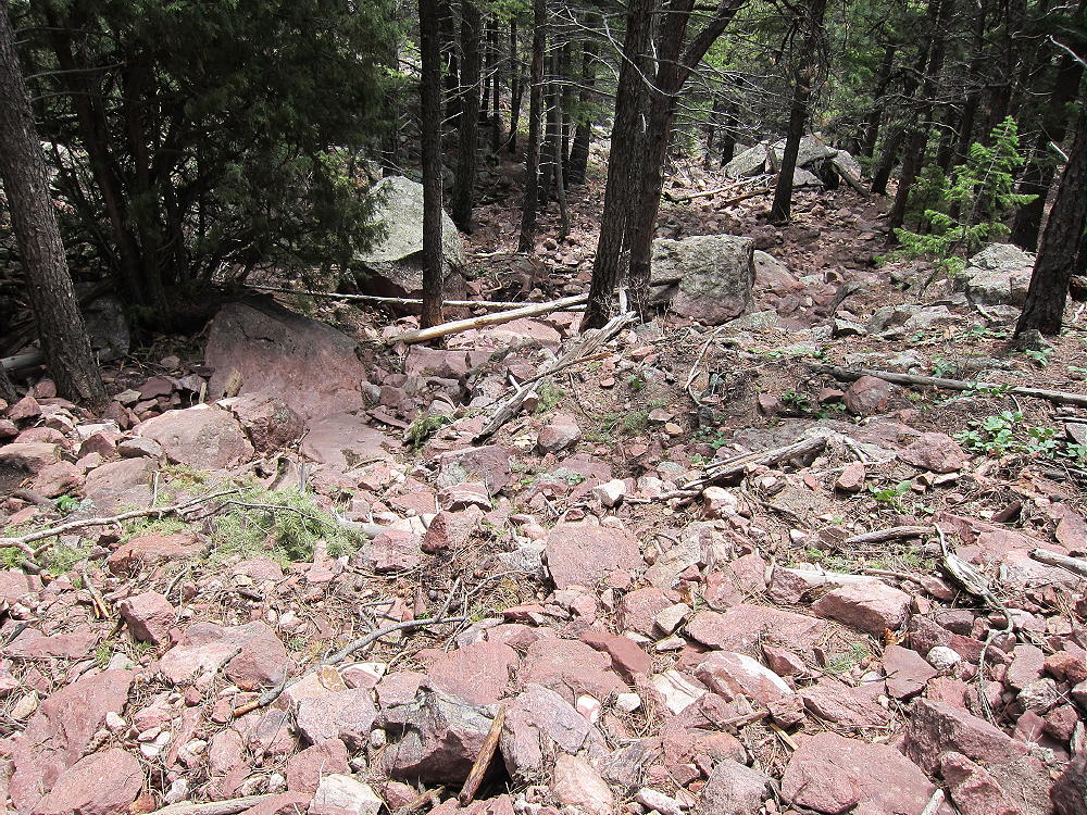
Flood Damage in Shadow Canyon
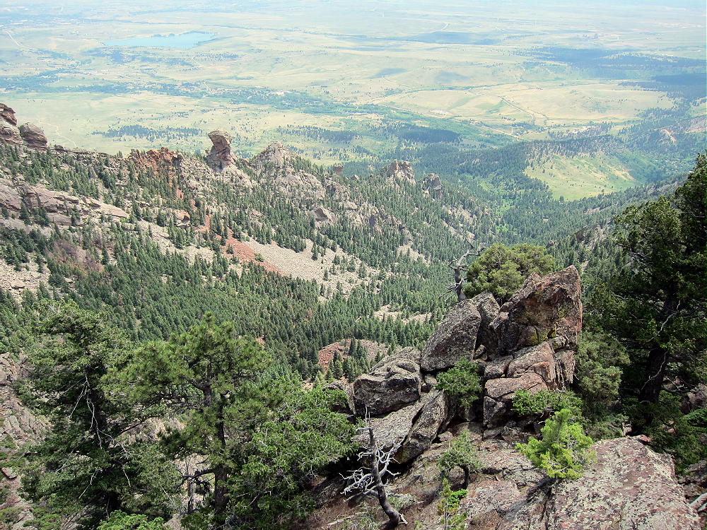
There are several routes up South Boulder Peak. My favorite trail starts at the South Mesa Trailhead on Eldorado Springs Drive and runs up Shadow Canyon, between Bear and South Boulder Peak.
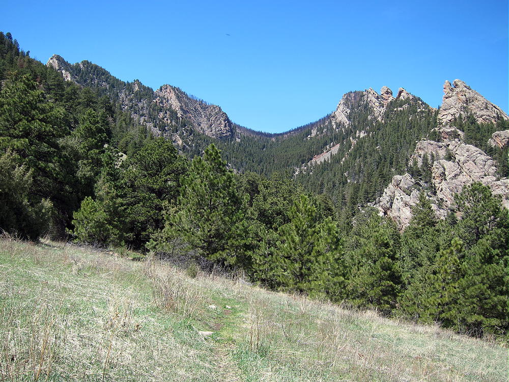
Shadow Canyon between South Boulder and Bear Peaks
The efficient Shadow Canyon Trail runs behind the huge Devils Thumb formation, and it’s an interesting hike up to the saddle between the twin peaks. The total round-trip distance from the trail-head to the top of South Boulder Peak is about 8 miles , with about 3000 vertical feet of gain.
Shadow Canyon from South Boulder Peak
Drive to Boulder and take Highway 93 south. About 1 mile south of the city limits, turn west on Highway 170, Eldorado Springs Drive. Continue west for about 2 miles to the South Mesa Trailhead on the north side of the road. Park at the trailhead or across the highway; parking is limited, so get there early. A fee is charged for cars not registered in Boulder County.
Hike northeast up the Mesa Trail, a dirt road in this part of the Park, and follow it to the Shadow Canyon Trail, also a dirt road. Stay on the road for about a mile, and just past the second of two old cabins, cross the creek, and enter the narrow part of the Canyon. The trail becomes a path and then gets steeper. Here’s a good map of the trails.
The route up Shadow Canyon is lush and shady at first; in the morning it’s cool and pleasant. The Canyon lives up to its name if you’re there early or late in the day. The trail gains altitude rapidly, and some sections are steep and rocky.
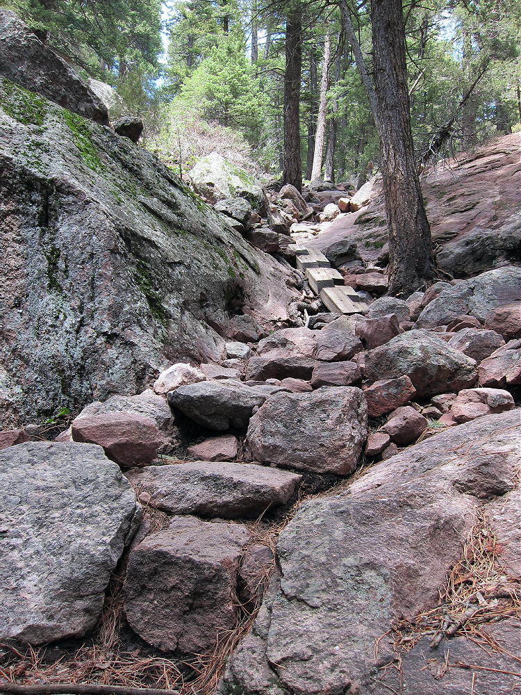
Shadow Canyon Trail with Rock Steps
There is flood damage, but the route is not hard to follow; the path stays near the center of the canyon all the way up. Soon the Devils Thumb looms high above.
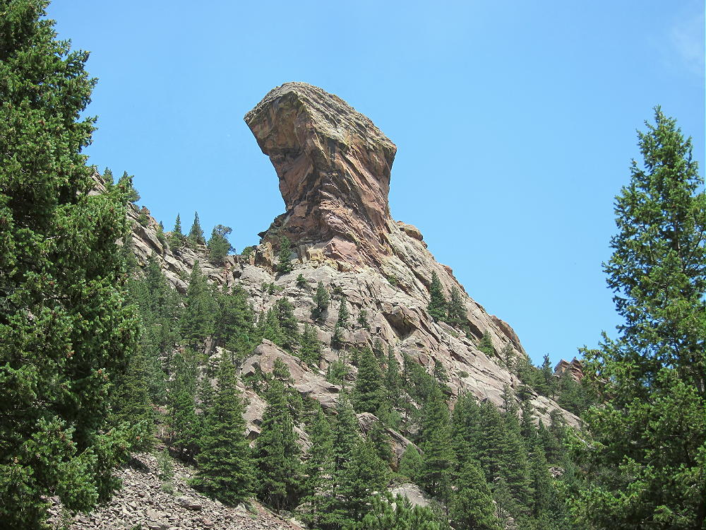
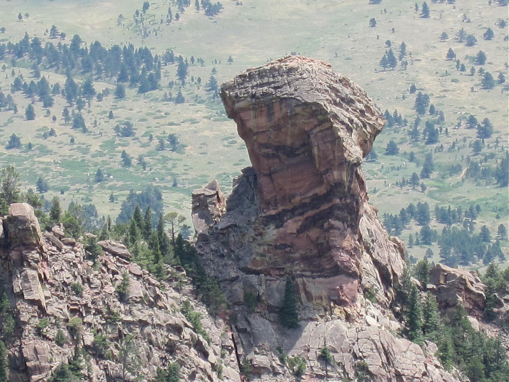
Devils Thumb from Shadow Canyon
Gradually the trail ascends above the Thumb, and there are a few short switchbacks to ease the grade. Burned trees and more flood damage appear in the upper part of the Canyon. Eventually the trail comes to a T-intersection at the burned-up saddle between Bear and South Boulder Peaks.
All the trees are dead, and a stark black ghost forest stands on the rocky slopes. Take the marked left fork and head west toward South Boulder Peak. The trail leads up through large rocks, and it’s hard to follow in spots, because much of the soil is gone. The path climbs more steeply and approaches the summit ridge, and the Peak is a short distance south over the rocks.
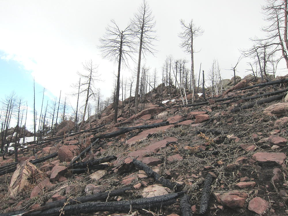
Burned Area Below South Boulder Peak
This was once a very beautiful spot, and there is a sense of tragedy about the place now. Some new growth has started, and in a few decades perhaps it will be nice again. I still have memories of picking blackberries up here – years ago – with one of my sons.
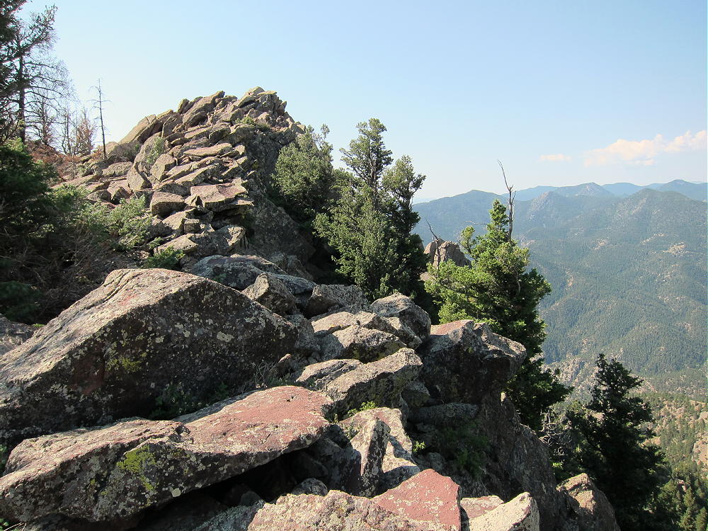
North Summit Ridge of South Boulder Peak
The activation zone is large, and it’s easy to set up east or north of the summit. Weather is very tricky on Bear and South Boulder Peak – these prominent summits create their own cumulus clouds and generate lightning storms! In April 2014, with clouds building, I set up about 60 feet below the summit, well down the slope, and I still had a fine activation, with just a 20-foot pole and an end-fed 67 foot wire running down the slope to the east! In July 2013 I set up north of the summit, out near the end of the ridge; I hung a 20M dipole from a dead tree and had a great first activation!
-
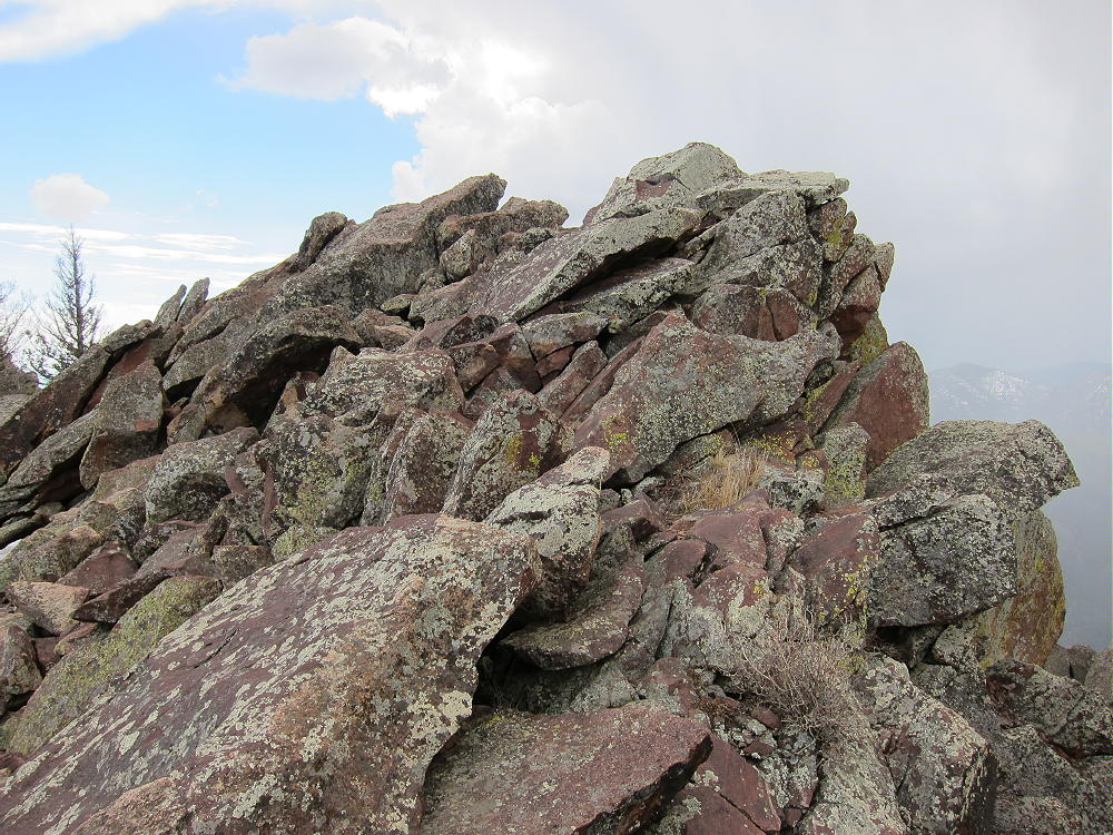
- South Boulder Peak Summit
-
- South Boulder Peak First Activation
-
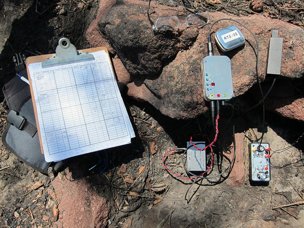
- South Boulder Peak First Activation Gear
-
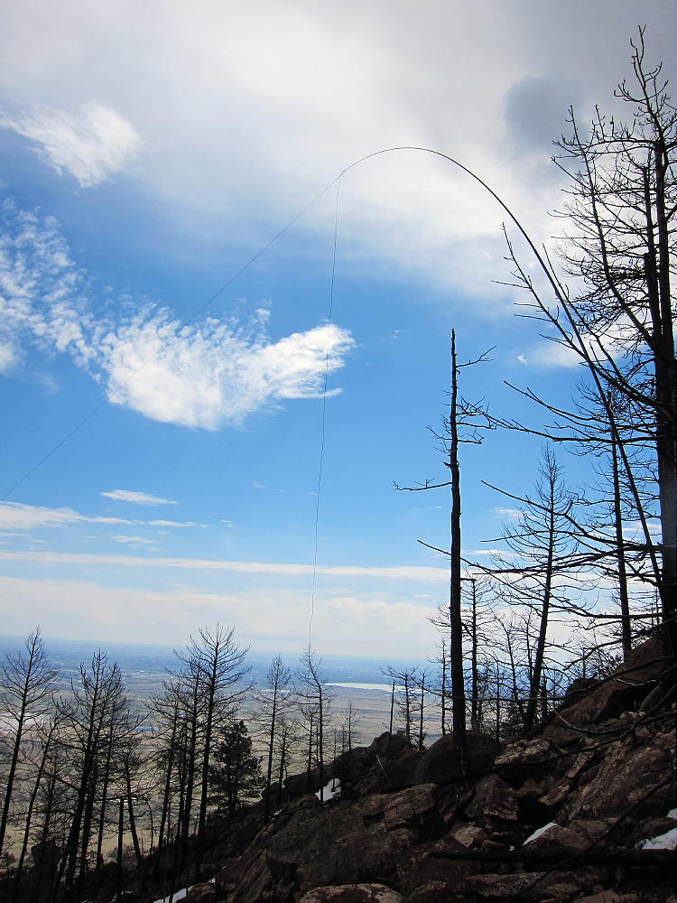
- South Boulder Peak Antenna Below Summit
There are enough visitors on South Boulder that setting up away from the popular summit is a good idea. People and dogs don’t mix well with HF antennas. This peak is so prominent that you’ll have a fun time anywhere in the activation zone. VHF/UHF coverage is impressive as well, although Bear Peak blocks the path northeast.
RED TAPE:
Please be aware that there are special rules that apply in the Boulder Mountain Park. The land west of the Bear Peak – South Boulder Peak ridge-line is part of a Habitat Conservation Area (HCA). These places are “off limits”, unless you get a special permit online. If you plan to hike in the HCA, get a permit. It is not necessary to enter the HCA to activate South Boulder Peak.
In my opinion the HCA rules are excessive and unnecessary. With South Boulder and Bear Peaks so heavily damaged by fire and floods, it’s apparent that the real enemies of the Habitat are Mother Nature Herself, not hikers and other visitors. The severe environmental damage caused by recent natural disasters is millions of times more severe than all the visitor impacts since men began to climb these mountains. I’ve been here long enough to see the whole cycle, and I think it’s incredible that we have these excessive regulations, created by well-meaning people who seek to minimize the relatively minor impact of hikers. The fires and floods have overturned their logic.
Please be aware of the Boulder OSMP Park rules and try to avoid any conflicts. Special rules apply to dogs. There are seasonal closures to protect nesting raptors, but these closures do not affect the trails to South Boulder Peak. Rangers patrol these trails, and they take their duties very seriously.
There are other interesting trails up South Boulder Peak:
1) The Fern Canyon Trail climbs the east side of Bear Peak – there is a connecting trail from Bear Peak to South Boulder Peak. A trailhead at the top of Lehigh Drive in the Table Mesa neighborhood of Boulder provides access to the Shanahan Ridge Trail, which leads west to Fern Canyon; or start at the NCAR parking area.
2) The Bear Peak West Ridge Trail climbs Bear Peak’s back side. This trail connects to the Bear Canyon Trail. Start at the NCAR parking area, or at the top of Lehigh Drive to access Bear Canyon.
3) A nice loop hike connects the Fern Canyon climb of Bear and South Boulder with the Shadow Canyon Trail. After climbing South Boulder, descend most of Shadow Canyon; at the upper cabin in Shadow Canyon, follow the Shadow Canyon North trail east, across a low ridge. This short-cut connects to the popular Mesa Trail, which leads back toward the Lehigh and NCAR trailheads.
4) It’s possible to do a dual activation of Green Mountain and South Boulder Peak, starting at the Green Mountain – West Ridge Trailhead near the high point of Flagstaff Road. There are good connecting trails all the way. The total distance is around 10-12 miles, and the vertical gain is about 2800 feet. The low point is at 7200 feet in upper Bear Canyon. This would take most of a good day, as well as plenty of water.
However you climb it, South Boulder Peak is an exciting, prominent SOTA peak with good access. It should have a long list of activations!
73
George Carey Fuller
KX0R
-
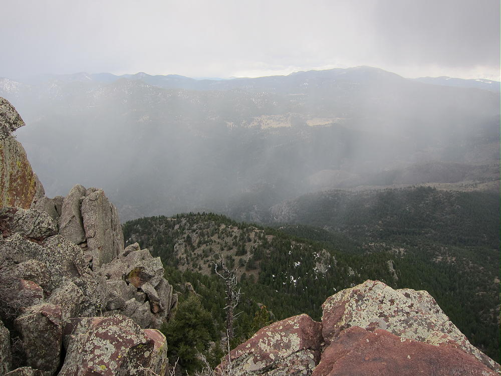
- Rain Shower West of South Boulder Peak
-
- View South from South Boulder Peak
-
- Devils Thumb from South Boulder Peak
-
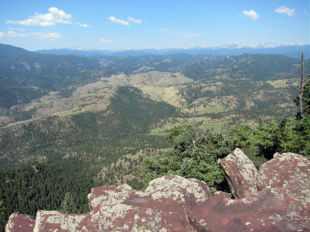
- View of Continental Divide West of South Boulder Peak
-
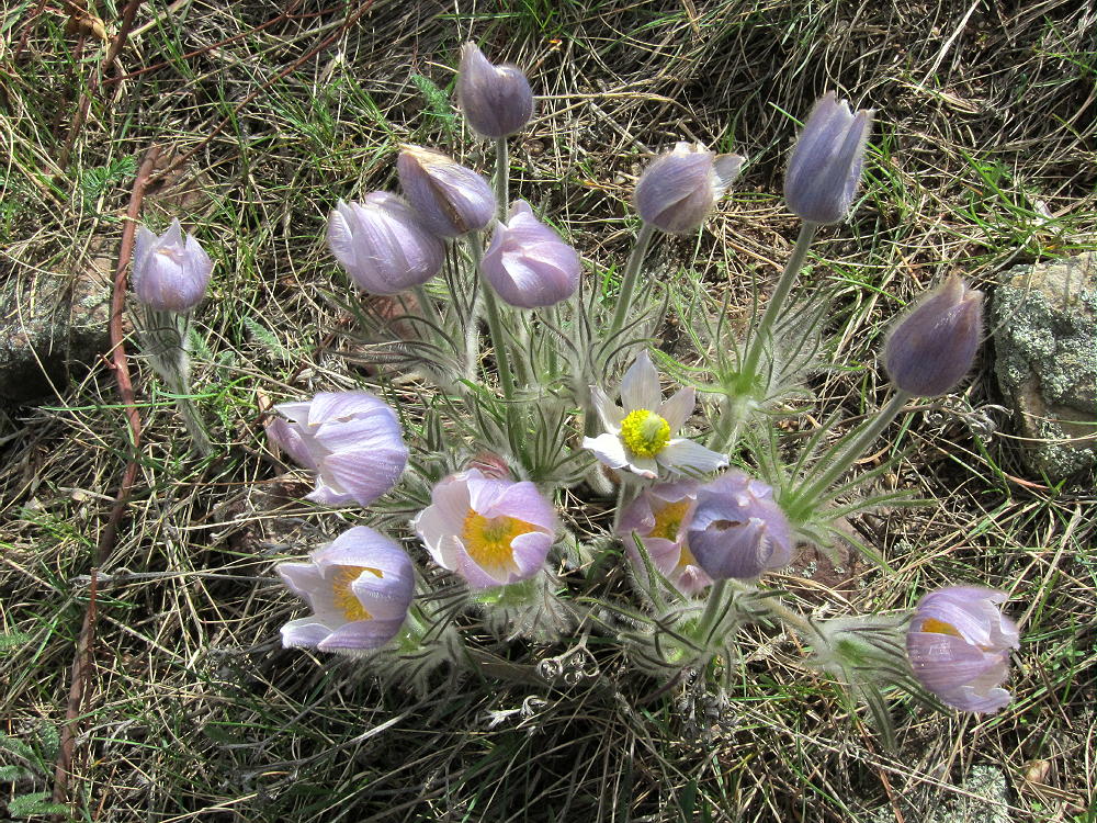
- Pasque Flowers near Shadow Canyon Trail in April
![]() !! WARNING !! There are old mountaineers, and
bold mountaineers... there are no old-bold mountaineers.
Hiking and mountain climbing are potentially hazardous activities particularly in Colorado with its extreme elevations. I am not accepting responsibility for any death or injury resulting from activations based on my trip reports. Proper training, experience, and personal capability assessment is required - enjoy!
!! WARNING !! There are old mountaineers, and
bold mountaineers... there are no old-bold mountaineers.
Hiking and mountain climbing are potentially hazardous activities particularly in Colorado with its extreme elevations. I am not accepting responsibility for any death or injury resulting from activations based on my trip reports. Proper training, experience, and personal capability assessment is required - enjoy!