


W0C/FR-029
North Tarryall Peak
3628 m / 11902 ft
Oct 15, 2016 – with N0TA
By KX0R
North Tarryall Peak is a classic alpine SOTA peak in the Tarryall Mountains east of South Park.
• Pike National Forest
• Somewhat challenging off-trail climb to the summit
• Spectacular scenery
• Exciting alpine summit
• Superb radio site
• ~ 3.5 miles round-trip
• ~ 1250 vertical feet
** SOTA Classic **
-
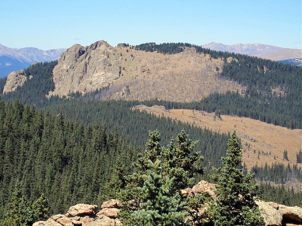
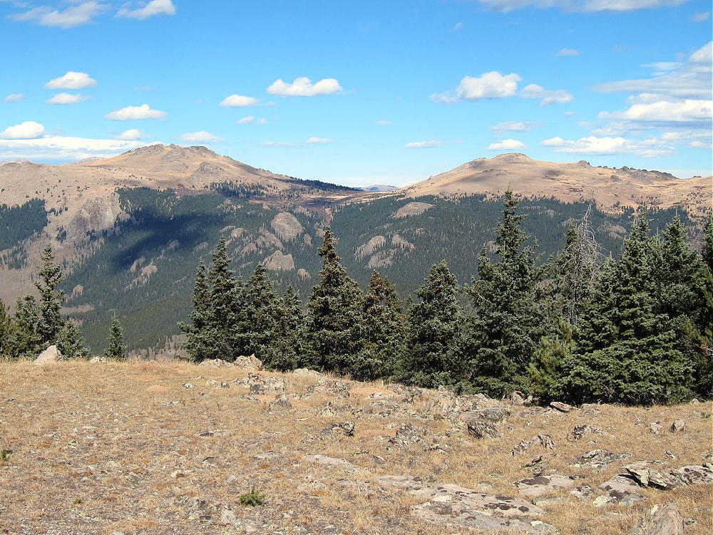
- North Tarryall Peak from Topaz Mountain
Driving Directions:
• Drive west on Highway 285 and cross Kenosha Pass
• About 2 miles beyond the Pass, turn left, south, on CR 56, the Lost Park Road
• This unpaved road is rocky and rough, but it’s normally a 2WD road, and high clearance is not required
• Follow CR 56 about 13.3 miles up to Lost Pass at 10,680 feet
• Park at the Pass
** Note that CR 56 may be closed seasonally – check with the USFS **
The Hike and the Climb:
• A fence runs up the hill just south of the Pass
• Hike southwest along the fence through the woods
• Head west near the top of the hill, and go through open forest to a bench at about 11,000 feet
• The bench is a large marsh
• Follow a game trail southwest across the southeast side of the bench
• Enter the forest at about 11,100 feet
• Follow game trails south-southwest up the steep slope toward the summit
• At about 11,650 feet, continue hiking up the rocky northeast ridge of the mountain
• Continue on the ridge to the summit area at 11,800 feet
• The rocky summit is visible to the southwest across a large alpine meadow
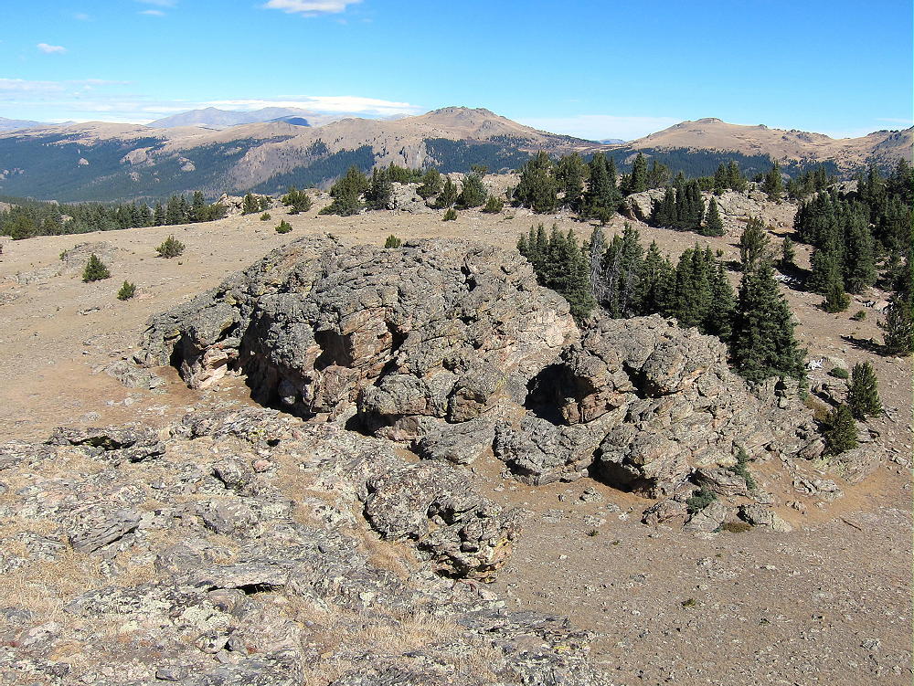
• An impressive old triangulation station stands intact on the rocky peak
• A convenient path leads up a gully to the summit
-
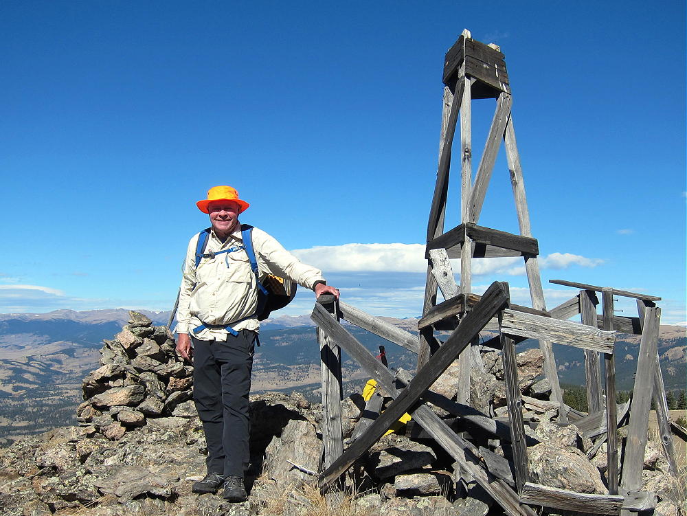
- North Tarryall Peak – Triangulation Station with N0TA
Additional Details:
The ascent route described above is direct and efficient. Since this way is up the northeast side of the mountain, it might not be so nice if there’s snow in the woods. Other possible routes start by driving (or hiking) south on FR-446 for a mile or two. Some old closed logging roads lead up roughly west from FR-446 and provide partial access to the upper part of the mountain. These roads are visible in the Google satellite images.
Regardless of the route you choose, GPS navigation is a good idea up there, because the forest is so thick that the summit’s often hidden from view. A good map and a compass also can keep you on course.
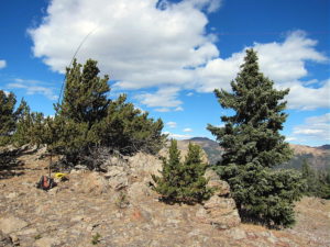
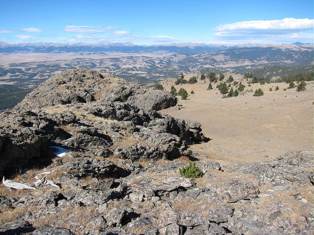
The huge activation zone definitely includes a broad sub-peak, with nice trees and shelter from wind, about 500 feet north of the triangulation station. Please see the enlarged topo map of the summit. Activating from the exposed triangulation station is also possible, but there’s little shelter from wind, and no trees are available.
-
- North Tarryall Peak – KX0R SOTA Activation
-
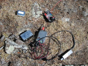
- North Tarryall Peak – KX0R Radio Gear
-
- North Tarryall Peak – View North of Large Activation Zone
North Tarryall Peak is a perfect HF site. Far from development, the noise level is very low. The prominent summit falls away quickly in all directions. No nearby mountains significantly block HF skip signals.
This mountain should be useful for VHF/UHF communication as well. It’s high enough to have coverage across South Park to the Divide and the Collegiate Peaks.
-
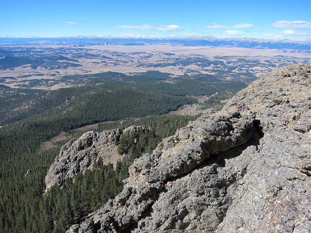
- North Tarryall Peak View West
North Tarryall Peak sits on the long, high ridge-top of the Tarryall Mountains. The open views from the cliffy summit are spectacular. Topaz Mountain W0C/SP-062 stands 2.4 miles to the southeast.
-
- Topaz Mountain from North Tarryall Peak – McCurdy, Bison, and Pikes Beyond
Pikes Peak is visible far to the south, beyond Topaz Mountain, Bison Peak, and McCurdy Mountain.
Most of South Park spreads out far below. Other mountain ranges are easy to see far in the distance.
-
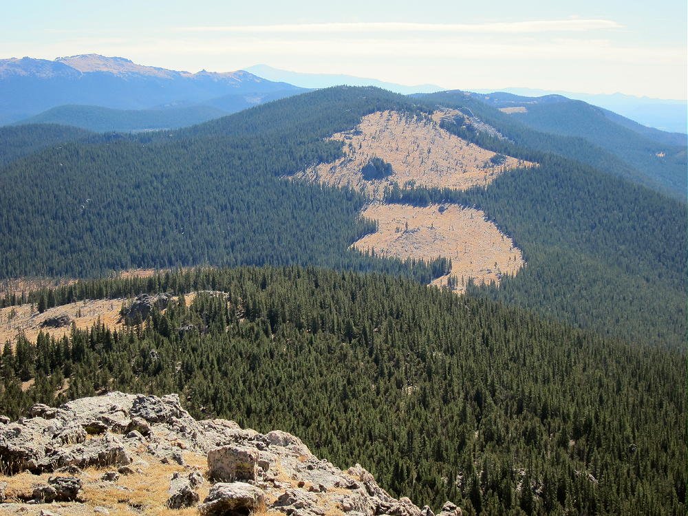
- North Tarryall Peak – View Northwest
Peak X (W0C/FR-022) and Peak Y (W0C/SP-052) stand less than 4 miles north in the Kenosha Mountains:
-
- North Tarryall Peak – View North of Peaks X and Y
In the southeast the eastern plains are visible, behind Lost Park and various summits in the Lost Creek Wilderness.
-
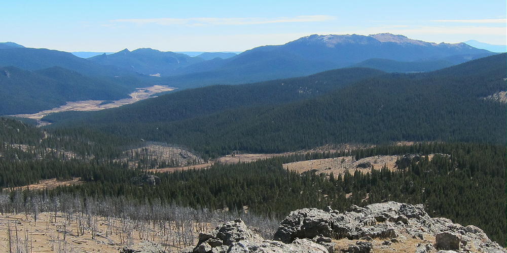
- North Tarryall Peak – View Southeast to Lost Park
North Tarryall can be combined with other nearby SOTA peaks for a dual activation:
W0C/SP-062 Topaz Mountain 2.4 miles southeast
W0C/SP-075 11060 4.2 miles east
W0C/SP-068 11423 6.2 miles southeast
North Tarryall Peak is a SOTA Classic!
• Spectacular rocky alpine summit
• Awesome views all around
• Near-perfect radio site
• Large, pleasant activation zone
• Challenging hike
• Relative solitude
Thanks to Mark N0MTN for his First Activation!
Be aware of possible hunters in the fall – wear bright orange; also note that the willow swamps east of the summit are prime moose territory.
73
George
KX0R
-
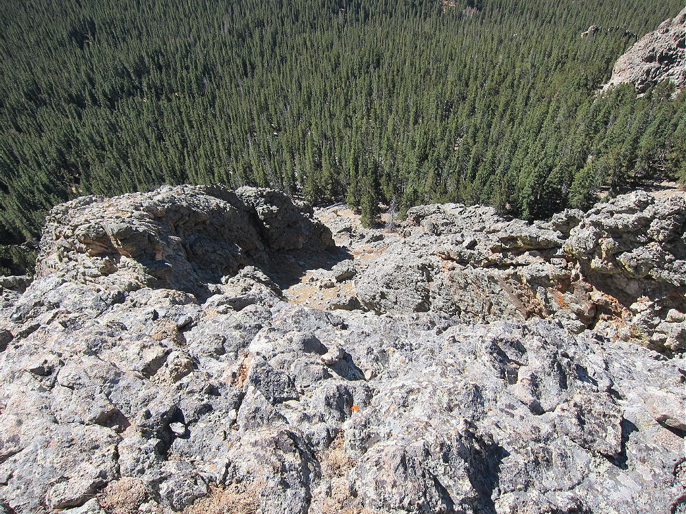
- North Tarryall Peak View Down the Cliffs
![]() !! WARNING !! There are old mountaineers, and
bold mountaineers... there are no old-bold mountaineers.
Hiking and mountain climbing are potentially hazardous activities particularly in Colorado with its extreme elevations. I am not accepting responsibility for any death or injury resulting from activations based on my trip reports. Proper training, experience, and personal capability assessment is required - enjoy!
!! WARNING !! There are old mountaineers, and
bold mountaineers... there are no old-bold mountaineers.
Hiking and mountain climbing are potentially hazardous activities particularly in Colorado with its extreme elevations. I am not accepting responsibility for any death or injury resulting from activations based on my trip reports. Proper training, experience, and personal capability assessment is required - enjoy!