


W0C/FR-012
Mount Alice
4057 m / 13310 ft
First Activation
Aug 20, 2015
By KX0R
Mount Alice is a rugged alpine peak on the Continental Divide, about three miles west of Longs Peak.
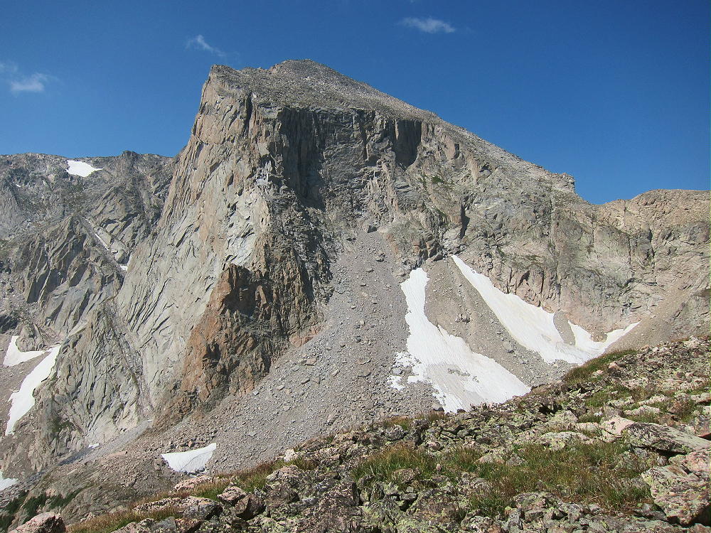
Mount Alice East Face
Key Points:
• Rocky Mountain National Park
• Northwest area of Wild Basin
• High, challenging activation
• Spectacular hike
• No trail to the summit
• Navigation and route-finding required
• 17.6 miles round-trip
• 4800 vertical feet
• Fine HF Site
Climbing Alice requires a long, sustained, non-technical hike; only activators with off-trail experience and good fitness should attempt to climb Mount Alice. Much of the route is above tree-line, in thin air; this trip should be reserved for a day with good weather. The mountain is most accessible in summer and fall.
There are two standard hiking routes for climbing Alice from Wild Basin. Both routes start at the Wild Basin Ranger Station and go up toward Thunder Lake. The southern route leads to Thunder Lake; a small trail continues west and climbs to the Divide at Boulder-Grand Pass. The final leg of this route runs north along the Divide about a mile and up to the summit. This route is Grade II, Class 2, about 9 miles each way, and 4800 vertical feet.
The northern route also heads toward Thunder Lake initially, but the Lion Lakes Trail is used to ascend north into the large cirque east of Mount Alice. A long ridge leads up west of Snowbank Lake to the Divide at 12,500 feet. The route continues south along the Divide and leads up the north slope of Alice via the steep Hourglass Ridge. This route is Grade II, Class 2+, about 8.8 miles each way, and 4800 vertical feet.
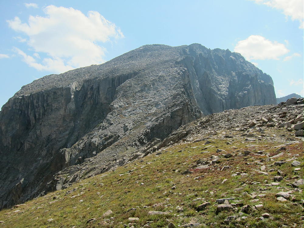
Mount Alice Hourglass Ridge
I climbed this mountain once prior to 2015 via the Hourglass Ridge, and that time I descended via the southern Boulder-Grand Pass route. I chose the Hourglass Route for my climb in 2015, mostly because it’s such a classic trip.
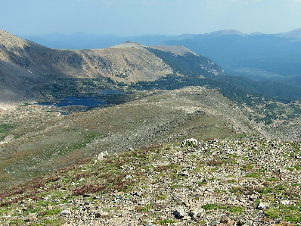
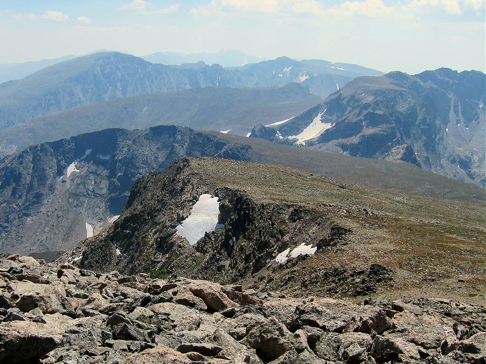
Both routes are spectacular, with interesting close views of Chiefs Head, Pagoda Mountain, Longs Peak, and Mount Meeker. Alice stands on the Continental Divide – it looks down thousands of feet to North Inlet and the west side of the National Park. This is some of the most beautiful glaciated terrain in northern Colorado.
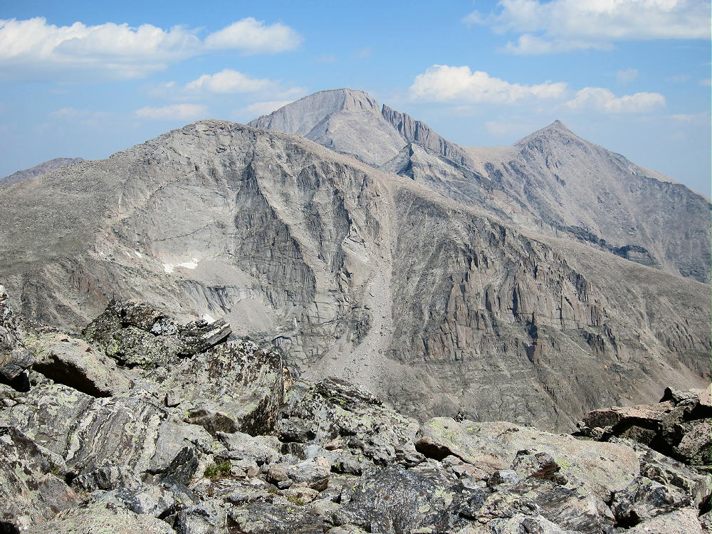
Chiefs Head, Longs, Pagoda, and Meeker from Alice
Here are additional details of the Hourglass Ridge Route I used in 2015:
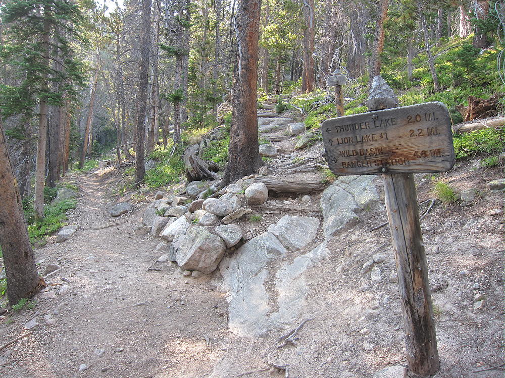
The trailhead is at the Wild Basin Ranger Station. An easy dirt road leads two miles west from the Peak to Peak Highway, Road 7, to the trailhead. An entry fee or pass is required to enter the National Park. The popular trailhead is not large, and it often fills before 8 AM on summer weekends. With the early start needed for Alice, parking should not be a problem. An early start also may avoid the entrance fee.
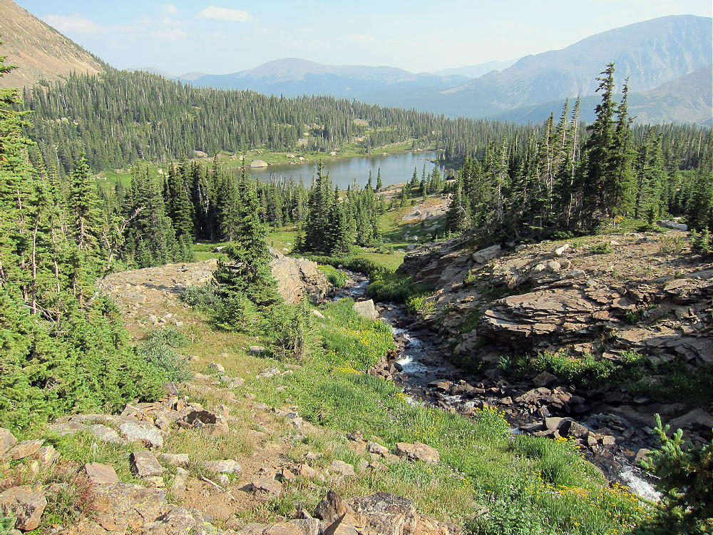
The first part of the trail is fast and easy – it follows the roaring North Saint Vrain Creek west up the drainage. Time may be saved by taking the north branch of the trail, which heads off up a hill about 1.2 miles from the trailhead; this short-cut leads to some backcountry campsites on the north side of the Creek. The main branch of the trail crosses a bridge over the Creek, runs along the south side of the Creek, leads by Calypso Cascades, and continues to Ouzel Falls. This route is longer, but it’s more scenic than the north side route; the choice is yours.
The trail is well marked – follow the signs toward Thunder Lake. The trail splits about 4.5 miles from the trailhead; follow the steep Lion Lakes Trail north uphill for about 2 miles.
Turn-off to Lion Lakes and Mount Alice
Continue on the trail past the first Lion Lake, and follow the creek up the cirque. The trail is marked by some cairns, and it crosses the creek below Trio Falls. Look sharp for cairns marking where the trail heads up to a rocky gully west of the Falls – this is the easiest way up to the next lake.
View of Lion Lake #1
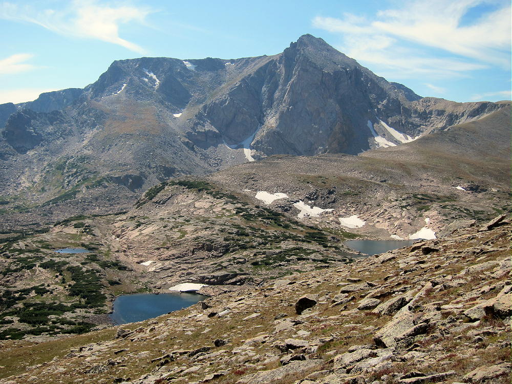
Beyond Lion Lake 2 the route is informal, with few cairns and no real trail. The goal is to ascend the obvious ridge west of Snowbank Lake sooner or later. Either head up toward the ridge from Lion Lake 2, or continue on to Snowbank Lake, and then climb up to the ridge there. Bring plenty of water, or pump water at the lakes. Pick a route that avoids thickets and cliffs. The hike is easier on top of the ridge, where there’s a small trail. Follow the ridge northwest about 1 mile, up about 1000 vertical feet, to the Continental Divide. The view of Alice’s nearly vertical cliffs is impressive!
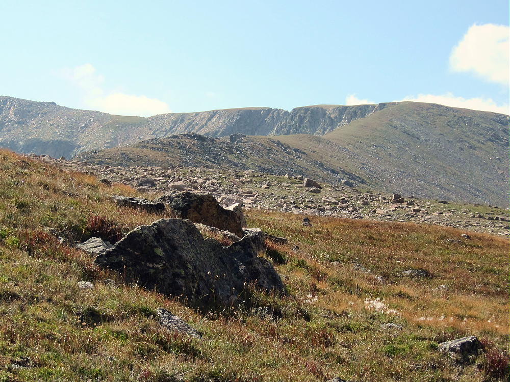
Ridge Leading up from Snowbank Lake to Continental Divide
View Down the Ridge to the Lion Lakes
On the Divide, hike southwest across the tundra toward Alice. The ridge narrows, and there are a couple of minor obstacles – traverse around any problems on the west side of the Divide. No difficult moves are required, and it’s not necessary to descend very far to bypass the obstructions.
View Back of Divide Route Northeast of Mount Alice
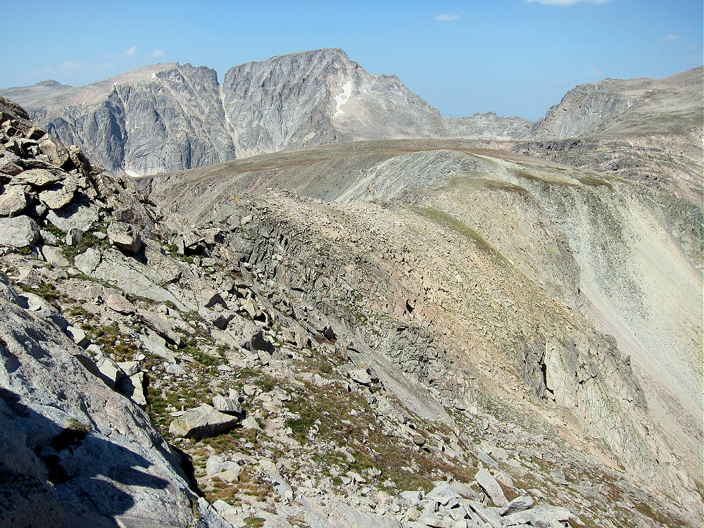
The Hourglass is a huge slope of rocks all the way to the summit of Alice. This slope is 800 vertical feet of class 2+ climbing. There are some paths up through the blocks and talus. Many of the rocks are loose, so good judgment is necessary. The various routes offer options and work OK. Avoid going too far left or right, especially in the first couple of hundred vertical feet. The route gets easier toward the top – the gradient eases, and the blocks are more stable. With snow or ice on the rocks, the difficulty increases; by late summer the Hourglass is usually clear of snow.
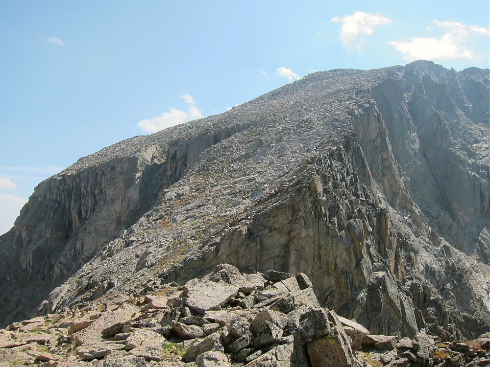
Hourglass Ridge Route up Mount Alice
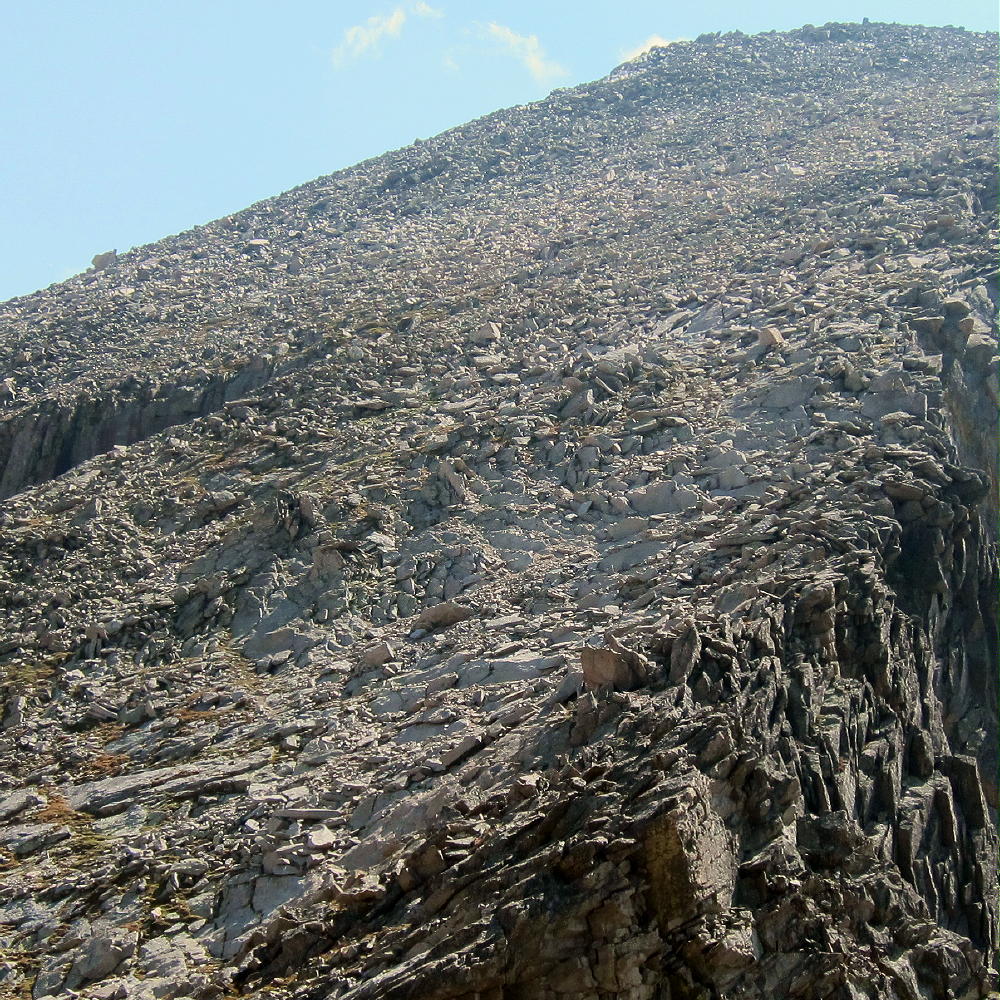
Hourglass Ridge Route Detail
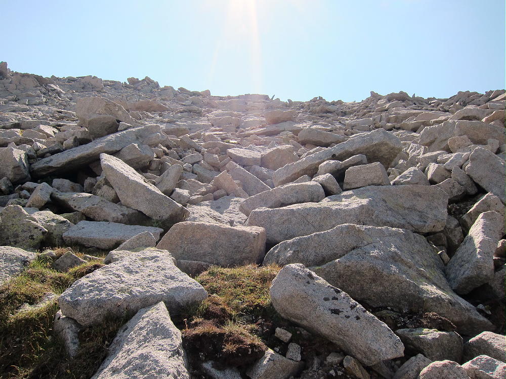
Detail of Upper Hourglass Route near the Summit
Alice has two summits; the small east summit is the actual peak, both on the Google map and the USGS quad. Both summits have almost the same altitude, and the shallow saddle between them is well within the large Activation Zone. I did my activation just east of the west summit, to avoid some wind.
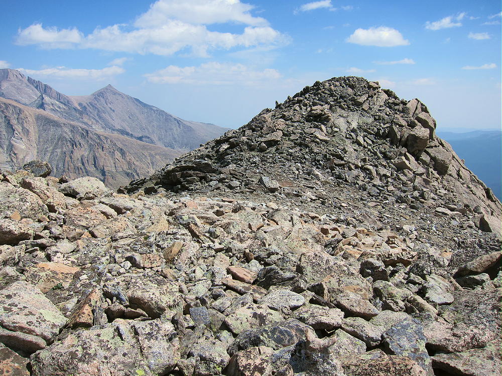
Actual Summit of Mount Alice (East Summit)
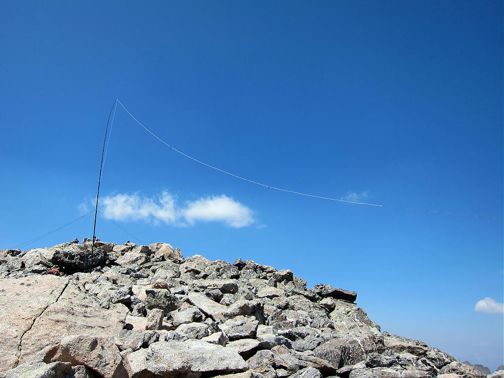
KX0R Activation Antenna on West Summit of Mount Alice
There’s little to support an HF antenna on the top of Alice, so bring a pole. Alice is almost ideal for HF – very prominent, with few close obstructing mountains. Longs Peak looks like a wall to the northeast, but this is no problem on HF. Alice has a limited open view to the southeast, but it’s mostly blocked for direct paths to populated areas on VHF and UHF. HF noise is very low, since there’s no development for several miles all around.
I had a nice HF activation, with 35 CW contacts on three bands. I had the whole mountain to myself when I was there.
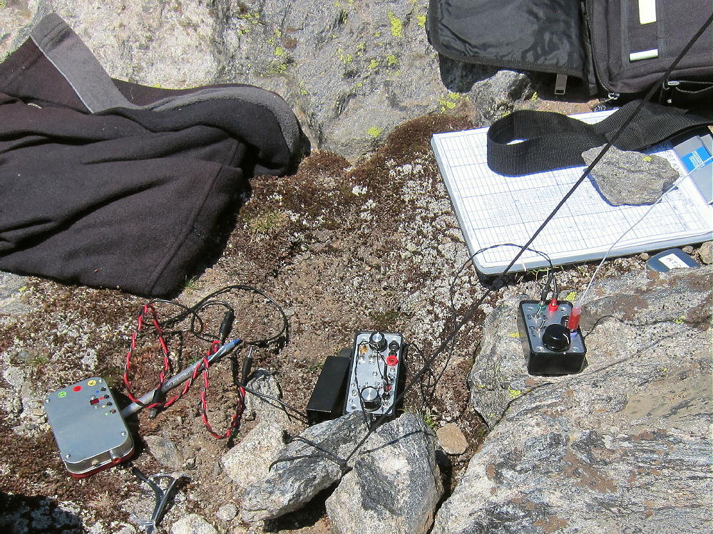
KX0R Activation Gear on Mount Alice
I descended via the Hourglass route – this was not as bad as it looked.
An alternate descent is available down the easy south ridge of Alice. This route drops 1250 vertical feet down across grassy tundra to Boulder-Grand Pass, about one mile along the Divide.
Divide on South Side of Mount Alice
While this route looks really nice from Alice, the descent down the east side of Boulder-Grand Pass is not visible. This steep route down runs along the edge of a snowfield, and it may be icy, wet, muddy, and loose. Early in the summer it may not be melted out, and descent of the steep snow would be dangerous without proper equipment. Usually it’s OK in August and early September. Check on conditions ahead of time before committing to a descent of the east side of Boulder-Grand Pass! There’s no built trail there, despite the name.
The trail below Boulder-Grand Pass down to Thunder Lake is good and easy to follow. After passing by Lake of Many Winds, the route continues along a rushing creek, through a beautiful sub-alpine forest, to Thunder Lake. The path leads along the north shore of the lake to the outlet end, where it meets the main trail slightly up the hill near some campsites. The trail from Thunder Lake to the trailhead is about 6 or 7 miles, depending on whether the shortcut on the north side of the creek is included.
Mount Alice is a wonderful alpine SOTA peak, and it’s a SOTA Classic! It’s an excellent radio summit with incredible scenery and challenging ascent routes. By any route it’s long and hard. This summit is only for strong climbers with alpine experience and lightweight equipment.
Mount Alice and Lion Lakes from Chiefs Head
Alice’s location high on the Divide makes it particularly prone to dangerous lightning storms, snow at any time of the year, and high winds. It should not be attempted unless the weather forecast is really good. An early start is recommended, both to reduce risks and to allow time to complete the journey during daylight. Despite her nice name, Alice has no mercy!
73
George Carey Fuller
KX0R
![]() !! WARNING !! There are old mountaineers, and
bold mountaineers... there are no old-bold mountaineers.
Hiking and mountain climbing are potentially hazardous activities particularly in Colorado with its extreme elevations. I am not accepting responsibility for any death or injury resulting from activations based on my trip reports. Proper training, experience, and personal capability assessment is required - enjoy!
!! WARNING !! There are old mountaineers, and
bold mountaineers... there are no old-bold mountaineers.
Hiking and mountain climbing are potentially hazardous activities particularly in Colorado with its extreme elevations. I am not accepting responsibility for any death or injury resulting from activations based on my trip reports. Proper training, experience, and personal capability assessment is required - enjoy!